TopoQuest Logo
Do you find TopoQuest useful?
Help keep TopoQuest running and adding new maps/features by donating!
Bitcoin:  19c7KJd3qBynnjoSw5npx9KScwjBe4ifkT
Litecoin:  LXs6TkuXGGXo1vDsWCkWVdjQX94eUKd6ui
Home View Maps Find Maps Find Places Resources & Links


Beecher East, Illinois Topographic Map

USGS Map Title: Beecher East, IL
USGS Map MRC: 41087C5
DRG (GeoTIFF) Download: o41087c5.tif


Neighboring USGS Topographic Map Quads:


  Steger, IL  
41087D6
 

  Dyer, IN  
41087D5
 

  Saint John, IN  
41087D4
 

  Beecher West, IL  
41087C6
 

  Beecher East, IL  
41087C5
 

  Lowell, IN  
41087C4
 

  Momence, IL  
41087B6
 

  Illiana Heights, IL  
41087B5
 

  Schneider, IN  
41087B4


Map MRC Location:

N42°
W88°
N42°
W87°
H8 H7 H6 H5 H4 H3 H2 H1
G8 G7 G6 G5 G4 G3 G2 G1
F8 F7 F6 F5 F4 F3 F2 F1
E8 E7 E6 E5 E4 E3 E2 E1
D8 D7 D6 D5 D4 D3 D2 D1
C8 C7 C6 C5 C4 C3 C2 C1
B8 B7 B6 B5 B4 B3 B2 B1
A8 A7 A6 A5 A4 A3 A2 A1
N41°
W88°
N41°
W87°

Beecher East, IL USGS 1:24K Topographic Map Preview:
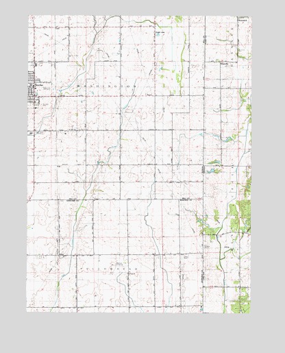
Beecher East, IL USGS Topographic Map
Click on map above to begin viewing in our Map Viewer.

This topographic map contains these locations and features:
Feature Name Type Latitude Longitude GNIS ID View Map
BeecherPopulated PlaceN41.3406°W87.6214°404101View Map
Beecher High SchoolSchoolN41.3450°W87.6220°423563View Map
BrockLocaleN41.2742°W87.5970°423565View Map
Brunswick CemeteryCemeteryN41.3606°W87.5080°431673View Map
Bulterna Farms and GreenhousesLocaleN41.3583°W87.5378°2566245View Map
Camp Area Number FiveParkN41.2961°W87.5170°432007View Map
ClausPopulated PlaceN41.3698°W87.6100°422559View Map
Deeke School (historical)SchoolN41.3261°W87.6037°407050View Map
Eagle LakePopulated PlaceN41.3670°W87.5520°407571View Map
Eagle Lake (historical)LakeN41.3695°W87.5448°1822229View Map
Fuller CemeteryCemeteryN41.3096°W87.5183°434891View Map
Goose Pond SwampSwampN41.2634°W87.5181°435210View Map
KlaasvillePopulated PlaceN41.3559°W87.5175°437373View Map
Mussman AirportAirportN41.2697°W87.5702°427336View Map
PolkPopulated PlaceN41.3117°W87.6084°423074View Map
Saint John United Church of ChristChurchN41.3267°W87.5981°426981View Map
Saint Johns United Church of Christ CemeteryCemeteryN41.3275°W87.5984°1952367View Map
Saint Lukes CemeteryCemeteryN41.3373°W87.6186°417518View Map
Saint Paul Lutheran CemeteryCemeteryN41.2667°W87.5692°1810690View Map
Saint Pauls Lutheran ChurchChurchN41.2670°W87.5692°417726View Map
Shady Lawn Golf CourseLocaleN41.3445°W87.6145°423562View Map
Township of WashingtonCivilN41.3410°W87.5981°429899View Map
Township of YellowheadCivilN41.2530°W87.5953°429967View Map
Village of BeecherCivilN41.3504°W87.6171°2398066View Map
Washington Township Center Shopping CenterLocaleN41.3414°W87.6028°2355538View Map
WTAS-FM (Crete)TowerN41.3148°W87.6198°428475View Map

Note: Coordinates in the location and feature list above are referenced to NAD83 datum.


Copyright (C) 2008-2025 Ryan Niemi / Sunset Dynamics ... All Rights Reserved