TopoQuest Logo
Do you find TopoQuest useful?
Help keep TopoQuest running and adding new maps/features by donating!
Bitcoin:  19c7KJd3qBynnjoSw5npx9KScwjBe4ifkT
Litecoin:  LXs6TkuXGGXo1vDsWCkWVdjQX94eUKd6ui
Home View Maps Find Maps Find Places Resources & Links


Mount Andrew, Alabama Topographic Map

USGS Map Title: Mount Andrew, AL
USGS Map MRC: 31085H5
DRG (GeoTIFF) Download: o31085h5.tif


Neighboring USGS Topographic Map Quads:


  Aberfoil, AL  
32085A6
 

  Midway, AL  
32085A5
 

  Comer, AL  
32085A4
 

  Perote, AL  
31085H6
 

  Mount Andrew, AL  
31085H5
 

  Clayton North, AL  
31085H4
 

  Josie, AL  
31085G6
 

  Louisville, AL  
31085G5
 

  Clayton South, AL  
31085G4


Map MRC Location:

N32°
W86°
N32°
W85°
H8 H7 H6 H5 H4 H3 H2 H1
G8 G7 G6 G5 G4 G3 G2 G1
F8 F7 F6 F5 F4 F3 F2 F1
E8 E7 E6 E5 E4 E3 E2 E1
D8 D7 D6 D5 D4 D3 D2 D1
C8 C7 C6 C5 C4 C3 C2 C1
B8 B7 B6 B5 B4 B3 B2 B1
A8 A7 A6 A5 A4 A3 A2 A1
N31°
W86°
N31°
W85°

Mount Andrew, AL USGS 1:24K Topographic Map Preview:
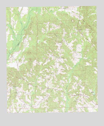
Mount Andrew, AL USGS Topographic Map
Click on map above to begin viewing in our Map Viewer.

This topographic map contains these locations and features:
Feature Name Type Latitude Longitude GNIS ID View Map
Anglins Bridge (historical)BridgeN31.9835°W85.5938°1805308View Map
Barkers School (historical)SchoolN31.8990°W85.6105°134755View Map
Bells CrossroadsPopulated PlaceN31.8954°W85.5236°156047View Map
Bethsaida ChurchChurchN31.9157°W85.6055°114158View Map
Bickleys Mill (historical)LocaleN31.8960°W85.5047°1805314View Map
Center RidgeRidgeN31.9640°W85.5536°115863View Map
Center Ridge CemeteryCemeteryN31.9580°W85.5486°2576286View Map
Center Ridge ChurchChurchN31.9577°W85.5491°115868View Map
Center Ridge SchoolSchoolN31.9585°W85.5455°115869View Map
Cooks Ford BridgeBridgeN31.9454°W85.6202°1805317View Map
Dickle Mill (historical)LocaleN31.8946°W85.5172°134774View Map
Elam ChurchChurchN31.9052°W85.5238°117902View Map
Evergreen Baptist ChurchChurchN31.9204°W85.5924°155868View Map
Garmon CrossroadsPopulated PlaceN31.9396°W85.5533°156394View Map
Greens Crossroad Volunteer Fire DepartmentBuildingN31.8849°W85.5991°2691420View Map
Greens CrossroadsPopulated PlaceN31.8854°W85.6008°164166View Map
Laurel Grove (historical)Populated PlaceN31.9729°W85.5833°134798View Map
Little Indian CreekStreamN31.9535°W85.6119°121802View Map
McClains SchoolSchoolN31.9682°W85.5816°134803View Map
Mount AndrewPopulated PlaceN31.9713°W85.5247°123138View Map
Mount Andrew CemeteryCemeteryN31.9707°W85.5269°134805View Map
Mount Andrew Volunteer Fire DepartmentBuildingN31.9630°W85.5405°2691505View Map
North Fork Little CreekStreamN31.9938°W85.5644°124000View Map
Pleasant Grove Baptist ChurchChurchN31.8888°W85.5302°124951View Map
Pleasant Grove Baptist Church CemeteryCemeteryN31.8886°W85.5305°2514504View Map
Polecat BranchStreamN31.9382°W85.5219°134814View Map
Robinson SchoolSchoolN31.9085°W85.5941°125734View Map
Sanders Store (historical)LocaleN31.9029°W85.5602°134821View Map
Shady Grove ChurchChurchN31.9054°W85.6133°126598View Map
Shady Grove Elementary School (historical)SchoolN31.9060°W85.6119°165600View Map
Shiloh African Methodist Episcopal ChurchChurchN31.9404°W85.5566°126730View Map
Shiloh CemeteryCemeteryN31.9407°W85.5566°1805546View Map
Spires Store (historical)LocaleN31.8927°W85.5141°1805352View Map
Spring CreekStreamN31.9729°W85.6022°127228View Map
Street Memorial United Methodist ChurchChurchN31.8993°W85.6111°155923View Map
Williams MillpondReservoirN31.8975°W85.5051°129029View Map
Willis Store (historical)LocaleN31.9321°W85.6097°134839View Map

Note: Coordinates in the location and feature list above are referenced to NAD83 datum.


Copyright (C) 2008-2025 Ryan Niemi / Sunset Dynamics ... All Rights Reserved