TopoQuest Logo
Do you find TopoQuest useful?
Help keep TopoQuest running and adding new maps/features by donating!
Bitcoin:  19c7KJd3qBynnjoSw5npx9KScwjBe4ifkT
Litecoin:  LXs6TkuXGGXo1vDsWCkWVdjQX94eUKd6ui
Home View Maps Find Maps Find Places Resources & Links


Dement Creek, Oregon Topographic Map

USGS Map Title: Dement Creek, OR
USGS Map MRC: 42124H2
DRG (GeoTIFF) Download: o42124h2.tif


Neighboring USGS Topographic Map Quads:


  Bill Peak, OR  
43124A3
 

  Myrtle Point, OR  
43124A2
 

  Bridge, OR  
43124A1
 

  Calf Ranch Mountain, OR  
42124H3
 

  Dement Creek, OR  
42124H2
 

  Powers, OR  
42124H1
 

  Mount Butler, OR  
42124G3
 

  Barklow Mountain, OR  
42124G2
 

  China Flat, OR  
42124G1


Map MRC Location:

N43°
W125°
N43°
W124°
H8 H7 H6 H5 H4 H3 H2 H1
G8 G7 G6 G5 G4 G3 G2 G1
F8 F7 F6 F5 F4 F3 F2 F1
E8 E7 E6 E5 E4 E3 E2 E1
D8 D7 D6 D5 D4 D3 D2 D1
C8 C7 C6 C5 C4 C3 C2 C1
B8 B7 B6 B5 B4 B3 B2 B1
A8 A7 A6 A5 A4 A3 A2 A1
N42°
W125°
N42°
W124°

Dement Creek, OR USGS 1:24K Topographic Map Preview:
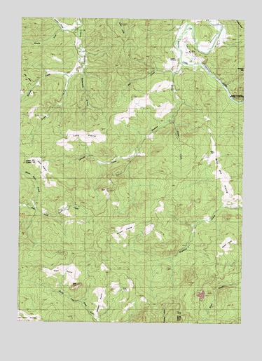
Dement Creek, OR USGS Topographic Map
Click on map above to begin viewing in our Map Viewer.

This topographic map contains these locations and features:
Feature Name Type Latitude Longitude GNIS ID View Map
Albert H Powers Memorial State ParkParkN42.9679°W124.1318°1132165View Map
Amifer (historical)LocaleN42.9815°W124.1507°1166261View Map
Beaverdam BranchStreamN42.9798°W124.2170°1117459View Map
Bills PrairieAreaN42.9748°W124.2498°1160699View Map
Custer Post Office (historical)Post OfficeN42.9326°W124.2001°1164301View Map
Delfit (historical)LocaleN42.9676°W124.1340°1166271View Map
Dement CemeteryCemeteryN42.9832°W124.1679°1135169View Map
Dement CreekStreamN42.9771°W124.1654°1119854View Map
Emmons (historical)LocaleN42.9737°W124.1476°1166272View Map
Koontz CreekStreamN42.9946°W124.2290°1122835View Map
Middle Fork Catching CreekStreamN42.9959°W124.2193°1124104View Map
Mill CreekStreamN42.9773°W124.1657°1124152View Map
Oregon Department of Transportation Boat LaunchLocaleN42.9815°W124.1538°2668588View Map
Roberts CreekStreamN42.9754°W124.2229°1126108View Map
Roland Post Office (historical)Post OfficeN42.9232°W124.1287°1164640View Map
Russel CreekStreamN42.9604°W124.1654°1126365View Map
South Fork Catching CreekStreamN42.9807°W124.2168°1127266View Map
Warner (historical)LocaleN42.9873°W124.1582°1136878View Map
White Rock CreekStreamN42.9218°W124.2423°1128990View Map

Note: Coordinates in the location and feature list above are referenced to NAD83 datum.


Copyright (C) 2008-2025 Ryan Niemi / Sunset Dynamics ... All Rights Reserved