TopoQuest Logo
Do you find TopoQuest useful?
Help keep TopoQuest running and adding new maps/features by donating!
Bitcoin:  19c7KJd3qBynnjoSw5npx9KScwjBe4ifkT
Litecoin:  LXs6TkuXGGXo1vDsWCkWVdjQX94eUKd6ui
Home View Maps Find Maps Find Places Resources & Links


Mount Fanny, Oregon Topographic Map

USGS Map Title: Mount Fanny, OR
USGS Map MRC: 45117C6
DRG (GeoTIFF) Download: o45117c6.tif


Neighboring USGS Topographic Map Quads:


  Gasset Bluff, OR  
45117D7
 

  Mount Moriah, OR  
45117D6
 

  Fox Point, OR  
45117D5
 

  Cove, OR  
45117C7
 

  Mount Fanny, OR  
45117C6
 

  Jim White Ridge, OR  
45117C5
 

  Union, OR  
45117B7
 

  Little Catherine Creek, OR  
45117B6
 

  China Cap, OR  
45117B5


Map MRC Location:

N46°
W118°
N46°
W117°
H8 H7 H6 H5 H4 H3 H2 H1
G8 G7 G6 G5 G4 G3 G2 G1
F8 F7 F6 F5 F4 F3 F2 F1
E8 E7 E6 E5 E4 E3 E2 E1
D8 D7 D6 D5 D4 D3 D2 D1
C8 C7 C6 C5 C4 C3 C2 C1
B8 B7 B6 B5 B4 B3 B2 B1
A8 A7 A6 A5 A4 A3 A2 A1
N45°
W118°
N45°
W117°

Mount Fanny, OR USGS 1:24K Topographic Map Preview:
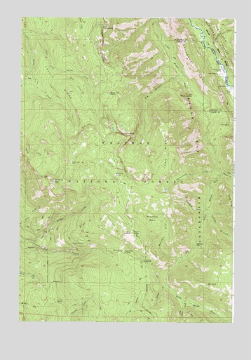
Mount Fanny, OR USGS Topographic Map
Click on map above to begin viewing in our Map Viewer.

This topographic map contains these locations and features:
Feature Name Type Latitude Longitude GNIS ID View Map
Backbone RidgeRidgeN45.3551°W117.6496°1117128View Map
Barrel SpringSpringN45.2590°W117.7245°1117259View Map
Bell CreekStreamN45.3524°W117.7249°1117491View Map
Ben PointSummitN45.2651°W117.6405°1117511View Map
Big CanyonValleyN45.3526°W117.6569°1117593View Map
Boulder CreekStreamN45.3115°W117.6327°1138481View Map
Bridge CreekStreamN45.2826°W117.7424°1118069View Map
Castle RidgeRidgeN45.3443°W117.7219°1118661View Map
Dobbin CreekStreamN45.2588°W117.6541°1119984View Map
Dunns BluffCliffN45.3265°W117.6877°1120221View Map
East Fork Indian CreekStreamN45.3685°W117.7488°1120311View Map
Fireline CreekStreamN45.2660°W117.6644°1120741View Map
Fool Hen SpringSpringN45.3704°W117.7133°1129516View Map
Grizzly CreekStreamN45.2965°W117.6413°1143102View Map
Horseheaven CreekStreamN45.3629°W117.6402°1143798View Map
Horseshoe BasinBasinN45.2926°W117.6727°1122031View Map
Horseshoe CreekStreamN45.2765°W117.6555°1122037View Map
Horseshoe SpringSpringN45.2987°W117.6677°1129514View Map
Huckleberry CreekStreamN45.3101°W117.6338°1122098View Map
Huckleberry TrailTrailN45.3068°W117.6549°1122101View Map
Indian Creek CampLocaleN45.3154°W117.7205°1122221View Map
KTVR-TVTowerN45.3093°W117.7369°1131254View Map
Little Minam MeadowFlatN45.3438°W117.6478°1123232View Map
Lodgepole SpringSpringN45.2635°W117.6783°1129513View Map
Lodgepole TrailTrailN45.2632°W117.6797°1123342View Map
Long RidgeRidgeN45.3168°W117.6613°1123448View Map
Lower Falls Little Minam RiverFallsN45.3444°W117.6524°1129515View Map
Lucky SpringSpringN45.2822°W117.7191°1123611View Map
Minam LodgeLocaleN45.3521°W117.6360°1124230View Map
Minam Lodge AirportAirportN45.3513°W117.6329°1131643View Map
Moss SpringSpringN45.2794°W117.6896°1124398View Map
Moss Springs Horse CampLocaleN45.2751°W117.6791°1952987View Map
Moss Springs Recreation SiteLocaleN45.2751°W117.6791°1124399View Map
Mount FannySummitN45.3079°W117.7302°1120626View Map
Mount Fanny SpringSpringN45.3101°W117.6951°1124405View Map
Mount Harris Recreation SiteLocaleN45.3713°W117.7071°1952988View Map
Pine ButteSummitN45.3440°W117.6983°1125384View Map
Point ProminenceSummitN45.3718°W117.7038°1125501View Map
Reds Horse RanchLocaleN45.3468°W117.6280°1125918View Map
Reds Wallowa Horse Ranch AirportAirportN45.3458°W117.6272°1131696View Map
Summit SpringSpringN45.2869°W117.6844°1127721View Map
Threemile CreekStreamN45.2965°W117.6416°1128071View Map
Whiskey FlatFlatN45.2821°W117.6474°1128943View Map
Yew SpringSpringN45.3314°W117.6277°1129384View Map

Note: Coordinates in the location and feature list above are referenced to NAD83 datum.


Copyright (C) 2008-2024 Ryan Niemi / Sunset Dynamics ... All Rights Reserved