TopoQuest Logo
Do you find TopoQuest useful?
Help keep TopoQuest running and adding new maps/features by donating!
Bitcoin:  19c7KJd3qBynnjoSw5npx9KScwjBe4ifkT
Litecoin:  LXs6TkuXGGXo1vDsWCkWVdjQX94eUKd6ui
Home View Maps Find Maps Find Places Resources & Links


Cove, Oregon Topographic Map

USGS Map Title: Cove, OR
USGS Map MRC: 45117C7
DRG (GeoTIFF) Download: o45117c7.tif


Neighboring USGS Topographic Map Quads:


  Imbler, OR  
45117D8
 

  Gasset Bluff, OR  
45117D7
 

  Mount Moriah, OR  
45117D6
 

  Conley, OR  
45117C8
 

  Cove, OR  
45117C7
 

  Mount Fanny, OR  
45117C6
 

  Craig Mountain, OR  
45117B8
 

  Union, OR  
45117B7
 

  Little Catherine Creek, OR  
45117B6


Map MRC Location:

N46°
W118°
N46°
W117°
H8 H7 H6 H5 H4 H3 H2 H1
G8 G7 G6 G5 G4 G3 G2 G1
F8 F7 F6 F5 F4 F3 F2 F1
E8 E7 E6 E5 E4 E3 E2 E1
D8 D7 D6 D5 D4 D3 D2 D1
C8 C7 C6 C5 C4 C3 C2 C1
B8 B7 B6 B5 B4 B3 B2 B1
A8 A7 A6 A5 A4 A3 A2 A1
N45°
W118°
N45°
W117°

Cove, OR USGS 1:24K Topographic Map Preview:
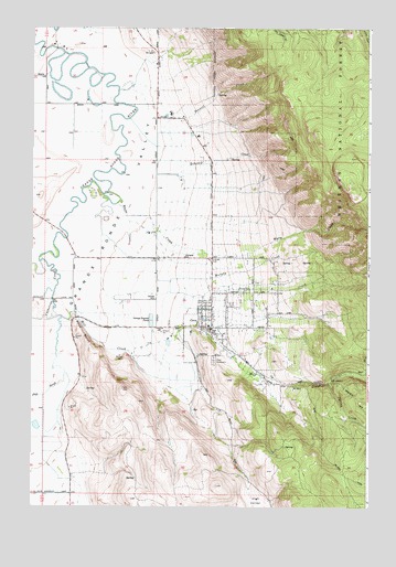
Cove, OR USGS Topographic Map
Click on map above to begin viewing in our Map Viewer.

This topographic map contains these locations and features:
Feature Name Type Latitude Longitude GNIS ID View Map
Bobington BranchStreamN45.2971°W117.8066°1129468View Map
Boswell CreekStreamN45.3474°W117.8260°1117954View Map
Catherine CreekStreamN45.3137°W117.8722°1118689View Map
City of CoveCivilN45.2964°W117.8102°2410249View Map
CovePopulated PlaceN45.2965°W117.8080°1136181View Map
Cove CemeteryCemeteryN45.2882°W117.8074°1119405View Map
Cove City HallBuildingN45.3008°W117.8128°2700328View Map
Cove Hot SpringsSpringN45.2897°W117.8131°1129471View Map
Cove Post OfficePost OfficeN45.2969°W117.8125°1165097View Map
Cove Public LibraryBuildingN45.2972°W117.8113°2700334View Map
Cove Rural Fire Protection DistrictBuildingN45.2968°W117.8119°2576478View Map
Cove SchoolSchoolN45.2973°W117.8097°2490820View Map
Cove Sewer Treatment PlantLocaleN45.2986°W117.8309°2697185View Map
Cove Side Ranch Port AirportAirportN45.3354°W117.8202°2646051View Map
Deer CreekStreamN45.2849°W117.7588°1119828View Map
Duncan CreekStreamN45.3207°W117.8494°1120208View Map
Eckesley CreekStreamN45.3401°W117.8197°1120383View Map
Elmer Dam Number FourDamN45.3683°W117.8639°1133522View Map
Elmer Dam Number ThreeDamN45.3633°W117.8520°1133521View Map
Elmers Reservoir 1ReservoirN45.3566°W117.8647°1129492View Map
Elmers Reservoir 2ReservoirN45.3622°W117.8585°1129493View Map
Elmers Reservoir 3ReservoirN45.3598°W117.8522°1129494View Map
Elmers Reservoir 4ReservoirN45.3610°W117.8660°1133523View Map
Hohstadt ReservoirReservoirN45.3576°W117.8094°1129512View Map
Hulick BranchStreamN45.2971°W117.8066°1129470View Map
Mill CreekStreamN45.2996°W117.8658°1124165View Map
Millard BranchStreamN45.2860°W117.7969°1129469View Map
Murphy CreekStreamN45.3290°W117.8433°1124551View Map
Phys PointRidgeN45.2951°W117.8560°1125350View Map
Phys SloughStreamN45.2993°W117.8638°1125351View Map
Shanghai School (historical)SchoolN45.3150°W117.8183°1126788View Map
Spring CreekStreamN45.2824°W117.7652°1127432View Map
Wagner SpringsSpringN45.3026°W117.8414°1161712View Map
Warm CreekStreamN45.3318°W117.8469°1128639View Map

Note: Coordinates in the location and feature list above are referenced to NAD83 datum.


Copyright (C) 2008-2025 Ryan Niemi / Sunset Dynamics ... All Rights Reserved