TopoQuest Logo
Do you find TopoQuest useful?
Help keep TopoQuest running and adding new maps/features by donating!
Bitcoin:  19c7KJd3qBynnjoSw5npx9KScwjBe4ifkT
Litecoin:  LXs6TkuXGGXo1vDsWCkWVdjQX94eUKd6ui
Home View Maps Find Maps Find Places Resources & Links


Mount Gurney, Oregon Topographic Map

USGS Map Title: Mount Gurney, OR
USGS Map MRC: 43123B6
DRG (GeoTIFF) Download: o43123b6.tif


Neighboring USGS Topographic Map Quads:


  Tioga, OR  
43123C7
 

  Cedar Creek, OR  
43123C6
 

  Callahan, OR  
43123C5
 

  Sitkum, OR  
43123B7
 

  Mount Gurney, OR  
43123B6
 

  Reston, OR  
43123B5
 

  Kenyon Mountain, OR  
43123A7
 

  Camas Valley, OR  
43123A6
 

  Tenmile, OR  
43123A5


Map MRC Location:

N44°
W124°
N44°
W123°
H8 H7 H6 H5 H4 H3 H2 H1
G8 G7 G6 G5 G4 G3 G2 G1
F8 F7 F6 F5 F4 F3 F2 F1
E8 E7 E6 E5 E4 E3 E2 E1
D8 D7 D6 D5 D4 D3 D2 D1
C8 C7 C6 C5 C4 C3 C2 C1
B8 B7 B6 B5 B4 B3 B2 B1
A8 A7 A6 A5 A4 A3 A2 A1
N43°
W124°
N43°
W123°

Mount Gurney, OR USGS 1:24K Topographic Map Preview:
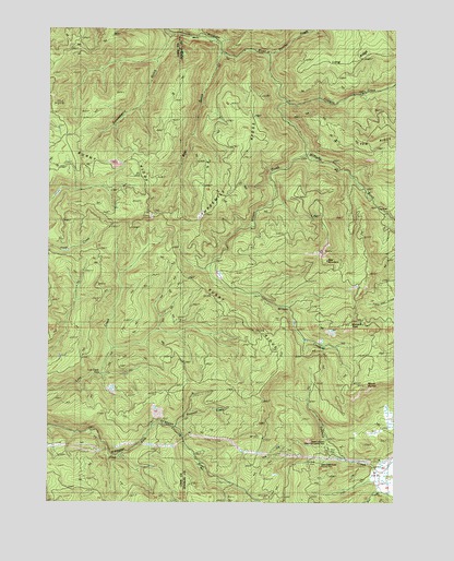
Mount Gurney, OR USGS Topographic Map
Click on map above to begin viewing in our Map Viewer.

This topographic map contains these locations and features:
Feature Name Type Latitude Longitude GNIS ID View Map
Bear CreekStreamN43.1290°W123.6331°1132423View Map
Bear GulchValleyN43.2426°W123.6920°1117383View Map
Bear MountainSummitN43.1887°W123.6531°1117389View Map
Bryson CreekStreamN43.2457°W123.6901°1132632View Map
Burnt RidgeRidgeN43.1832°W123.7026°1157426View Map
Buzzard RockSummitN43.1718°W123.6445°1118421View Map
Dave Busenbark County ParkParkN43.1359°W123.6573°1119697View Map
Fivemile CreekStreamN43.2304°W123.6684°1120806View Map
Gooseberry CreekStreamN43.2429°W123.6901°1132418View Map
Knepper CreekStreamN43.1443°W123.7054°1132425View Map
Lost Creek FallsFallsN43.1584°W123.7326°1123497View Map
Mount GurneySummitN43.1565°W123.6384°1136348View Map
Murry CreekStreamN43.2443°W123.6901°1132631View Map
Panther CreekStreamN43.2429°W123.6743°1125161View Map
Severt-Iverson County ParkParkN43.1373°W123.6498°1132430View Map
Threemile RidgeRidgeN43.2346°W123.6804°1157425View Map
Weekly Post Office (historical)Post OfficeN43.1307°W123.6320°1164774View Map
Wilson CreekStreamN43.2173°W123.6606°1129187View Map
Wilson CreekStreamN43.1359°W123.6442°1132424View Map
Yew RidgeRidgeN43.2215°W123.6315°1129383View Map

Note: Coordinates in the location and feature list above are referenced to NAD83 datum.


Copyright (C) 2008-2025 Ryan Niemi / Sunset Dynamics ... All Rights Reserved