TopoQuest Logo
Do you find TopoQuest useful?
Help keep TopoQuest running and adding new maps/features by donating!
Bitcoin:  19c7KJd3qBynnjoSw5npx9KScwjBe4ifkT
Litecoin:  LXs6TkuXGGXo1vDsWCkWVdjQX94eUKd6ui
Home View Maps Find Maps Find Places Resources & Links


Callahan, Oregon Topographic Map

USGS Map Title: Callahan, OR
USGS Map MRC: 43123C5
DRG (GeoTIFF) Download: o43123c5.tif


Neighboring USGS Topographic Map Quads:


  Kelly Butte, OR  
43123D6
 

  Tyee, OR  
43123D5
 

  Tyee Mountain, OR  
43123D4
 

  Cedar Creek, OR  
43123C6
 

  Callahan, OR  
43123C5
 

  Garden Valley, OR  
43123C4
 

  Mount Gurney, OR  
43123B6
 

  Reston, OR  
43123B5
 

  Roseburg West, OR  
43123B4


Map MRC Location:

N44°
W124°
N44°
W123°
H8 H7 H6 H5 H4 H3 H2 H1
G8 G7 G6 G5 G4 G3 G2 G1
F8 F7 F6 F5 F4 F3 F2 F1
E8 E7 E6 E5 E4 E3 E2 E1
D8 D7 D6 D5 D4 D3 D2 D1
C8 C7 C6 C5 C4 C3 C2 C1
B8 B7 B6 B5 B4 B3 B2 B1
A8 A7 A6 A5 A4 A3 A2 A1
N43°
W124°
N43°
W123°

Callahan, OR USGS 1:24K Topographic Map Preview:
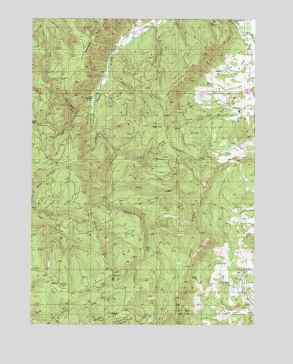
Callahan, OR USGS Topographic Map
Click on map above to begin viewing in our Map Viewer.

This topographic map contains these locations and features:
Feature Name Type Latitude Longitude GNIS ID View Map
Baughaman LookoutLocaleN43.2690°W123.5809°1117324View Map
Baughman (historical)LocaleN43.2693°W123.6145°1952907View Map
Bear CreekStreamN43.3384°W123.5904°1117351View Map
Bear RidgeRidgeN43.2851°W123.5301°1117394View Map
Blood CampLocaleN43.2998°W123.6040°1132646View Map
Britt Nichols County ParkParkN43.2557°W123.5406°1118087View Map
Buffalo CreekStreamN43.3507°W123.5837°1160562View Map
CallahanPopulated PlaceN43.2659°W123.6098°1118471View Map
Callahan Guard StationBuildingN43.2663°W123.6091°1132645View Map
Camp CreekStreamN43.3051°W123.5795°1118499View Map
Churchill RapidsRapidsN43.3748°W123.5081°1132639View Map
Cole CreekStreamN43.3371°W123.6001°1119129View Map
Coles ValleyPopulated PlaceN43.3651°W123.5026°1132640View Map
Coles ValleyValleyN43.3740°W123.5131°1119146View Map
Coles Valley Post Office (historical)Post OfficeN43.3651°W123.5026°1165072View Map
Day CreekStreamN43.3512°W123.5998°1132642View Map
Green ButteSummitN43.3307°W123.5554°1121370View Map
Grier ReservoirReservoirN43.3418°W123.5917°1132643View Map
Hawkins LakeLakeN43.2690°W123.5323°1121668View Map
Lost LakeLakeN43.2846°W123.6079°1123506View Map
Melrose DivisionCivilN43.3073°W123.6110°1938057View Map
Mill CreekStreamN43.3648°W123.5012°1124159View Map
Mill CreekStreamN43.3457°W123.5873°1132644View Map
Rock CreekStreamN43.3279°W123.5870°1126145View Map
Willow CreekStreamN43.2512°W123.5081°1132641View Map

Note: Coordinates in the location and feature list above are referenced to NAD83 datum.


Copyright (C) 2008-2025 Ryan Niemi / Sunset Dynamics ... All Rights Reserved