TopoQuest Logo
Do you find TopoQuest useful?
Help keep TopoQuest running and adding new maps/features by donating!
Bitcoin:  19c7KJd3qBynnjoSw5npx9KScwjBe4ifkT
Litecoin:  LXs6TkuXGGXo1vDsWCkWVdjQX94eUKd6ui
Home View Maps Find Maps Find Places Resources & Links


Reston, Oregon Topographic Map

USGS Map Title: Reston, OR
USGS Map MRC: 43123B5
DRG (GeoTIFF) Download: o43123b5.tif


Neighboring USGS Topographic Map Quads:


  Cedar Creek, OR  
43123C6
 

  Callahan, OR  
43123C5
 

  Garden Valley, OR  
43123C4
 

  Mount Gurney, OR  
43123B6
 

  Reston, OR  
43123B5
 

  Roseburg West, OR  
43123B4
 

  Camas Valley, OR  
43123A6
 

  Tenmile, OR  
43123A5
 

  Winston, OR  
43123A4


Map MRC Location:

N44°
W124°
N44°
W123°
H8 H7 H6 H5 H4 H3 H2 H1
G8 G7 G6 G5 G4 G3 G2 G1
F8 F7 F6 F5 F4 F3 F2 F1
E8 E7 E6 E5 E4 E3 E2 E1
D8 D7 D6 D5 D4 D3 D2 D1
C8 C7 C6 C5 C4 C3 C2 C1
B8 B7 B6 B5 B4 B3 B2 B1
A8 A7 A6 A5 A4 A3 A2 A1
N43°
W124°
N43°
W123°

Reston, OR USGS 1:24K Topographic Map Preview:
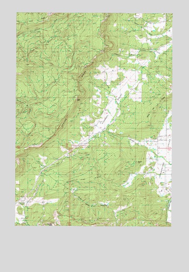
Reston, OR USGS Topographic Map
Click on map above to begin viewing in our Map Viewer.

This topographic map contains these locations and features:
Feature Name Type Latitude Longitude GNIS ID View Map
Bushnell RockPillarN43.1259°W123.5979°1118371View Map
Doerner Creek ReservoirReservoirN43.2425°W123.5280°1163829View Map
Dysert CreekStreamN43.2290°W123.5262°1132428View Map
Eagle RockSummitN43.1998°W123.5790°1132419View Map
East Fork Byron CreekStreamN43.1790°W123.5206°1132729View Map
Flournoy CreekStreamN43.1818°W123.5540°1132429View Map
Flournoy ValleyBasinN43.1815°W123.5592°1120847View Map
Flournoy Valley AirportAirportN43.2059°W123.5332°2646005View Map
Fort Flournoy (historical)LocaleN43.1748°W123.5290°1132955View Map
Little Cow CreekStreamN43.1951°W123.6198°1123163View Map
Long RidgeRidgeN43.2437°W123.6193°1123449View Map
Lookingglass AirportAirportN43.1589°W123.5055°2646006View Map
Lost CreekStreamN43.1951°W123.6198°1123487View Map
Morgan HillSummitN43.1629°W123.5290°1163840View Map
RestonPopulated PlaceN43.1301°W123.6201°1125961View Map
Reston Post Office (historical)Post OfficeN43.1301°W123.6201°1165846View Map
Reston RidgeRidgeN43.1984°W123.5776°1163839View Map
Rock CreekStreamN43.1818°W123.5540°1133423View Map
Smith ReservoirReservoirN43.1490°W123.5401°1163831View Map
Sugar Pine RidgeRidgeN43.1509°W123.5815°1127690View Map
White Tail RidgeRidgeN43.1993°W123.5109°1129003View Map
Wylie ReservoirReservoirN43.1557°W123.5295°1163830View Map
Yew CampLocaleN43.2276°W123.6179°1132420View Map

Note: Coordinates in the location and feature list above are referenced to NAD83 datum.


Copyright (C) 2008-2024 Ryan Niemi / Sunset Dynamics ... All Rights Reserved