TopoQuest Logo
Do you find TopoQuest useful?
Help keep TopoQuest running and adding new maps/features by donating!
Bitcoin:  19c7KJd3qBynnjoSw5npx9KScwjBe4ifkT
Litecoin:  LXs6TkuXGGXo1vDsWCkWVdjQX94eUKd6ui
Home View Maps Find Maps Find Places Resources & Links


Smokemont, North Carolina Topographic Map

USGS Map Title: Smokemont, NC
USGS Map MRC: 35083E3
DRG (GeoTIFF) Download: o35083e3.tif


Neighboring USGS Topographic Map Quads:


  Mount Le Conte, TN  
35083F4
 

  Mount Guyot, TN  
35083F3
 

  Luftee Knob, NC  
35083F2
 

  Clingmans Dome, NC  
35083E4
 

  Smokemont, NC  
35083E3
 

  Bunches Bald, NC  
35083E2
 

  Bryson City, NC  
35083D4
 

  Whittier, NC  
35083D3
 

  Sylva North, NC  
35083D2


Map MRC Location:

N36°
W84°
N36°
W83°
H8 H7 H6 H5 H4 H3 H2 H1
G8 G7 G6 G5 G4 G3 G2 G1
F8 F7 F6 F5 F4 F3 F2 F1
E8 E7 E6 E5 E4 E3 E2 E1
D8 D7 D6 D5 D4 D3 D2 D1
C8 C7 C6 C5 C4 C3 C2 C1
B8 B7 B6 B5 B4 B3 B2 B1
A8 A7 A6 A5 A4 A3 A2 A1
N35°
W84°
N35°
W83°

Smokemont, NC USGS 1:24K Topographic Map Preview:
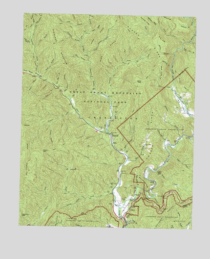
Smokemont, NC USGS Topographic Map
Click on map above to begin viewing in our Map Viewer.

This topographic map contains these locations and features:
Feature Name Type Latitude Longitude GNIS ID View Map
Ace CreekStreamN35.5823°W83.2663°980027View Map
Ace Enloe RidgeRidgeN35.5967°W83.2765°1004637View Map
Ballhoot Scar OverlookLocaleN35.5173°W83.2843°980500View Map
Batsaw BranchStreamN35.6032°W83.2654°980621View Map
Bearwallow BranchStreamN35.6240°W83.3265°980761View Map
Becks BaldSummitN35.5863°W83.2886°980876View Map
Becks BranchStreamN35.5437°W83.2999°980877View Map
Beech Flats ProngStreamN35.5873°W83.3615°980904View Map
Big Cove ChurchChurchN35.5537°W83.2518°981374View Map
Big Cove CommunityCivilN35.5480°W83.2505°2419311View Map
Bradley CemeteryCemeteryN35.5587°W83.3163°981803View Map
Bradley ForkStreamN35.5557°W83.3118°981808View Map
Cabin BranchStreamN35.6151°W83.3285°982383View Map
Carver CemeteryCemeteryN35.5677°W83.3071°982705View Map
Chambers CemeteryCemeteryN35.5334°W83.3021°982994View Map
Chasteen CreekStreamN35.5757°W83.3124°983056View Map
Cherokee Fire Department Station 3BuildingN35.5274°W83.2777°2639471View Map
Cliff BranchStreamN35.5815°W83.3510°983282View Map
Collins CreekStreamN35.5673°W83.3338°983386View Map
Conner - Oconaluftee CemeteryCemeteryN35.5377°W83.3037°983459View Map
Coon BranchStreamN35.6051°W83.3663°983497View Map
Couches CreekStreamN35.5362°W83.3029°983597View Map
Dock Conner CemeteryCemeteryN35.5743°W83.3376°2775238View Map
Enloe African CemeteryCemeteryN35.5212°W83.3101°994907View Map
Enloe CemeteryCemeteryN35.5144°W83.3077°984816View Map
Enloe CreekStreamN35.6093°W83.2590°984797View Map
Enloe RidgeRidgeN35.6099°W83.2716°984799View Map
Floyd CemeteryCemeteryN35.5235°W83.3075°985246View Map
Fountain BranchStreamN35.5893°W83.2652°985332View Map
Fox KnobSummitN35.5075°W83.3277°985358View Map
Galamore BranchStreamN35.5537°W83.2593°985518View Map
Grassy BranchStreamN35.5023°W83.2963°985944View Map
Hideaway BrookStreamN35.6190°W83.2779°986735View Map
Hughes CemeteryCemeteryN35.5156°W83.3002°2775254View Map
Hunter CreekStreamN35.6232°W83.3690°987253View Map
Jim Mac BranchStreamN35.5834°W83.3518°987608View Map
Jonas Jenkins CemeteryCemeteryN35.5326°W83.3400°2775264View Map
Kanati ForkStreamN35.5879°W83.3624°987868View Map
Kephart ProngStreamN35.5873°W83.3615°987928View Map
Kephart Prong CemeteryCemeteryN35.5872°W83.3574°989163View Map
Kephart ShelterLocaleN35.6101°W83.3685°2776769View Map
Little Creek FallsFallsN35.5062°W83.3724°988616View Map
Louie Camp BranchStreamN35.6209°W83.3279°989039View Map
Lower Grassy BranchStreamN35.6176°W83.3671°989097View Map
Madcap BranchStreamN35.5176°W83.3282°989220View Map
Mine RidgeRidgeN35.6189°W83.3024°990041View Map
Mingo CreekStreamN35.5340°W83.2768°990054View Map
Mingo FallsFallsN35.5320°W83.2746°990055View Map
Mingus CreekStreamN35.5207°W83.3074°990059View Map
Mingus Creek CemeteryCemeteryN35.5203°W83.3402°2775280View Map
Mount ClarkSummitN35.5477°W83.3249°1004645View Map
Mount NobleSummitN35.5047°W83.3375°1023666View Map
Mount Stand WatieSummitN35.5337°W83.3338°1004641View Map
Nations CemeteryCemeteryN35.5162°W83.2995°990874View Map
New Beck CemeteryCemeteryN35.5448°W83.2988°980873View Map
Newton BaldSummitN35.5439°W83.3591°1021646View Map
Newton BranchStreamN35.5615°W83.3535°991139View Map
Noland Children CemeteryCemeteryN35.5816°W83.3503°2775286View Map
Oconaluftee River OverlookLocaleN35.5132°W83.2935°991513View Map
Oconaluftee Visitor CenterBuildingN35.5131°W83.3061°2775217View Map
Old Beck CemeteryCemeteryN35.5458°W83.3012°987291View Map
Pigeon CreekStreamN35.5423°W83.2671°992181View Map
Piney Grove ChurchChurchN35.5034°W83.2960°992349View Map
Poplar Hollow BranchStreamN35.5243°W83.2896°992695View Map
Queen CemeteryCemeteryN35.5257°W83.3072°992946View Map
Ramp Cove BranchStreamN35.6062°W83.2596°993012View Map
Rattlesnake Mountain TunnelTunnelN35.5190°W83.2696°993059View Map
Raven ForkStreamN35.5118°W83.3021°993063View Map
Raven Fork OverlookLocaleN35.5187°W83.2879°993064View Map
RavensfordPopulated PlaceN35.5109°W83.2954°1022172View Map
Sequoyah ChurchChurchN35.5276°W83.2779°994502View Map
Shell Bark BranchStreamN35.5795°W83.3452°994633View Map
Sherrill Cove BranchStreamN35.5182°W83.2779°994667View Map
Sherrill Cove TunnelTunnelN35.5115°W83.2715°994668View Map
Simmons BranchStreamN35.6201°W83.2527°994835View Map
Smith BranchStreamN35.5868°W83.3596°994932View Map
SmokemontLocaleN35.5534°W83.3085°995016View Map
Smokemont CampgroundLocaleN35.5564°W83.3116°2775219View Map
Smokemont Group CampLocaleN35.5598°W83.3128°2775220View Map
Soggy Hill BranchStreamN35.5451°W83.2674°995097View Map
Stony Mountain RidgeRidgeN35.5295°W83.2890°995577View Map
Straight Fork ChurchChurchN35.5682°W83.2538°995600View Map
Sweat Heifer CreekStreamN35.6068°W83.3679°995773View Map
Tabor BranchStreamN35.5982°W83.3268°995818View Map
Taywa CreekStreamN35.6012°W83.3279°995906View Map
Tennessee BranchStreamN35.6073°W83.3327°995929View Map
The GorgesValleyN35.5887°W83.2652°995975View Map
Tom Huskey's Child CemeteryCemeteryN35.6018°W83.3277°2775309View Map
Tow String ChurchChurchN35.5493°W83.2846°996175View Map
Tow String CreekStreamN35.5395°W83.2977°996176View Map
Tow String Horse CampLocaleN35.5425°W83.2976°2775221View Map
Township of CharlestonCivilN35.5194°W83.3498°1027225View Map
Tuskee GapGapN35.5587°W83.3729°996373View Map
Upper Grassy BranchStreamN35.6176°W83.3671°996552View Map
Whitewater BranchStreamN35.5951°W83.2671°997260View Map
Will BranchStreamN35.5751°W83.3393°997345View Map

Note: Coordinates in the location and feature list above are referenced to NAD83 datum.


Copyright (C) 2008-2025 Ryan Niemi / Sunset Dynamics ... All Rights Reserved