TopoQuest Logo
Do you find TopoQuest useful?
Help keep TopoQuest running and adding new maps/features by donating!
Bitcoin:  19c7KJd3qBynnjoSw5npx9KScwjBe4ifkT
Litecoin:  LXs6TkuXGGXo1vDsWCkWVdjQX94eUKd6ui
Home View Maps Find Maps Find Places Resources & Links


Center, Texas Topographic Map

USGS Map Title: Center, TX
USGS Map MRC: 31094G2
DRG (GeoTIFF) Download: o31094g2.tif


Neighboring USGS Topographic Map Quads:


  Tenaha West, TX  
31094H3
 

  Tenaha East, TX  
31094H2
 

  Logansport West, LA  
31094H1
 

  Arcadia, TX  
31094G3
 

  Center, TX  
31094G2
 

  Shelbyville, TX  
31094G1
 

  Mount Herman, TX  
31094F3
 

  Neuville, TX  
31094F2
 

  Hurstown, TX  
31094F1


Map MRC Location:

N32°
W95°
N32°
W94°
H8 H7 H6 H5 H4 H3 H2 H1
G8 G7 G6 G5 G4 G3 G2 G1
F8 F7 F6 F5 F4 F3 F2 F1
E8 E7 E6 E5 E4 E3 E2 E1
D8 D7 D6 D5 D4 D3 D2 D1
C8 C7 C6 C5 C4 C3 C2 C1
B8 B7 B6 B5 B4 B3 B2 B1
A8 A7 A6 A5 A4 A3 A2 A1
N31°
W95°
N31°
W94°

Center, TX USGS 1:24K Topographic Map Preview:
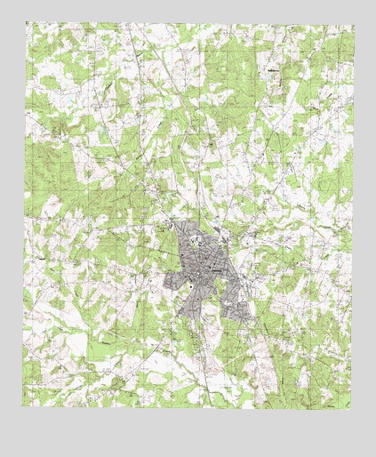
Center, TX USGS Topographic Map
Click on map above to begin viewing in our Map Viewer.

This topographic map contains these locations and features:
Feature Name Type Latitude Longitude GNIS ID View Map
Asbury Chapel CemeteryCemeteryN31.8635°W94.1330°1351293View Map
Blunt CemeteryCemeteryN31.8396°W94.1863°1352431View Map
Blunt ChapelChurchN31.8305°W94.1994°1352432View Map
Bush CreekStreamN31.7730°W94.2227°1353402View Map
C H Daniels Intermediate SchoolSchoolN31.7852°W94.1713°2008859View Map
Cedar Yard CemeteryCemeteryN31.8713°W94.2255°1354168View Map
CenterPopulated PlaceN31.7955°W94.1791°1354185View Map
Center City HallBuildingN31.8050°W94.1864°2753387View Map
Center Country ClubLocaleN31.8691°W94.2099°1384542View Map
Center DivisionCivilN31.8241°W94.1716°1938612View Map
Center Elementary SchoolSchoolN31.7893°W94.1846°2008860View Map
Center Fire DepartmentBuildingN31.8011°W94.1781°2655283View Map
Center High SchoolSchoolN31.8035°W94.1805°2008861View Map
Center Independent School District Police DepartmentBuildingN31.7932°W94.1847°2751288View Map
Center Junior High SchoolSchoolN31.8032°W94.1844°2008862View Map
Center Municipal AirportAirportN31.8316°W94.1564°1386363View Map
Center Police DepartmentBuildingN31.7912°W94.1845°2751193View Map
Center Post OfficePost OfficeN31.7971°W94.1796°2731940View Map
City of CenterCivilN31.7929°W94.1795°2409423View Map
Henrietta CemeteryCemeteryN31.8299°W94.1816°1359040View Map
Irish CreekStreamN31.7746°W94.2280°1360027View Map
Jericho SchoolSchoolN31.8538°W94.1571°1360224View Map
Jones BranchStreamN31.8391°W94.1985°1360376View Map
KDET-AM (Center)TowerN31.8343°W94.2149°1385525View Map
KLCR-FM (Center)TowerN31.8343°W94.2149°1385808View Map
LamarPopulated PlaceN31.7988°W94.2444°1889814View Map
Mull CemeteryCemeteryN31.7741°W94.1835°1363463View Map
Newburn CemeteryCemeteryN31.8310°W94.2177°1363839View Map
Newhope ChurchChurchN31.7974°W94.2305°1363844View Map
North East Texas Emergency Medical ServiceBuildingN31.8053°W94.1671°2720843View Map
North JerichoPopulated PlaceN31.8607°W94.1585°1890050View Map
North Jericho Baptist ChurchChurchN31.8729°W94.1469°1354859View Map
North Jericho CemeteryCemeteryN31.8731°W94.1481°2573414View Map
Oaklawn CemeteryCemeteryN31.8241°W94.1510°1364307View Map
Oliver CreekStreamN31.7674°W94.2116°1364526View Map
Pleasant Grove CemeteryCemeteryN31.8721°W94.2144°1365403View Map
Prairie View CemeteryCemeteryN31.7813°W94.1710°1365745View Map
Saint John ChurchChurchN31.7630°W94.1310°1367172View Map
Shelby CountyCivilN31.7924°W94.1450°1383995View Map
Shelby County Courthouse SquareParkN31.7957°W94.1827°2031877View Map
Shelby County JailBuildingN31.7909°W94.1848°2738691View Map
Shelby County MuseumBuildingN31.7960°W94.1791°2014445View Map
Shelby County Sheriff's DepartmentBuildingN31.7908°W94.1848°2751132View Map
Shelby Regional Medical CenterHospitalN31.7962°W94.1892°2015757View Map
Shofner CreekStreamN31.7685°W94.2013°1368222View Map
Smith CemeteryCemeteryN31.8313°W94.1999°1368472View Map
Smith CreekStreamN31.8707°W94.1858°1368479View Map
WebbPopulated PlaceN31.7630°W94.1252°2034908View Map

Note: Coordinates in the location and feature list above are referenced to NAD83 datum.


Copyright (C) 2008-2025 Ryan Niemi / Sunset Dynamics ... All Rights Reserved