TopoQuest Logo
Do you find TopoQuest useful?
Help keep TopoQuest running and adding new maps/features by donating!
Bitcoin:  19c7KJd3qBynnjoSw5npx9KScwjBe4ifkT
Litecoin:  LXs6TkuXGGXo1vDsWCkWVdjQX94eUKd6ui
Home View Maps Find Maps Find Places Resources & Links


Mount Howe, Montana Topographic Map

USGS Map Title: Mount Howe, MT
USGS Map MRC: 46110E4
DRG (GeoTIFF) Download: o46110e4.tif


Neighboring USGS Topographic Map Quads:


  Hoover Spring, MT  
46110F5
 

  Russian Flat, MT  
46110F4
 

  Daisy Peak, MT  
46110F3
 

  Checkerboard, MT  
46110E5
 

  Mount Howe, MT  
46110E4
 

  Mud Creek, MT  
46110E3
 

  Lennep, MT  
46110D5
 

  Groveland, MT  
46110D4
 

  Martinsdale, MT  
46110D3


Map MRC Location:

N47°
W111°
N47°
W110°
H8 H7 H6 H5 H4 H3 H2 H1
G8 G7 G6 G5 G4 G3 G2 G1
F8 F7 F6 F5 F4 F3 F2 F1
E8 E7 E6 E5 E4 E3 E2 E1
D8 D7 D6 D5 D4 D3 D2 D1
C8 C7 C6 C5 C4 C3 C2 C1
B8 B7 B6 B5 B4 B3 B2 B1
A8 A7 A6 A5 A4 A3 A2 A1
N46°
W111°
N46°
W110°

Mount Howe, MT USGS 1:24K Topographic Map Preview:
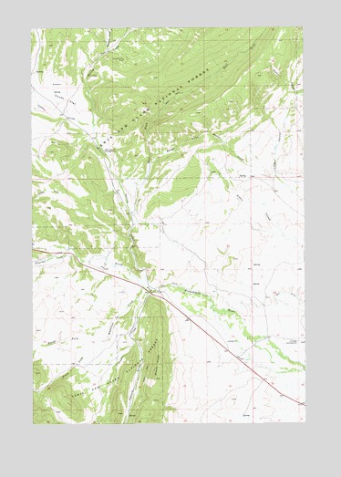
Mount Howe, MT USGS Topographic Map
Click on map above to begin viewing in our Map Viewer.

This topographic map contains these locations and features:
Feature Name Type Latitude Longitude GNIS ID View Map
Baxter GulchValleyN46.5827°W110.4455°779452View Map
BCE Number 3959 MineMineN46.6241°W110.4638°804648View Map
Clara Burton MineMineN46.6150°W110.4585°781308View Map
Clara Burton MineMineN46.6150°W110.4580°804649View Map
Cooks FlatFlatN46.6019°W110.4849°781610View Map
Cooks GulchValleyN46.5941°W110.4735°781611View Map
Cooper CreekStreamN46.5416°W110.4466°781630View Map
East Fork Spring CreekStreamN46.5663°W110.4552°782906View Map
Flagstaff CreekStreamN46.5549°W110.4855°783484View Map
Fort Howie (historical)MilitaryN46.5278°W110.3917°1762754View Map
Holliday Landing Strip (historical)AirportN46.5258°W110.3780°793959View Map
Lou Ire MineMineN46.5138°W110.4908°804700View Map
Mill DitchCanalN46.5405°W110.3838°787379View Map
Moonlight MineMineN46.5119°W110.4866°804701View Map
Mount HoweSummitN46.5144°W110.4446°785112View Map
North Fork Whetstone CreekStreamN46.5266°W110.4716°788277View Map
Pasture GulchValleyN46.5272°W110.4555°788680View Map
South Fork Whetstone CreekStreamN46.5266°W110.4719°791083View Map
Spring CreekStreamN46.5441°W110.4499°791266View Map
Spring Creek CampgroundLocaleN46.5863°W110.4674°791276View Map
West Fork Cooper CreekStreamN46.5008°W110.4713°793002View Map
Whetstone CreekStreamN46.5430°W110.4499°793165View Map
Whitetail CreekStreamN46.6172°W110.4658°793240View Map
Woods GulchValleyN46.5780°W110.3891°793517View Map

Note: Coordinates in the location and feature list above are referenced to NAD83 datum.


Copyright (C) 2008-2025 Ryan Niemi / Sunset Dynamics ... All Rights Reserved