TopoQuest Logo
Do you find TopoQuest useful?
Help keep TopoQuest running and adding new maps/features by donating!
Bitcoin:  19c7KJd3qBynnjoSw5npx9KScwjBe4ifkT
Litecoin:  LXs6TkuXGGXo1vDsWCkWVdjQX94eUKd6ui
Home View Maps Find Maps Find Places Resources & Links


Checkerboard, Montana Topographic Map

USGS Map Title: Checkerboard, MT
USGS Map MRC: 46110E5
DRG (GeoTIFF) Download: o46110e5.tif


Neighboring USGS Topographic Map Quads:


  Volcano Butte, MT  
46110F6
 

  Hoover Spring, MT  
46110F5
 

  Russian Flat, MT  
46110F4
 

  Fourmile Spring, MT  
46110E6
 

  Checkerboard, MT  
46110E5
 

  Mount Howe, MT  
46110E4
 

  Castle Town, MT  
46110D6
 

  Lennep, MT  
46110D5
 

  Groveland, MT  
46110D4


Map MRC Location:

N47°
W111°
N47°
W110°
H8 H7 H6 H5 H4 H3 H2 H1
G8 G7 G6 G5 G4 G3 G2 G1
F8 F7 F6 F5 F4 F3 F2 F1
E8 E7 E6 E5 E4 E3 E2 E1
D8 D7 D6 D5 D4 D3 D2 D1
C8 C7 C6 C5 C4 C3 C2 C1
B8 B7 B6 B5 B4 B3 B2 B1
A8 A7 A6 A5 A4 A3 A2 A1
N46°
W111°
N46°
W110°

Checkerboard, MT USGS 1:24K Topographic Map Preview:
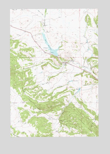
Checkerboard, MT USGS Topographic Map
Click on map above to begin viewing in our Map Viewer.

This topographic map contains these locations and features:
Feature Name Type Latitude Longitude GNIS ID View Map
09N09E02____01 WellWellN46.5702°W110.5555°816867View Map
Bair DamDamN46.5791°W110.5587°794961View Map
Bair ReservoirReservoirN46.5824°W110.5609°779262View Map
Bair Reservoir Sportsmans AccessLocaleN46.5825°W110.5591°798884View Map
Brooks CreekStreamN46.5702°W110.5502°780430View Map
CheckerboardPopulated PlaceN46.5725°W110.5469°806920View Map
Checkerboard CreekStreamN46.5736°W110.5419°781181View Map
Checkerboard School (historical)SchoolN46.5725°W110.5469°1762769View Map
Christensen Number 1 DamDamN46.5783°W110.5108°796222View Map
Christensen Number 2 DamDamN46.5549°W110.5374°796223View Map
Christensen ReservoirReservoirN46.5543°W110.5395°781251View Map
Coates PondLakeN46.5274°W110.5896°781462View Map
Copper CreekStreamN46.6177°W110.5774°781647View Map
Copperopolis MineMineN46.6011°W110.6183°804626View Map
Delpine Post Office (historical)Post OfficeN46.5722°W110.5466°1762702View Map
Delpine School (historical)SchoolN46.5722°W110.5466°1762763View Map
Dry ForkStreamN46.5308°W110.5435°782596View Map
Flagstaff EnclosureLocaleN46.5055°W110.5616°783485View Map
Flagstaff ReservoirReservoirN46.5457°W110.5282°783487View Map
Holliday DamDamN46.5466°W110.5274°795019View Map
Orcutt GulchValleyN46.5649°W110.5113°788480View Map
Solbergs Pine Valley CabinsLocaleN46.5722°W110.5535°1762857View Map
Sourdough CreekStreamN46.5669°W110.5188°790862View Map
Stohr CreekStreamN46.5727°W110.5794°791539View Map
SW SW Section 27 MineMineN46.5933°W110.5841°804642View Map
Thorsens PondLakeN46.5333°W110.6231°792115View Map
Trail CreekStreamN46.5644°W110.5127°792315View Map
West Fork Flagstaff CreekStreamN46.5308°W110.5435°793025View Map
Whetstone RidgeRidgeN46.5047°W110.5119°793168View Map

Note: Coordinates in the location and feature list above are referenced to NAD83 datum.


Copyright (C) 2008-2025 Ryan Niemi / Sunset Dynamics ... All Rights Reserved