TopoQuest Logo
Do you find TopoQuest useful?
Help keep TopoQuest running and adding new maps/features by donating!
Bitcoin:  19c7KJd3qBynnjoSw5npx9KScwjBe4ifkT
Litecoin:  LXs6TkuXGGXo1vDsWCkWVdjQX94eUKd6ui
Home View Maps Find Maps Find Places Resources & Links


Breitenbush Hot Springs, Oregon Topographic Map

USGS Map Title: Breitenbush Hot Springs, OR
USGS Map MRC: 44121G8
DRG (GeoTIFF) Download: o44121g8.tif


Neighboring USGS Topographic Map Quads:


  Bull of the Woods, OR  
44122H1
 

  Mount Lowe, OR  
44121H8
 

  Pinhead Buttes, OR  
44121H7
 

  Mother Lode Mountain, OR  
44122G1
 

  Breitenbush Hot Springs, OR  
44121G8
 

  Olallie Butte, OR  
44121G7
 

  Idanha, OR  
44122F1
 

  Mount Bruno, OR  
44121F8
 

  Mount Jefferson, OR  
44121F7


Map MRC Location:

N45°
W122°
N45°
W121°
H8 H7 H6 H5 H4 H3 H2 H1
G8 G7 G6 G5 G4 G3 G2 G1
F8 F7 F6 F5 F4 F3 F2 F1
E8 E7 E6 E5 E4 E3 E2 E1
D8 D7 D6 D5 D4 D3 D2 D1
C8 C7 C6 C5 C4 C3 C2 C1
B8 B7 B6 B5 B4 B3 B2 B1
A8 A7 A6 A5 A4 A3 A2 A1
N44°
W122°
N44°
W121°

Breitenbush Hot Springs, OR USGS 1:24K Topographic Map Preview:
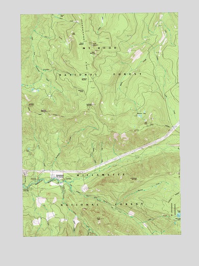
Breitenbush Hot Springs, OR USGS Topographic Map
Click on map above to begin viewing in our Map Viewer.

This topographic map contains these locations and features:
Feature Name Type Latitude Longitude GNIS ID View Map
Bald ButteSummitN44.8115°W121.9004°1137437View Map
Berry CreekStreamN44.8546°W121.8940°1137947View Map
Bow String PitMineN44.8612°W121.9138°2754448View Map
Breiten Guard StationLocaleN44.7821°W121.9676°1116644View Map
BreitenbushPopulated PlaceN44.7818°W121.9720°1156681View Map
Breitenbush Fire DepartmentBuildingN44.7863°W121.9722°2577045View Map
Breitenbush Hot SpringsPopulated PlaceN44.7829°W121.9790°1138591View Map
Breitenbush MountainSummitN44.7804°W121.9104°1138593View Map
Breitenbush Post Office (historical)Post OfficeN44.7818°W121.9720°1164950View Map
Breitenbush Recreation SiteLocaleN44.7810°W121.9901°1138590View Map
Cachebox CreekStreamN44.8465°W121.9898°1139131View Map
Cachebox MeadowFlatN44.8393°W121.9479°1162871View Map
Cascade CreekStreamN44.7546°W121.9498°1139415View Map
Cleator Bend Recreation SiteLocaleN44.7776°W121.9995°1139814View Map
Collawash MountainSummitN44.8237°W121.9442°1139986View Map
Crown LakeLakeN44.7608°W121.8778°1140491View Map
Devils CreekStreamN44.7801°W121.9706°1140946View Map
Devils PeakSummitN44.7593°W121.9392°1140967View Map
Devils Peak TrailTrailN44.7515°W121.9240°1140969View Map
East Fork WayTrailN44.8457°W121.9962°1141616View Map
Firecamp LakesLakeN44.7593°W121.8776°1142128View Map
Gyp CreekStreamN44.8657°W121.9898°1143174View Map
Gyp PointRidgeN44.8637°W121.9617°1143175View Map
Hawk MountainSummitN44.8568°W121.9445°1143376View Map
Hawk Mountain QuarryMineN44.8538°W121.9151°2754449View Map
Hill CreekStreamN44.7773°W121.9973°1143597View Map
Janus Butte TrailTrailN44.8598°W121.9948°1144222View Map
Lake CreekStreamN44.7565°W121.9098°1144758View Map
Little Cedar QuarryMineN44.8599°W121.9026°2754450View Map
Mansfield CreekStreamN44.7810°W121.9781°1145785View Map
Mansfield MountainSummitN44.8198°W121.9809°1145786View Map
Mansfield TrailTrailN44.8101°W121.9823°1145787View Map
Maryanne SpringSpringN44.8319°W121.9512°1145858View Map
Mill CreekStreamN44.7646°W121.9640°1156905View Map
Mink CreekStreamN44.7857°W121.9401°1146329View Map
Minnie Boohoo CreekStreamN44.7790°W121.9998°1153026View Map
North Fork Breitenbush RiverStreamN44.7798°W121.9648°1146910View Map
Queen QuarryMineN44.8519°W121.8909°2754451View Map
Rapidan CreekStreamN44.7850°W121.9433°1148218View Map
Rapidan TrailTrailN44.8082°W121.9229°1148219View Map
Roaring CreekStreamN44.7643°W121.9265°1148517View Map
Roaring Creek TrailTrailN44.7704°W121.8951°1148518View Map
Round Lake TrailTrailN44.8548°W121.9767°1148771View Map
Round MeadowFlatN44.8560°W121.9548°1148773View Map
Scorpion MountainSummitN44.8235°W121.9954°1149160View Map
Short CreekStreamN44.7810°W121.9884°1149430View Map
Short LakeLakeN44.7993°W121.9958°1149437View Map
Skunk CreekStreamN44.7612°W121.9587°1149645View Map
South Fork Breitenbush RiverStreamN44.7798°W121.9648°1149937View Map
Sportsman LakesReservoirN44.8169°W121.9067°1150139View Map
Thomas TrailTrailN44.7585°W121.9959°1151081View Map
Twin MeadowsFlatN44.8510°W121.9417°1151572View Map
Twin Meadows TrailTrailN44.8473°W121.9079°1151573View Map

Note: Coordinates in the location and feature list above are referenced to NAD83 datum.


Copyright (C) 2008-2024 Ryan Niemi / Sunset Dynamics ... All Rights Reserved