TopoQuest Logo
Do you find TopoQuest useful?
Help keep TopoQuest running and adding new maps/features by donating!
Bitcoin:  19c7KJd3qBynnjoSw5npx9KScwjBe4ifkT
Litecoin:  LXs6TkuXGGXo1vDsWCkWVdjQX94eUKd6ui
Home View Maps Find Maps Find Places Resources & Links


Mount June, Oregon Topographic Map

USGS Map Title: Mount June, OR
USGS Map MRC: 43122G6
DRG (GeoTIFF) Download: o43122g6.tif


Neighboring USGS Topographic Map Quads:


  Lowell, OR  
43122H7
 

  Fall Creek Lake, OR  
43122H6
 

  Saddleblanket Mountain, OR  
43122H5
 

  Kloster Mountain, OR  
43122G7
 

  Mount June, OR  
43122G6
 

  Westfir West, OR  
43122G5
 

  Culp Creek, OR  
43122F7
 

  Rose Hill, OR  
43122F6
 

  Holland Point, OR  
43122F5


Map MRC Location:

N44°
W123°
N44°
W122°
H8 H7 H6 H5 H4 H3 H2 H1
G8 G7 G6 G5 G4 G3 G2 G1
F8 F7 F6 F5 F4 F3 F2 F1
E8 E7 E6 E5 E4 E3 E2 E1
D8 D7 D6 D5 D4 D3 D2 D1
C8 C7 C6 C5 C4 C3 C2 C1
B8 B7 B6 B5 B4 B3 B2 B1
A8 A7 A6 A5 A4 A3 A2 A1
N43°
W123°
N43°
W122°

Mount June, OR USGS 1:24K Topographic Map Preview:
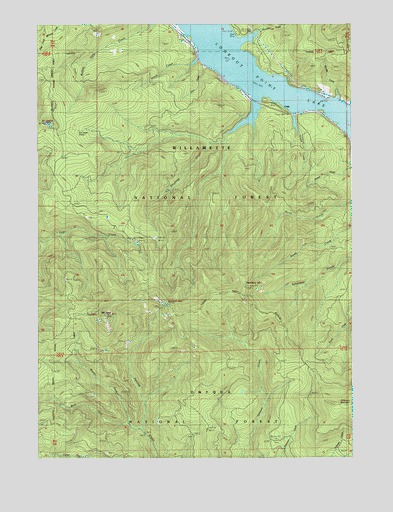
Mount June, OR USGS Topographic Map
Click on map above to begin viewing in our Map Viewer.

This topographic map contains these locations and features:
Feature Name Type Latitude Longitude GNIS ID View Map
Ash Swale ShelterLocaleN43.8446°W122.7345°1637967View Map
Bannister CreekStreamN43.8729°W122.6628°1137501View Map
Coon CreekStreamN43.8582°W122.6762°1153370View Map
CraleLocaleN43.8507°W122.6539°1140362View Map
Crale CreekStreamN43.8490°W122.6489°1140363View Map
Eagles RestSummitN43.8468°W122.7478°1141498View Map
Eagles Rest TrailTrailN43.8437°W122.7212°1141499View Map
Fern CreekStreamN43.8637°W122.6851°1142068View Map
Goodman CreekStreamN43.8529°W122.6637°1142845View Map
Hardesty Lookout TowerTowerN43.7990°W122.6687°1699866View Map
Hardesty MountainSummitN43.7972°W122.6703°1143297View Map
Hardesty TrailTrailN43.8223°W122.6589°1158276View Map
Hazel CreekStreamN43.8651°W122.6865°1143425View Map
Ivan Oakes ParkParkN43.8721°W122.6706°1162176View Map
Ivan Oaks Boat RampLocaleN43.8716°W122.6723°2668274View Map
Lookout Point LakeReservoirN43.8714°W122.6795°1145479View Map
Middle Fork Junetta CreekStreamN43.7587°W122.7101°1146149View Map
Mount JuneSummitN43.7911°W122.7244°1144437View Map
Patterson MountainSummitN43.7653°W122.6261°1147493View Map
Reserve (historical)LocaleN43.8637°W122.6678°1166257View Map
Rhodes CreekStreamN43.8535°W122.6312°1148405View Map
Sawtooth RockPillarN43.7943°W122.6996°1149106View Map
Signal Point Recreation AreaAreaN43.8748°W122.6984°1162177View Map
West Fork Junetta CreekStreamN43.7604°W122.7156°1152089View Map

Note: Coordinates in the location and feature list above are referenced to NAD83 datum.


Copyright (C) 2008-2024 Ryan Niemi / Sunset Dynamics ... All Rights Reserved