TopoQuest Logo
Do you find TopoQuest useful?
Help keep TopoQuest running and adding new maps/features by donating!
Bitcoin:  19c7KJd3qBynnjoSw5npx9KScwjBe4ifkT
Litecoin:  LXs6TkuXGGXo1vDsWCkWVdjQX94eUKd6ui
Home View Maps Find Maps Find Places Resources & Links


Holland Point, Oregon Topographic Map

USGS Map Title: Holland Point, OR
USGS Map MRC: 43122F5
DRG (GeoTIFF) Download: o43122f5.tif


Neighboring USGS Topographic Map Quads:


  Mount June, OR  
43122G6
 

  Westfir West, OR  
43122G5
 

  Westfir East, OR  
43122G4
 

  Rose Hill, OR  
43122F6
 

  Holland Point, OR  
43122F5
 

  Oakridge, OR  
43122F4
 

  Fairview Peak, OR  
43122E6
 

  Bearbones Mountain, OR  
43122E5
 

  Warner Mountain, OR  
43122E4


Map MRC Location:

N44°
W123°
N44°
W122°
H8 H7 H6 H5 H4 H3 H2 H1
G8 G7 G6 G5 G4 G3 G2 G1
F8 F7 F6 F5 F4 F3 F2 F1
E8 E7 E6 E5 E4 E3 E2 E1
D8 D7 D6 D5 D4 D3 D2 D1
C8 C7 C6 C5 C4 C3 C2 C1
B8 B7 B6 B5 B4 B3 B2 B1
A8 A7 A6 A5 A4 A3 A2 A1
N43°
W123°
N43°
W122°

Holland Point, OR USGS 1:24K Topographic Map Preview:
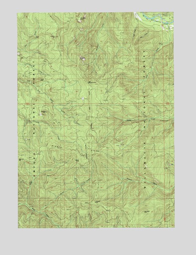
Holland Point, OR USGS Topographic Map
Click on map above to begin viewing in our Map Viewer.

This topographic map contains these locations and features:
Feature Name Type Latitude Longitude GNIS ID View Map
Barnard BridgeBridgeN43.7469°W122.5111°1162155View Map
Chilly CreekStreamN43.7432°W122.5301°1139647View Map
Deception ButteSummitN43.7464°W122.5767°1140772View Map
Deception RockSummitN43.7231°W122.5767°1140776View Map
Dinner RidgeRidgeN43.6698°W122.5776°1134461View Map
Dinner Ridge WayTrailN43.6679°W122.5087°1141042View Map
Errin CampgroundLocaleN43.7471°W122.5095°1162156View Map
Ferrin Recreation SiteLocaleN43.7479°W122.5103°1926267View Map
Fivepoint HillSummitN43.7356°W122.5958°1142209View Map
Gray CreekStreamN43.7421°W122.5048°1142998View Map
Hill Post Office (historical)Post OfficeN43.7082°W122.5484°1164412View Map
Holland MeadowsFlatN43.6693°W122.5662°1143666View Map
Holland Meadows TrailTrailN43.6971°W122.5681°1143667View Map
Holland PointSummitN43.6639°W122.5765°1143668View Map
Larison Creek TrailTrailN43.7073°W122.5031°1144830View Map
Little Deception RockPillarN43.7092°W122.5700°1145145View Map
Lower Parker FallsFallsN43.6358°W122.6067°2576236View Map
McFarland PointSummitN43.6340°W122.5261°1145978View Map
MoonfallsFallsN43.7357°W122.6111°1155385View Map
Packard Creek TrailTrailN43.6348°W122.5062°1147332View Map
Parker CreekStreamN43.6340°W122.6078°1147446View Map
Pinard ButteSummitN43.7108°W122.6083°1147680View Map
Pinard FallsFallsN43.7094°W122.6153°2576238View Map
Spot CreekStreamN43.7415°W122.5203°1150140View Map
Swastika MountainSummitN43.6923°W122.6035°1150767View Map
Swastika Mountain TrailTrailN43.6890°W122.5976°1150768View Map
Timbered KnollSummitN43.6405°W122.5652°1151245View Map
Upper Parker FallsFallsN43.6375°W122.6039°2576237View Map
Willamette Divide TrailTrailN43.7335°W122.5948°1152380View Map
Wyatt CreekStreamN43.6393°W122.6201°1152668View Map

Note: Coordinates in the location and feature list above are referenced to NAD83 datum.


Copyright (C) 2008-2024 Ryan Niemi / Sunset Dynamics ... All Rights Reserved