TopoQuest Logo
Do you find TopoQuest useful?
Help keep TopoQuest running and adding new maps/features by donating!
Bitcoin:  19c7KJd3qBynnjoSw5npx9KScwjBe4ifkT
Litecoin:  LXs6TkuXGGXo1vDsWCkWVdjQX94eUKd6ui
Home View Maps Find Maps Find Places Resources & Links


Rose Hill, Oregon Topographic Map

USGS Map Title: Rose Hill, OR
USGS Map MRC: 43122F6
DRG (GeoTIFF) Download: o43122f6.tif


Neighboring USGS Topographic Map Quads:


  Kloster Mountain, OR  
43122G7
 

  Mount June, OR  
43122G6
 

  Westfir West, OR  
43122G5
 

  Culp Creek, OR  
43122F7
 

  Rose Hill, OR  
43122F6
 

  Holland Point, OR  
43122F5
 

  Silica Mountain, OR  
43122E7
 

  Fairview Peak, OR  
43122E6
 

  Bearbones Mountain, OR  
43122E5


Map MRC Location:

N44°
W123°
N44°
W122°
H8 H7 H6 H5 H4 H3 H2 H1
G8 G7 G6 G5 G4 G3 G2 G1
F8 F7 F6 F5 F4 F3 F2 F1
E8 E7 E6 E5 E4 E3 E2 E1
D8 D7 D6 D5 D4 D3 D2 D1
C8 C7 C6 C5 C4 C3 C2 C1
B8 B7 B6 B5 B4 B3 B2 B1
A8 A7 A6 A5 A4 A3 A2 A1
N43°
W123°
N43°
W122°

Rose Hill, OR USGS 1:24K Topographic Map Preview:
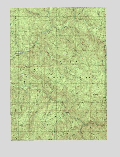
Rose Hill, OR USGS Topographic Map
Click on map above to begin viewing in our Map Viewer.

This topographic map contains these locations and features:
Feature Name Type Latitude Longitude GNIS ID View Map
Adams CreekStreamN43.6723°W122.7306°1137013View Map
Alex CreekStreamN43.7298°W122.6484°1137118View Map
Blodgett CreekStreamN43.6748°W122.7384°1138267View Map
Bonita Post Office (historical)Post OfficeN43.6512°W122.6764°1164227View Map
Cat CreekStreamN43.6335°W122.6603°1139459View Map
Cedar CreekStreamN43.6707°W122.7067°1139495View Map
Cedar Creek Recreation SiteLocaleN43.6698°W122.7059°1139516View Map
Cedar SpringSpringN43.6396°W122.7345°1139531View Map
Champion CreekStreamN43.6398°W122.6559°1139558View Map
Crawfish CreekStreamN43.6640°W122.6976°1140405View Map
Crawfish LakeLakeN43.6251°W122.7034°1140407View Map
Curran CreekStreamN43.7412°W122.7023°1140562View Map
Dinner CreekStreamN43.7165°W122.7159°1141038View Map
Dog CreekStreamN43.6615°W122.6906°1141128View Map
Donna CreekStreamN43.6707°W122.7070°1141179View Map
Doris CreekStreamN43.7326°W122.6770°1141193View Map
Doris RidgeRidgeN43.7110°W122.6456°1156723View Map
East Fork Layng CreekStreamN43.7137°W122.6295°1141578View Map
East Fork Prather CreekStreamN43.7126°W122.7415°1141593View Map
Green Rock MineMineN43.6290°W122.6414°1156726View Map
Harvey CreekStreamN43.7273°W122.6867°1143345View Map
Harvey PointRidgeN43.7165°W122.6831°1167042View Map
Herman CreekStreamN43.7385°W122.6676°1143510View Map
Hobo CreekStreamN43.6469°W122.6715°1143624View Map
Hobo Creek Recreation SiteLocaleN43.6471°W122.6678°1156725View Map
Hotel SpringSpringN43.6276°W122.6289°1153341View Map
Inch CreekStreamN43.6515°W122.6792°1144011View Map
Junetta CreekStreamN43.7323°W122.6962°1144438View Map
Kelly RidgeRidgeN43.7040°W122.6345°1156724View Map
Laying Creek Water Treatment PlantLocaleN43.7078°W122.7387°2660807View Map
Layng Creek Fossil BedsParkN43.7114°W122.7297°2754352View Map
Layng Creek Ranger StationBuildingN43.7068°W122.7401°1144898View Map
Lower Trestle Creek FallsFallsN43.6472°W122.6575°2576234View Map
Lund Park Recreation SiteLocaleN43.6510°W122.6767°1145681View Map
Marten CreekStreamN43.6515°W122.6792°1145835View Map
Patterson CreekStreamN43.7376°W122.6645°1147492View Map
Prather CreekStreamN43.7065°W122.7409°1147990View Map
Rose HillSummitN43.6883°W122.7175°1148731View Map
Rujada PointRidgeN43.6943°W122.7323°1158463View Map
Rujada Post Office (historical)Post OfficeN43.7065°W122.7420°1164650View Map
Rujada Recreation SiteLocaleN43.7060°W122.7445°1134907View Map
Saltpeter CreekStreamN43.7321°W122.6495°1149007View Map
Silverstairs CreekStreamN43.7171°W122.6298°1149513View Map
Spirit FallsFallsN43.7308°W122.6416°1155386View Map
Sugarloaf MountainSummitN43.6642°W122.6262°1150559View Map
Trestle CreekStreamN43.6448°W122.6612°1151413View Map
Upper Trestle Creek FallsFallsN43.6514°W122.6514°2576235View Map
West Fork Prather CreekStreamN43.7151°W122.7428°1152105View Map

Note: Coordinates in the location and feature list above are referenced to NAD83 datum.


Copyright (C) 2008-2025 Ryan Niemi / Sunset Dynamics ... All Rights Reserved