TopoQuest Logo
Do you find TopoQuest useful?
Help keep TopoQuest running and adding new maps/features by donating!
Bitcoin:  19c7KJd3qBynnjoSw5npx9KScwjBe4ifkT
Litecoin:  LXs6TkuXGGXo1vDsWCkWVdjQX94eUKd6ui
Home View Maps Find Maps Find Places Resources & Links


Mount Meigs, Alabama Topographic Map

USGS Map Title: Mount Meigs, AL
USGS Map MRC: 32086C1
DRG (GeoTIFF) Download: o32086c1.tif


Neighboring USGS Topographic Map Quads:


  Willow Springs, AL  
32086D2
 

  Brassell, AL  
32086D1
 

  Shorter, AL  
32085D8
 

  Barachias, AL  
32086C2
 

  Mount Meigs, AL  
32086C1
 

  Chesson, AL  
32085C8
 

  Davis Crossroads, AL  
32086B2
 

  Teasleys Mill, AL  
32086B1
 

  Fitzpatrick, AL  
32085B8


Map MRC Location:

N33°
W87°
N33°
W86°
H8 H7 H6 H5 H4 H3 H2 H1
G8 G7 G6 G5 G4 G3 G2 G1
F8 F7 F6 F5 F4 F3 F2 F1
E8 E7 E6 E5 E4 E3 E2 E1
D8 D7 D6 D5 D4 D3 D2 D1
C8 C7 C6 C5 C4 C3 C2 C1
B8 B7 B6 B5 B4 B3 B2 B1
A8 A7 A6 A5 A4 A3 A2 A1
N32°
W87°
N32°
W86°

Mount Meigs, AL USGS 1:24K Topographic Map Preview:
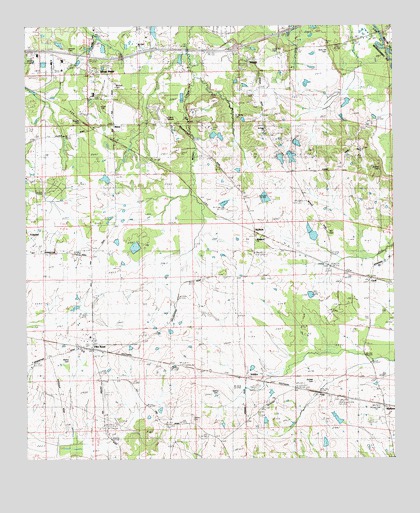
Mount Meigs, AL USGS Topographic Map
Click on map above to begin viewing in our Map Viewer.

This topographic map contains these locations and features:
Feature Name Type Latitude Longitude GNIS ID View Map
Antioch Baptist Church (historical)ChurchN32.3679°W86.1108°147688View Map
Antioch CemeteryCemeteryN32.3681°W86.1113°113106View Map
Ashurst CemeteryCemeteryN32.3468°W86.1058°113257View Map
Barkley DamDamN32.3135°W86.0900°130415View Map
Barkley LakeReservoirN32.3135°W86.0900°130416View Map
Barnett CemeteryCemeteryN32.2729°W86.0280°113502View Map
Bartlett Ranch AirportAirportN32.2725°W86.0989°2676371View Map
Belser DamDamN32.3418°W86.0633°130455View Map
Belser LakeReservoirN32.3418°W86.0633°130456View Map
Birch Hill CemeteryCemeteryN32.3685°W86.0219°114361View Map
Boykin DamDamN32.3035°W86.1250°130392View Map
Boykin LakeReservoirN32.3035°W86.1250°130391View Map
Brewer Memorial ChurchChurchN32.3013°W86.0086°163293View Map
Brighter CemeteryCemeteryN32.3024°W86.0452°147728View Map
Camp BelserLocaleN32.3488°W86.0769°115433View Map
CecilPopulated PlaceN32.3026°W86.0086°115733View Map
Eastwood VillaPopulated PlaceN32.3710°W86.0550°142509View Map
FoxchasePopulated PlaceN32.3154°W86.1152°142549View Map
Foxwood TracePopulated PlaceN32.3368°W86.1189°142551View Map
Frank Rutland Lake Number 1ReservoirN32.3369°W86.0384°164452View Map
Frank Rutland Lake Number TwoReservoirN32.3301°W86.0450°130440View Map
Frank Rutland Number 1 DamDamN32.3368°W86.0400°130452View Map
Frank Rutland Number 2 DamDamN32.3301°W86.0450°130439View Map
Freeman DamDamN32.3301°W86.0983°130441View Map
Freeman LakeReservoirN32.3312°W86.0978°130442View Map
FreeportPopulated PlaceN32.3479°W86.0741°142552View Map
Georgia Washington SchoolSchoolN32.3554°W86.1016°142565View Map
Gerald Wallace Lake Number OneReservoirN32.3401°W86.0366°130454View Map
Gerald Wallace Lake Number TwoReservoirN32.3509°W86.0247°130464View Map
Gerald Wallace Number 1 DamDamN32.3401°W86.0366°130453View Map
Gerald Wallace Number 2 DamDamN32.3451°W86.0283°130465View Map
Gilder CemeteryCemeteryN32.3512°W86.0983°118951View Map
Gilmer CemeteryCemeteryN32.2629°W86.0694°118969View Map
Gilmer SchoolSchoolN32.2615°W86.0755°118971View Map
Glory Hill ChurchChurchN32.3313°W86.0816°142569View Map
Grace CemeteryCemeteryN32.3551°W86.0938°142574View Map
Grace ChurchChurchN32.3551°W86.0977°142575View Map
Hardt CemeteryCemeteryN32.2629°W86.0405°119726View Map
Harris SchoolSchoolN32.3565°W86.0472°142594View Map
Hill CemeteryCemeteryN32.3154°W86.0219°120092View Map
Interchange 16CrossingN32.3690°W86.0527°155620View Map
Judkins CemeteryCemeteryN32.3335°W86.0047°121064View Map
Kershaw AirportAirportN32.3609°W86.1174°129429View Map
KnollwoodPopulated PlaceN32.3646°W86.0494°142655View Map
Lilly Hill Church (historical)ChurchN32.2529°W86.0583°142672View Map
Little Rock ChurchChurchN32.3365°W86.0600°121867View Map
LondonPopulated PlaceN32.2732°W86.0502°156628View Map
Lucas Hill CemeteryCemeteryN32.3679°W86.0402°122100View Map
Lydia Hill Church (historical)ChurchN32.2646°W86.0838°142675View Map
Lydia Hill School (historical)SchoolN32.2640°W86.0833°142676View Map
Manning Springs/McDade CemeteryCemeteryN32.3515°W86.0455°142684View Map
MathewsPopulated PlaceN32.2654°W86.0038°156669View Map
MathewsPopulated PlaceN32.2646°W86.0046°2747836View Map
Mathews ChurchChurchN32.2693°W86.0050°142686View Map
Mathews Post OfficePost OfficeN32.2649°W86.0036°169098View Map
Mathis CemeteryCemeteryN32.2687°W86.0602°122381View Map
Mathis CemeteryCemeteryN32.2801°W86.1122°122382View Map
McClurkin Lake Number ThreeReservoirN32.3165°W86.0288°130418View Map
McClurkin Lake Number TwoReservoirN32.3118°W86.0283°130414View Map
McClurkin Number 2 DamDamN32.3118°W86.0283°130413View Map
McClurkin Number 3 DamDamN32.3151°W86.0300°130417View Map
McClurkin SchoolSchoolN32.3107°W86.0480°122480View Map
McDadePopulated PlaceN32.3157°W86.0463°156683View Map
MerryPopulated PlaceN32.3468°W86.0944°152304View Map
Mitchell CemeteryCemeteryN32.3576°W86.0947°122896View Map
Mount MeigsPopulated PlaceN32.3626°W86.1019°123243View Map
Mount Meigs CemeteryCemeteryN32.3551°W86.0994°142732View Map
Mount Meigs DivisionCivilN32.3655°W86.0578°165906View Map
Mount Meigs Post OfficePost OfficeN32.3618°W86.1010°169099View Map
Mount Olive ChurchChurchN32.3693°W86.0864°123301View Map
Mount Pleasant ChurchChurchN32.2507°W86.0002°142736View Map
Mount Pleasant SchoolSchoolN32.2510°W86.0016°123374View Map
Murdock ChurchChurchN32.3546°W86.1000°142742View Map
Peace ChurchChurchN32.2790°W86.1227°124538View Map
Peace ChurchChurchN32.3399°W86.0097°124539View Map
Pike RoadPopulated PlaceN32.2843°W86.1030°155197View Map
Pike Road ChurchChurchN32.2846°W86.1030°142789View Map
Pike Road Post OfficePost OfficeN32.3482°W86.0956°169100View Map
Pike Road Volunteer Fire Department Station 1BuildingN32.3029°W86.0557°2691229View Map
Pike Road Volunteer Fire Department Station 2BuildingN32.3545°W86.0835°2691479View Map
Pike Road Volunteer Fire Department Station 3BuildingN32.2646°W86.0033°2691488View Map
Pike Road Volunteer Fire Department Station 5BuildingN32.3334°W86.0257°2691585View Map
Saint James CemeteryCemeteryN32.3482°W86.0522°126097View Map
Saint Matthew ChurchChurchN32.2679°W86.0211°126170View Map
Saint Paul ChurchChurchN32.3038°W86.0591°126179View Map
Saint Pauls ChurchChurchN32.3454°W86.0441°142845View Map
Shirley DamDamN32.2618°W86.0216°130358View Map
Shirley LakeReservoirN32.2618°W86.0216°130357View Map
TimberlanePopulated PlaceN32.3413°W86.1077°142902View Map
WaughPopulated PlaceN32.3651°W86.0450°128654View Map
Weeping Willow ChurchChurchN32.2501°W86.0927°128705View Map
Woodland United Methodist ChurchChurchN32.3135°W86.0472°155472View Map

Note: Coordinates in the location and feature list above are referenced to NAD83 datum.


Copyright (C) 2008-2024 Ryan Niemi / Sunset Dynamics ... All Rights Reserved