TopoQuest Logo
Do you find TopoQuest useful?
Help keep TopoQuest running and adding new maps/features by donating!
Bitcoin:  19c7KJd3qBynnjoSw5npx9KScwjBe4ifkT
Litecoin:  LXs6TkuXGGXo1vDsWCkWVdjQX94eUKd6ui
Home View Maps Find Maps Find Places Resources & Links


Teasleys Mill, Alabama Topographic Map

USGS Map Title: Teasleys Mill, AL
USGS Map MRC: 32086B1
DRG (GeoTIFF) Download: o32086b1.tif


Neighboring USGS Topographic Map Quads:


  Barachias, AL  
32086C2
 

  Mount Meigs, AL  
32086C1
 

  Chesson, AL  
32085C8
 

  Davis Crossroads, AL  
32086B2
 

  Teasleys Mill, AL  
32086B1
 

  Fitzpatrick, AL  
32085B8
 

  Ramer, AL  
32086A2
 

  Pine Level, AL  
32086A1
 

  China Grove, AL  
32085A8


Map MRC Location:

N33°
W87°
N33°
W86°
H8 H7 H6 H5 H4 H3 H2 H1
G8 G7 G6 G5 G4 G3 G2 G1
F8 F7 F6 F5 F4 F3 F2 F1
E8 E7 E6 E5 E4 E3 E2 E1
D8 D7 D6 D5 D4 D3 D2 D1
C8 C7 C6 C5 C4 C3 C2 C1
B8 B7 B6 B5 B4 B3 B2 B1
A8 A7 A6 A5 A4 A3 A2 A1
N32°
W87°
N32°
W86°

Teasleys Mill, AL USGS 1:24K Topographic Map Preview:
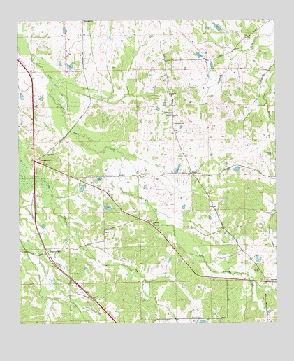
Teasleys Mill, AL USGS Topographic Map
Click on map above to begin viewing in our Map Viewer.

This topographic map contains these locations and features:
Feature Name Type Latitude Longitude GNIS ID View Map
Allison DamDamN32.2451°W86.1033°130336View Map
Allison LakeReservoirN32.2462°W86.1021°130335View Map
Barnett CemeteryCemeteryN32.2107°W86.0511°147697View Map
Briar Hill ChurchChurchN32.1660°W86.0594°114880View Map
Briar Hill School (historical)SchoolN32.1663°W86.0611°147726View Map
Brooks Lake Number TwoReservoirN32.1729°W86.0818°130231View Map
Brooks Number 2 DamDamN32.1735°W86.0833°130232View Map
CantyPopulated PlaceN32.1635°W86.0830°156147View Map
Carters HillPopulated PlaceN32.1929°W86.1172°156153View Map
Chapel Gray School (historical)SchoolN32.1915°W86.1180°147761View Map
Cherry Hill School (historical)SchoolN32.2099°W86.0500°147762View Map
Clay Hill ChurchChurchN32.1463°W86.0083°116201View Map
DowningPopulated PlaceN32.1418°W86.0058°1989119View Map
Elizabeth ChurchChurchN32.1457°W86.0997°117926View Map
Grays LakeReservoirN32.1810°W86.0940°130244View Map
Guy Pugh DamDamN32.1251°W86.0383°130180View Map
Jerusalem ChurchChurchN32.2107°W86.0505°120872View Map
Kirksey DamDamN32.2301°W86.1000°130324View Map
Kirksey LakeReservoirN32.2315°W86.0994°130323View Map
Lake PughReservoirN32.1254°W86.0365°130179View Map
Lee Merriweather DamDamN32.2451°W86.0266°130334View Map
Liberty Church (historical)ChurchN32.1924°W86.1180°142669View Map
MamiePopulated PlaceN32.1865°W86.0405°122240View Map
McNear School (historical)SchoolN32.1368°W86.0897°142694View Map
Meriwether CemeteryCemeteryN32.2432°W86.0136°163269View Map
Merriweather LakeReservoirN32.2471°W86.0279°130333View Map
Morris Dees Lake Number TwoReservoirN32.2187°W86.1229°130298View Map
Morris Dees Number 2 DamDamN32.2168°W86.1233°130299View Map
Mount Olia ChurchChurchN32.2199°W86.0497°152455View Map
New Liberty ChurchChurchN32.1949°W86.1111°123857View Map
Orange CemeteryCemeteryN32.1946°W86.0016°124299View Map
Panhandle CemeteryCemeteryN32.2076°W86.0491°124397View Map
Pike Road DivisionCivilN32.2415°W86.1176°165907View Map
Pike Road Volunteer Fire Department Station 4BuildingN32.1853°W86.0714°2691478View Map
Pleasant Grove ChurchChurchN32.2118°W86.0491°152975View Map
Shepherd HillPopulated PlaceN32.1857°W86.0663°157049View Map
Sorrell LakeReservoirN32.2356°W86.0369°130328View Map
T S Turnipseed DamDamN32.1501°W86.0116°130213View Map
T S Turnipseed LakeReservoirN32.1501°W86.0116°130214View Map
Teasleys MillPopulated PlaceN32.1543°W86.1113°153665View Map
W C Gray DamDamN32.1801°W86.0950°130243View Map
W J Sorrell DamDamN32.2351°W86.0366°130329View Map
W R Turnipseed DamDamN32.1885°W86.0483°130257View Map
W R Turnipseed LakeReservoirN32.1885°W86.0478°130256View Map

Note: Coordinates in the location and feature list above are referenced to NAD83 datum.


Copyright (C) 2008-2025 Ryan Niemi / Sunset Dynamics ... All Rights Reserved