TopoQuest Logo
Do you find TopoQuest useful?
Help keep TopoQuest running and adding new maps/features by donating!
Bitcoin:  19c7KJd3qBynnjoSw5npx9KScwjBe4ifkT
Litecoin:  LXs6TkuXGGXo1vDsWCkWVdjQX94eUKd6ui
Home View Maps Find Maps Find Places Resources & Links


Picture Gorge East, Oregon Topographic Map

USGS Map Title: Picture Gorge East, OR
USGS Map MRC: 44119E5
DRG (GeoTIFF) Download: o44119e5.tif


Neighboring USGS Topographic Map Quads:


  Mount Misery, OR  
44119F6
 

  Miller Flat, OR  
44119F5
 

  Courthouse Rock, OR  
44119F4
 

  Picture Gorge West, OR  
44119E6
 

  Picture Gorge East, OR  
44119E5
 

  Sheep Ridge, OR  
44119E4
 

  Day Basin, OR  
44119D6
 

  Dayville, OR  
44119D5
 

  Aldrich Mountain North, OR  
44119D4


Map MRC Location:

N45°
W120°
N45°
W119°
H8 H7 H6 H5 H4 H3 H2 H1
G8 G7 G6 G5 G4 G3 G2 G1
F8 F7 F6 F5 F4 F3 F2 F1
E8 E7 E6 E5 E4 E3 E2 E1
D8 D7 D6 D5 D4 D3 D2 D1
C8 C7 C6 C5 C4 C3 C2 C1
B8 B7 B6 B5 B4 B3 B2 B1
A8 A7 A6 A5 A4 A3 A2 A1
N44°
W120°
N44°
W119°

Picture Gorge East, OR USGS 1:24K Topographic Map Preview:
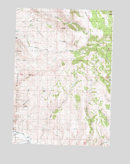
Picture Gorge East, OR USGS Topographic Map
Click on map above to begin viewing in our Map Viewer.

This topographic map contains these locations and features:
Feature Name Type Latitude Longitude GNIS ID View Map
Big BasinBasinN44.6060°W119.6017°1117583View Map
Cottonwood CreekStreamN44.5018°W119.6019°1140182View Map
Erickson MillLocaleN44.5868°W119.5525°1136268View Map
Hole in the GroundBasinN44.5351°W119.6175°1121915View Map
Land's Inn Ranch AirportAirportN44.5922°W119.5627°1133803View Map
Mascall RanchLocaleN44.5035°W119.6069°1123825View Map
Middle MountainSummitN44.5835°W119.6203°1124124View Map
Old Kennedy Cabin (historical)LocaleN44.5399°W119.5808°1147198View Map
Old Watkins Cabin (historical)LocaleN44.5699°W119.6042°1124976View Map
Rattlesnake CreekStreamN44.5110°W119.6191°1125830View Map
Sheep GulchValleyN44.5013°W119.5947°1126823View Map
SugarloafSummitN44.6074°W119.5644°1127693View Map
Turtle CoveBasinN44.5965°W119.6222°1128324View Map
Willow SpringSpringN44.5491°W119.5878°1129167View Map
Windy PointSummitN44.5629°W119.6030°1133804View Map

Note: Coordinates in the location and feature list above are referenced to NAD83 datum.


Copyright (C) 2008-2024 Ryan Niemi / Sunset Dynamics ... All Rights Reserved