TopoQuest Logo
Do you find TopoQuest useful?
Help keep TopoQuest running and adding new maps/features by donating!
Bitcoin:  19c7KJd3qBynnjoSw5npx9KScwjBe4ifkT
Litecoin:  LXs6TkuXGGXo1vDsWCkWVdjQX94eUKd6ui
Home View Maps Find Maps Find Places Resources & Links


Mount Pleasant, Indiana Topographic Map

USGS Map Title: Mount Pleasant, IN
USGS Map MRC: 40085A3
DRG (GeoTIFF) Download: o40085a3.tif


Neighboring USGS Topographic Map Quads:


  Muncie West, IN  
40085B4
 

  Muncie East, IN  
40085B3
 

  Farmland, IN  
40085B2
 

  Sulphur Springs, IN  
40085A4
 

  Mount Pleasant, IN  
40085A3
 

  Modoc, IN  
40085A2
 

  New Castle West, IN  
39085H4
 

  New Castle East, IN  
39085H3
 

  Hagerstown, IN  
39085H2


Map MRC Location:

N41°
W86°
N41°
W85°
H8 H7 H6 H5 H4 H3 H2 H1
G8 G7 G6 G5 G4 G3 G2 G1
F8 F7 F6 F5 F4 F3 F2 F1
E8 E7 E6 E5 E4 E3 E2 E1
D8 D7 D6 D5 D4 D3 D2 D1
C8 C7 C6 C5 C4 C3 C2 C1
B8 B7 B6 B5 B4 B3 B2 B1
A8 A7 A6 A5 A4 A3 A2 A1
N40°
W86°
N40°
W85°

Mount Pleasant, IN USGS 1:24K Topographic Map Preview:
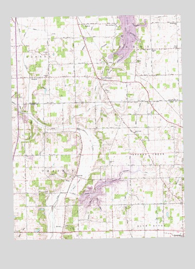
Mount Pleasant, IN USGS Topographic Map
Click on map above to begin viewing in our Map Viewer.

This topographic map contains these locations and features:
Feature Name Type Latitude Longitude GNIS ID View Map
Brave RunStreamN40.0687°W85.3600°431456View Map
Brown RunStreamN40.0225°W85.3175°431633View Map
Buck Creek ChurchChurchN40.0592°W85.2855°431729View Map
Burlington RunStreamN40.1137°W85.2900°431846View Map
Cemetery RunStreamN40.0748°W85.3139°432299View Map
Center SchoolSchoolN40.1056°W85.2714°432340View Map
Chief RunStreamN40.0639°W85.3508°432474View Map
Clift DitchCanalN40.0575°W85.3189°432652View Map
Cunningham DitchCanalN40.1242°W85.2616°433249View Map
Fairview CemeteryCemeteryN40.1053°W85.3483°434322View Map
Felton CemeteryCemeteryN40.0948°W85.3033°434441View Map
Felton CreekStreamN40.1056°W85.2936°434442View Map
Gates CornerPopulated PlaceN40.1062°W85.2527°434992View Map
Gibson DitchCanalN40.1178°W85.3536°435055View Map
Harris ChapelChurchN40.0989°W85.2830°435780View Map
Harvey CemeteryCemeteryN40.0074°W85.3374°435850View Map
Harvey RunStreamN40.0070°W85.3464°435853View Map
Hodson CemeteryCemeteryN40.0294°W85.2514°436269View Map
Huffman CreekStreamN40.1159°W85.2897°436587View Map
Kirklin FarmsLocaleN40.0750°W85.2508°2710855View Map
Lebanon CemeteryCemeteryN40.0269°W85.3522°437721View Map
Little Buck CreekStreamN40.0725°W85.3633°438001View Map
LurayPopulated PlaceN40.0712°W85.3669°438410View Map
Luray PitMineN40.0650°W85.3675°2649541View Map
Macedonia CemeteryCemeteryN40.0914°W85.3480°438451View Map
Macedonia CreekStreamN40.0909°W85.3614°438456View Map
MedfordPopulated PlaceN40.1206°W85.3208°438960View Map
Moon BrookStreamN40.0264°W85.3358°439378View Map
Mount PleasantPopulated PlaceN40.0889°W85.3058°439640View Map
Mount Pleasant CemeteryCemeteryN40.0861°W85.3089°439659View Map
Mount Summit CemeteryCemeteryN40.0039°W85.3722°439702View Map
New BurlingtonPopulated PlaceN40.1200°W85.2977°440029View Map
Philadelphia ChurchChurchN40.1203°W85.2525°441079View Map
Prairie Creek ReservoirReservoirN40.1249°W85.2881°441554View Map
Red BrookStreamN40.0256°W85.3172°441817View Map
RogersvillePopulated PlaceN40.0356°W85.3294°442256View Map
Rogersville CemeteryCemeteryN40.0430°W85.3043°442257View Map
Sheetz DitchCanalN40.0306°W85.3289°443339View Map
Starkey's AirportAirportN40.0425°W85.2630°449270View Map
Stone BranchStreamN40.0770°W85.2800°444196View Map
Summit Lake ReservoirReservoirN40.0273°W85.3095°446923View Map
Sweringen DitchCanalN40.0370°W85.2864°444489View Map
Township of PerryCivilN40.1130°W85.2719°453719View Map
Township of PrairieCivilN40.0184°W85.3558°453768View Map
Township of Stoney CreekCivilN40.0479°W85.2609°453877View Map
WERK-AM (Muncie)TowerN40.1150°W85.3672°448442View Map

Note: Coordinates in the location and feature list above are referenced to NAD83 datum.


Copyright (C) 2008-2024 Ryan Niemi / Sunset Dynamics ... All Rights Reserved