TopoQuest Logo
Do you find TopoQuest useful?
Help keep TopoQuest running and adding new maps/features by donating!
Bitcoin:  19c7KJd3qBynnjoSw5npx9KScwjBe4ifkT
Litecoin:  LXs6TkuXGGXo1vDsWCkWVdjQX94eUKd6ui
Home View Maps Find Maps Find Places Resources & Links


Beetown, Wisconsin Topographic Map

USGS Map Title: Beetown, WI
USGS Map MRC: 42090G8
DRG (GeoTIFF) Download: o42090g8.tif


Neighboring USGS Topographic Map Quads:


  Brodtville, WI  
42091H1
 

  Bloomington, WI  
42090H8
 

  Mount Hope, WI  
42090H7
 

  Guttenberg, IA  
42091G1
 

  Beetown, WI  
42090G8
 

  Hurricane, WI  
42090G7
 

  Turkey River, IA  
42091F1
 

  Cassville, WI  
42090F8
 

  Balltown, IA  
42090F7


Map MRC Location:

N43°
W91°
N43°
W90°
H8 H7 H6 H5 H4 H3 H2 H1
G8 G7 G6 G5 G4 G3 G2 G1
F8 F7 F6 F5 F4 F3 F2 F1
E8 E7 E6 E5 E4 E3 E2 E1
D8 D7 D6 D5 D4 D3 D2 D1
C8 C7 C6 C5 C4 C3 C2 C1
B8 B7 B6 B5 B4 B3 B2 B1
A8 A7 A6 A5 A4 A3 A2 A1
N42°
W91°
N42°
W90°

Beetown, WI USGS 1:24K Topographic Map Preview:
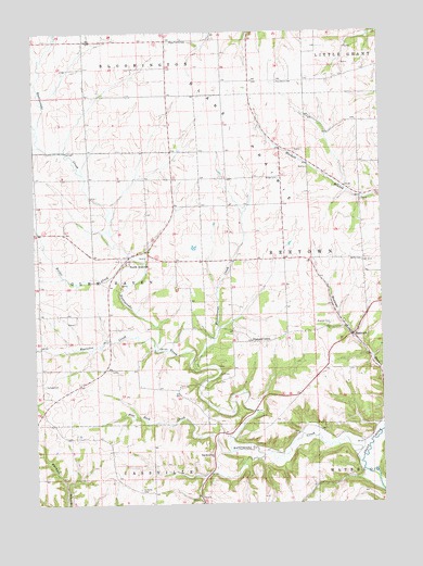
Beetown, WI USGS Topographic Map
Click on map above to begin viewing in our Map Viewer.

This topographic map contains these locations and features:
Feature Name Type Latitude Longitude GNIS ID View Map
BeetownPopulated PlaceN42.7950°W90.8854°1561503View Map
Beetown CemeteryCemeteryN42.7978°W90.8935°1561505View Map
Blake PrairieFlatN42.8630°W90.9440°1561914View Map
Blake Prairie CemeteryCemeteryN42.8725°W90.9515°1561915View Map
Burns CemeteryCemeteryN42.8143°W90.8821°1562438View Map
Diamond GrovePopulated PlaceN42.7925°W90.9196°1577572View Map
Dodge CemeteryCemeteryN42.8360°W90.9115°1564021View Map
Flat Rock CreekStreamN42.7642°W90.9276°1565064View Map
Flat Rock SchoolSchoolN42.7625°W90.9371°1565065View Map
Heiler CreekStreamN42.8142°W90.9601°1566268View Map
Kuenster CreekStreamN42.7905°W90.9518°1567658View Map
Muskellunge CreekStreamN42.7853°W90.9410°1570060View Map
North AndoverPopulated PlaceN42.8155°W90.9660°1570347View Map
Providence CemeteryCemeteryN42.8616°W90.9123°1571954View Map
Ramsey CemeteryCemeteryN42.7817°W90.9970°1572052View Map
Rattlesnake CreekStreamN42.7605°W90.8835°1572096View Map
Saint Marys CemeteryCemeteryN42.7539°W90.9629°1573272View Map

Note: Coordinates in the location and feature list above are referenced to NAD83 datum.


Copyright (C) 2008-2025 Ryan Niemi / Sunset Dynamics ... All Rights Reserved