TopoQuest Logo
Do you find TopoQuest useful?
Help keep TopoQuest running and adding new maps/features by donating!
Bitcoin:  19c7KJd3qBynnjoSw5npx9KScwjBe4ifkT
Litecoin:  LXs6TkuXGGXo1vDsWCkWVdjQX94eUKd6ui
Home View Maps Find Maps Find Places Resources & Links


Brodtville, Wisconsin Topographic Map

USGS Map Title: Brodtville, WI
USGS Map MRC: 42091H1
DRG (GeoTIFF) Download: o42091h1.tif


Neighboring USGS Topographic Map Quads:


  Prairie du Chien, WI  
43091A2
 

  Bridgeport, WI  
43091A1
 

  Wauzeka West, WI  
43090A8
 

  Clayton, IA  
42091H2
 

  Brodtville, WI  
42091H1
 

  Bloomington, WI  
42090H8
 

  Garnavillo, IA  
42091G2
 

  Guttenberg, IA  
42091G1
 

  Beetown, WI  
42090G8


Map MRC Location:

N43°
W92°
N43°
W91°
H8 H7 H6 H5 H4 H3 H2 H1
G8 G7 G6 G5 G4 G3 G2 G1
F8 F7 F6 F5 F4 F3 F2 F1
E8 E7 E6 E5 E4 E3 E2 E1
D8 D7 D6 D5 D4 D3 D2 D1
C8 C7 C6 C5 C4 C3 C2 C1
B8 B7 B6 B5 B4 B3 B2 B1
A8 A7 A6 A5 A4 A3 A2 A1
N42°
W92°
N42°
W91°

Brodtville, WI USGS 1:24K Topographic Map Preview:
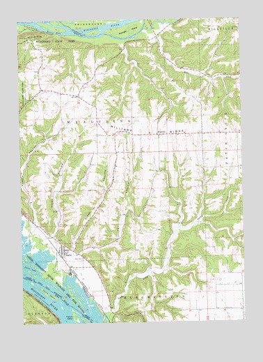
Brodtville, WI USGS Topographic Map
Click on map above to begin viewing in our Map Viewer.

This topographic map contains these locations and features:
Feature Name Type Latitude Longitude GNIS ID View Map
BagleyPopulated PlaceN42.9055°W91.1012°1561083View Map
Bagley CemeteryCemeteryN42.9016°W91.0912°1561084View Map
Bagley Volunteer Fire DepartmentBuildingN42.9021°W91.1001°2697678View Map
Bagley Wastewater Treatment FacilityLocaleN42.9017°W91.1033°2709262View Map
BrodtvillePopulated PlaceN42.9525°W91.0465°1562230View Map
Clarks BranchStreamN42.9038°W91.0962°2760617View Map
Dry HollowValleyN42.9036°W91.0931°1564118View Map
Ferry LakeLakeN42.8983°W91.1201°1564922View Map
Flint CemeteryCemeteryN42.9528°W91.0782°1565071View Map
Gasner HollowValleyN42.9166°W91.1179°1565438View Map
Gasner Hollow Prairie State Natural AreaParkN42.9208°W91.1212°1989133View Map
Glass HollowValleyN42.9057°W91.0972°1565554View Map
Hoosier LakeLakeN42.9016°W91.1155°2729973View Map
Hovie IslandIslandN42.8880°W91.1122°457687View Map
Jays LakeLakeN42.8886°W91.0914°2729974View Map
Lane CreekStreamN42.9983°W91.0435°1567830View Map
Ready HollowValleyN42.9108°W91.1081°1572123View Map
State Line SloughGutN42.8794°W91.0924°461966View Map
Town of BloomingtonCivilN42.8760°W91.0043°1582836View Map
Town of WyalusingCivilN42.9510°W91.0847°1584486View Map
Village of BagleyCivilN42.9011°W91.0971°1582740View Map
Walnut EddyRapidsN42.9955°W91.1096°1576175View Map
Weniger IslandIslandN42.9958°W91.0615°1576429View Map
Wyalusing Hardwood Forest State Natural AreaParkN42.9914°W91.0915°1989135View Map
Wyalusing State ParkParkN42.9917°W91.1224°1577060View Map
Wyalusing Walnut Forest State Natural AreaParkN42.9953°W91.1210°1989136View Map

Note: Coordinates in the location and feature list above are referenced to NAD83 datum.


Copyright (C) 2008-2025 Ryan Niemi / Sunset Dynamics ... All Rights Reserved