TopoQuest Logo
Do you find TopoQuest useful?
Help keep TopoQuest running and adding new maps/features by donating!
Bitcoin:  19c7KJd3qBynnjoSw5npx9KScwjBe4ifkT
Litecoin:  LXs6TkuXGGXo1vDsWCkWVdjQX94eUKd6ui
Home View Maps Find Maps Find Places Resources & Links


Mount Vernon, Missouri Topographic Map

USGS Map Title: Mount Vernon, MO
USGS Map MRC: 37093A7
DRG (GeoTIFF) Download: o37093a7.tif


Neighboring USGS Topographic Map Quads:


  Rescue, MO  
37093B8
 

  Miller, MO  
37093B7
 

  Halltown, MO  
37093B6
 

  Stotts City, MO  
37093A8
 

  Mount Vernon, MO  
37093A7
 

  Chesapeake, MO  
37093A6
 

  Monett, MO  
36093H8
 

  Verona, MO  
36093H7
 

  Aurora, MO  
36093H6


Map MRC Location:

N38°
W94°
N38°
W93°
H8 H7 H6 H5 H4 H3 H2 H1
G8 G7 G6 G5 G4 G3 G2 G1
F8 F7 F6 F5 F4 F3 F2 F1
E8 E7 E6 E5 E4 E3 E2 E1
D8 D7 D6 D5 D4 D3 D2 D1
C8 C7 C6 C5 C4 C3 C2 C1
B8 B7 B6 B5 B4 B3 B2 B1
A8 A7 A6 A5 A4 A3 A2 A1
N37°
W94°
N37°
W93°

Mount Vernon, MO USGS 1:24K Topographic Map Preview:
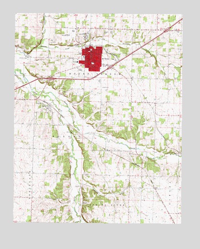
Mount Vernon, MO USGS Topographic Map
Click on map above to begin viewing in our Map Viewer.

This topographic map contains these locations and features:
Feature Name Type Latitude Longitude GNIS ID View Map
Blue Hall School (historical)SchoolN37.0737°W93.8694°745892View Map
Browning HollowValleyN37.0245°W93.8241°714796View Map
City of Mount VernonCivilN37.1050°W93.8190°2395131View Map
Crawford CemeteryCemeteryN37.0812°W93.8096°716473View Map
Doubling SpurLocaleN37.1117°W93.8277°740486View Map
Edgewood School (historical)SchoolN37.0717°W93.7827°746420View Map
Faucett LakeReservoirN37.0417°W93.7785°762966View Map
Faucetts Point Lake DamDamN37.0417°W93.7785°762965View Map
Hillhouse BranchStreamN37.0028°W93.8246°719616View Map
HobergPopulated PlaceN37.0698°W93.8488°719649View Map
Hoberg CemeteryCemeteryN37.0714°W93.8549°719650View Map
Honey CreekStreamN37.0792°W93.8616°719756View Map
Independent Order of Odd Fellows CemeteryCemeteryN37.0856°W93.8113°2702407View Map
Kingsway ChurchChurchN37.0978°W93.8316°720632View Map
Lawrence CountyCivilN37.1064°W93.8329°758509View Map
Lawrence County Sheriff's OfficeBuildingN37.1042°W93.8175°2752149View Map
Lee School (historical)SchoolN37.0131°W93.8339°746418View Map
Missouri Rehabilitation HospitalHospitalN37.1114°W93.8211°2655055View Map
Mount VernonPopulated PlaceN37.1037°W93.8185°722909View Map
Mount Vernon Elementary SchoolSchoolN37.1154°W93.8221°2710331View Map
Mount Vernon Elementary SchoolSchoolN37.0956°W93.8159°2710333View Map
Mount Vernon Fire DepartmentBuildingN37.1078°W93.8325°2621185View Map
Mount Vernon Golf CourseLocaleN37.1144°W93.8061°2678233View Map
Mount Vernon High SchoolSchoolN37.1140°W93.8239°2710330View Map
Mount Vernon Middle SchoolSchoolN37.0988°W93.8234°2710332View Map
Mount Vernon Post OfficePost OfficeN37.1021°W93.8181°2782838View Map
Mount Vernon Rural Fire Protection AssociationBuildingN37.1079°W93.8324°2620661View Map
OpalPopulated PlaceN37.0212°W93.7702°741121View Map
Roberts CemeteryCemeteryN37.0867°W93.7563°725397View Map
Shanghai School (historical)SchoolN37.1088°W93.7882°746419View Map
Skinners SpurLocaleN37.0556°W93.7677°740487View Map
Smith CemeteryCemeteryN37.1148°W93.7524°726586View Map
Southwest Research Center DamDamN37.0784°W93.7752°762987View Map
Southwest Research Center LakeReservoirN37.0784°W93.7752°762988View Map
Spanish Fort (historical)LocaleN37.0564°W93.8328°739500View Map
Spanish Fort CemeteryCemeteryN37.0542°W93.8313°726825View Map
Spanish Fort School (historical)SchoolN37.0546°W93.8314°2710404View Map
Spring River ChurchChurchN37.0117°W93.8238°726947View Map
Springhill AirportAirportN37.0925°W93.7706°2679371View Map
Township of HobergCivilN37.0599°W93.8594°766882View Map
Township of Mount VernonCivilN37.1168°W93.8025°766885View Map
Truitt CreekStreamN37.1051°W93.8566°727814View Map
Village of HobergCivilN37.0682°W93.8493°2398516View Map
Whitehall School (historical)SchoolN37.0981°W93.8508°746417View Map
Williams CemeteryCemeteryN37.0986°W93.8641°728882View Map
Zion School (historical)SchoolN37.0361°W93.7890°746421View Map

Note: Coordinates in the location and feature list above are referenced to NAD83 datum.


Copyright (C) 2008-2025 Ryan Niemi / Sunset Dynamics ... All Rights Reserved