TopoQuest Logo
Do you find TopoQuest useful?
Help keep TopoQuest running and adding new maps/features by donating!
Bitcoin:  19c7KJd3qBynnjoSw5npx9KScwjBe4ifkT
Litecoin:  LXs6TkuXGGXo1vDsWCkWVdjQX94eUKd6ui
Home View Maps Find Maps Find Places Resources & Links


Chesapeake, Missouri Topographic Map

USGS Map Title: Chesapeake, MO
USGS Map MRC: 37093A6
DRG (GeoTIFF) Download: o37093a6.tif


Neighboring USGS Topographic Map Quads:


  Miller, MO  
37093B7
 

  Halltown, MO  
37093B6
 

  Halltown NE, MO  
37093B5
 

  Mount Vernon, MO  
37093A7
 

  Chesapeake, MO  
37093A6
 

  Billings, MO  
37093A5
 

  Verona, MO  
36093H7
 

  Aurora, MO  
36093H6
 

  Crane, MO  
36093H5


Map MRC Location:

N38°
W94°
N38°
W93°
H8 H7 H6 H5 H4 H3 H2 H1
G8 G7 G6 G5 G4 G3 G2 G1
F8 F7 F6 F5 F4 F3 F2 F1
E8 E7 E6 E5 E4 E3 E2 E1
D8 D7 D6 D5 D4 D3 D2 D1
C8 C7 C6 C5 C4 C3 C2 C1
B8 B7 B6 B5 B4 B3 B2 B1
A8 A7 A6 A5 A4 A3 A2 A1
N37°
W94°
N37°
W93°

Chesapeake, MO USGS 1:24K Topographic Map Preview:
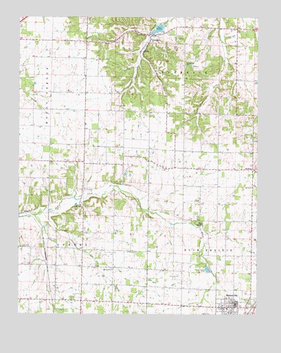
Chesapeake, MO USGS Topographic Map
Click on map above to begin viewing in our Map Viewer.

This topographic map contains these locations and features:
Feature Name Type Latitude Longitude GNIS ID View Map
Aurora Country ClubLocaleN37.0528°W93.7169°754992View Map
Aurora Rural Fire Department Station 3BuildingN37.0421°W93.7166°2621320View Map
Buck Prairie School (historical)SchoolN37.0692°W93.6633°746429View Map
Butler CemeteryCemeteryN37.0003°W93.6538°715120View Map
Campground CemeteryCemeteryN37.1065°W93.6611°715317View Map
ChesapeakePopulated PlaceN37.1170°W93.6816°715770View Map
Chesapeake Census Designated PlaceCensusN37.1161°W93.6791°2587059View Map
Chesapeake School (historical)SchoolN37.1153°W93.6819°746427View Map
City of MarionvilleCivilN37.0023°W93.6360°2395012View Map
Dover ChurchChurchN37.0617°W93.6746°717022View Map
ElliottPopulated PlaceN37.0428°W93.7477°740830View Map
Elm BranchStreamN37.0439°W93.7346°717500View Map
Elm Branch ChurchChurchN37.0187°W93.7010°717506View Map
Elm Branch School (historical)SchoolN37.0192°W93.7013°746426View Map
Fairview School (historical)SchoolN37.0106°W93.6650°2710368View Map
Grammer CemeteryCemeteryN37.0166°W93.6665°718663View Map
Honey Creek School (historical)SchoolN37.0395°W93.6627°746432View Map
Lick Prairie Community HallLocaleN37.0284°W93.7444°729919View Map
MarionvillePopulated PlaceN37.0031°W93.6374°721871View Map
Marionville City Fire and RescueBuildingN37.0046°W93.6376°2620273View Map
Marionville High SchoolSchoolN37.0151°W93.6302°2710327View Map
Marionville Police DepartmentBuildingN37.0040°W93.6376°2752364View Map
Marionville Post OfficePost OfficeN37.0051°W93.6387°2782632View Map
Marionville Rural Fire DepartmentBuildingN37.0046°W93.6359°2621546View Map
McKinleyPopulated PlaceN37.0612°W93.6274°722142View Map
McKinley School (historical)SchoolN37.0606°W93.6283°746430View Map
McNeil ChapelChurchN37.0470°W93.6555°729927View Map
Mount Olive ChurchChurchN37.0534°W93.6274°722810View Map
Oakland School (historical)SchoolN37.0566°W93.7346°746424View Map
OrangePopulated PlaceN37.0451°W93.7169°741122View Map
Orange ChurchChurchN37.0445°W93.7169°746425View Map
Pleasant Valley School (historical)SchoolN37.0989°W93.6313°746428View Map
Polk SpringSpringN37.0376°W93.6544°724714View Map
Prairie View School (historical)SchoolN37.0964°W93.7152°746423View Map
Take-In School (historical)SchoolN37.0631°W93.6949°746431View Map
Township of TurnbackCivilN37.1206°W93.6616°766890View Map
Woodland CemeteryCemeteryN37.0878°W93.6999°729099View Map

Note: Coordinates in the location and feature list above are referenced to NAD83 datum.


Copyright (C) 2008-2024 Ryan Niemi / Sunset Dynamics ... All Rights Reserved