TopoQuest Logo
Do you find TopoQuest useful?
Help keep TopoQuest running and adding new maps/features by donating!
Bitcoin:  19c7KJd3qBynnjoSw5npx9KScwjBe4ifkT
Litecoin:  LXs6TkuXGGXo1vDsWCkWVdjQX94eUKd6ui
Home View Maps Find Maps Find Places Resources & Links


Almanor, California Topographic Map

USGS Map Title: Almanor, CA
USGS Map MRC: 40121B2
DRG (GeoTIFF) Download: o40121b2.tif


Neighboring USGS Topographic Map Quads:


  Stover Mountain, CA  
40121C3
 

  Chester, CA  
40121C2
 

  Westwood West, CA  
40121C1
 

  Humbug Valley, CA  
40121B3
 

  Almanor, CA  
40121B2
 

  Canyondam, CA  
40121B1
 

  Belden, CA  
40121A3
 

  Caribou, CA  
40121A2
 

  Twain, CA  
40121A1


Map MRC Location:

N41°
W122°
N41°
W121°
H8 H7 H6 H5 H4 H3 H2 H1
G8 G7 G6 G5 G4 G3 G2 G1
F8 F7 F6 F5 F4 F3 F2 F1
E8 E7 E6 E5 E4 E3 E2 E1
D8 D7 D6 D5 D4 D3 D2 D1
C8 C7 C6 C5 C4 C3 C2 C1
B8 B7 B6 B5 B4 B3 B2 B1
A8 A7 A6 A5 A4 A3 A2 A1
N40°
W122°
N40°
W121°

Almanor, CA USGS 1:24K Topographic Map Preview:
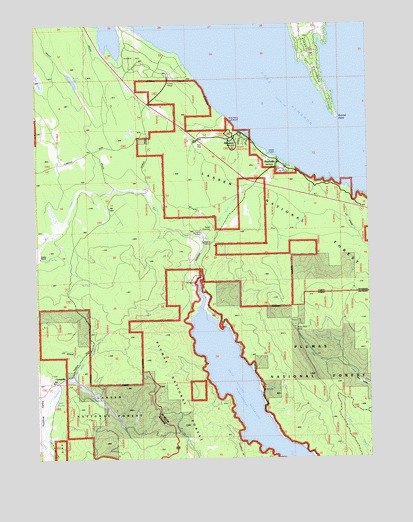
Almanor, CA USGS Topographic Map
Click on map above to begin viewing in our Map Viewer.

This topographic map contains these locations and features:
Feature Name Type Latitude Longitude GNIS ID View Map
Aknabir CanogriybdLocaleN40.2185°W121.1777°274889View Map
AlmanorPopulated PlaceN40.2174°W121.1741°256193View Map
Almanor - Prattville Fire DistrictBuildingN40.2071°W121.1600°2621902View Map
Almanor CampgroundLocaleN40.2185°W121.1780°277133View Map
Almanor Census Designated PlaceCensusN40.2145°W121.1762°2407722View Map
Almanor PeninsulaCapeN40.2316°W121.1427°256195View Map
Almanor Post Office (historical)Post OfficeN40.2174°W121.1766°1940075View Map
Bunnel PointCapeN40.2227°W121.1372°257697View Map
Butt Valley ReservoirReservoirN40.1426°W121.1716°257757View Map
Butt Valley TunnelTunnelN40.2002°W121.1764°257758View Map
Cantebury GulchValleyN40.1296°W121.1750°257934View Map
Cool Springs CampgroundLocaleN40.1452°W121.1664°258676View Map
Keefer RanchLocaleN40.1835°W121.2500°262091View Map
Lake AlmanorReservoirN40.2292°W121.1547°256197View Map
Lake Almanor Country ClubLocaleN40.2442°W121.1449°274882View Map
Lake Almanor WestPopulated PlaceN40.2363°W121.2044°1662414View Map
Lake Almanor West Census Designated PlaceCensusN40.2336°W121.2021°2408531View Map
LongvillePopulated PlaceN40.1477°W121.2447°262894View Map
Miller CreekStreamN40.1477°W121.2397°263629View Map
Mule Shoe MineMineN40.1624°W121.1539°263954View Map
Peninsula Fire Protection District Station 2BuildingN40.2476°W121.1453°2621866View Map
PG and E Recreation SiteLocaleN40.1263°W121.2397°277134View Map
Ponderosa Flat CampgroundLocaleN40.1663°W121.1852°264923View Map
PrattvillePopulated PlaceN40.2088°W121.1566°265028View Map
Prattville Census Designated PlaceCensusN40.2060°W121.1575°2409103View Map
Rock LakeLakeN40.2340°W121.2365°265506View Map
Soda SpringSpringN40.1418°W121.2444°267371View Map
West Almanor Community Services District Fire StationBuildingN40.2377°W121.2045°2621873View Map

Note: Coordinates in the location and feature list above are referenced to NAD83 datum.


Copyright (C) 2008-2025 Ryan Niemi / Sunset Dynamics ... All Rights Reserved