TopoQuest Logo
Do you find TopoQuest useful?
Help keep TopoQuest running and adding new maps/features by donating!
Bitcoin:  19c7KJd3qBynnjoSw5npx9KScwjBe4ifkT
Litecoin:  LXs6TkuXGGXo1vDsWCkWVdjQX94eUKd6ui
Home View Maps Find Maps Find Places Resources & Links


Caribou, California Topographic Map

USGS Map Title: Caribou, CA
USGS Map MRC: 40121A2
DRG (GeoTIFF) Download: o40121a2.tif


Neighboring USGS Topographic Map Quads:


  Humbug Valley, CA  
40121B3
 

  Almanor, CA  
40121B2
 

  Canyondam, CA  
40121B1
 

  Belden, CA  
40121A3
 

  Caribou, CA  
40121A2
 

  Twain, CA  
40121A1
 

  Storrie, CA  
39121H3
 

  Bucks Lake, CA  
39121H2
 

  Meadow Valley, CA  
39121H1


Map MRC Location:

N41°
W122°
N41°
W121°
H8 H7 H6 H5 H4 H3 H2 H1
G8 G7 G6 G5 G4 G3 G2 G1
F8 F7 F6 F5 F4 F3 F2 F1
E8 E7 E6 E5 E4 E3 E2 E1
D8 D7 D6 D5 D4 D3 D2 D1
C8 C7 C6 C5 C4 C3 C2 C1
B8 B7 B6 B5 B4 B3 B2 B1
A8 A7 A6 A5 A4 A3 A2 A1
N40°
W122°
N40°
W121°

Caribou, CA USGS 1:24K Topographic Map Preview:
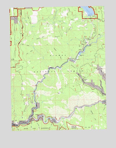
Caribou, CA USGS Topographic Map
Click on map above to begin viewing in our Map Viewer.

This topographic map contains these locations and features:
Feature Name Type Latitude Longitude GNIS ID View Map
BeldenPopulated PlaceN40.0060°W121.2491°266440View Map
Belden CampgroundLocaleN40.0043°W121.2489°274885View Map
Belden ForebayReservoirN40.0838°W121.1517°256796View Map
Benner CreekStreamN40.1141°W121.1441°256826View Map
Bey Cha CreekStreamN40.0713°W121.1700°259360View Map
Butt CreekStreamN40.0935°W121.1314°257755View Map
Butt Valley 93 DamDamN40.1149°W121.1477°1663565View Map
CaribouPopulated PlaceN40.0804°W121.1577°1658222View Map
Caribou Afterbay 97-120 DamDamN40.0782°W121.1611°1663676View Map
Caribou Census Designated PlaceCensusN40.0720°W121.1657°2407962View Map
Cherry HillSummitN40.0616°W121.1369°258249View Map
China RavineValleyN40.0863°W121.2239°258317View Map
Clear CreekStreamN40.0027°W121.1808°266575View Map
Cold Brook CreekStreamN40.0763°W121.1580°258521View Map
Cold Spring RavineValleyN40.0093°W121.2186°258564View Map
Cottonwood CreekStreamN40.0807°W121.2480°258765View Map
Crablouse RavineValleyN40.0685°W121.1816°258848View Map
Deadwood CanyonValleyN40.0704°W121.1714°259146View Map
Deadwood SaddleGapN40.0504°W121.1558°259161View Map
Deer CreekStreamN40.0852°W121.1519°259210View Map
East Branch North Fork Feather RiverStreamN40.0141°W121.2255°266674View Map
Fales BasinBasinN40.0016°W121.1516°233865View Map
Feather River Canyon DivisionCivilN40.0040°W121.2334°2583194View Map
Fern CanyonValleyN40.0043°W121.2444°260082View Map
French BarLocaleN40.0157°W121.2150°260368View Map
French CreekStreamN40.0843°W121.1511°260378View Map
French RavineValleyN40.0074°W121.1886°266728View Map
Gansner Bar CampgroundLocaleN40.0199°W121.2225°260467View Map
Gansner Bar Forest Service FacilityLocaleN40.0166°W121.2236°274886View Map
HavenPopulated PlaceN40.0093°W121.2302°1658972View Map
Indian BarBarN40.0118°W121.2014°261707View Map
Kellogg RavineValleyN40.0082°W121.1966°262105View Map
McFarlane RavineValleyN40.0927°W121.2177°263344View Map
Middle Branch Mosquito CreekStreamN40.1091°W121.1941°263495View Map
Middle CampsiteLocaleN40.0657°W121.2483°263499View Map
Mill CreekStreamN40.0127°W121.1850°228696View Map
Missouri BarBarN40.0082°W121.2055°263702View Map
Mosquito CreekStreamN40.0610°W121.2005°263860View Map
Mosquito RidgeRidgeN40.0988°W121.1800°263877View Map
North Branch Mosquito CreekStreamN40.1110°W121.1972°264120View Map
North Fork CampgroundLocaleN40.0399°W121.2200°264144View Map
Oak FlatFlatN40.0849°W121.1591°264277View Map
Oak RavineValleyN40.0124°W121.2236°229872View Map
Owl CreekStreamN40.1079°W121.1264°230176View Map
Pea Soup BarBarN40.0116°W121.1975°264585View Map
Poverty BarBarN40.0085°W121.1908°1701405View Map
Queen Lily CampgroundLocaleN40.0457°W121.2180°265108View Map
Rattlesnake GulchValleyN40.0224°W121.1464°265212View Map
Red HillSummitN40.0374°W121.1872°265276View Map
Red Rock MineMineN40.1118°W121.1694°265325View Map
Rich BarLocaleN40.0110°W121.1930°265400View Map
Serpentine CanyonValleyN40.0093°W121.1925°266003View Map
Silva RavineValleyN40.0813°W121.2186°266176View Map
Smith PointCapeN40.0152°W121.2097°267266View Map
Smiths BarBarN40.0146°W121.2094°1701410View Map
Soda RavineValleyN40.1057°W121.2227°267365View Map
Soda SpringSpringN40.1110°W121.2283°267370View Map
South Branch Mosquito CreekStreamN40.1091°W121.1941°267408View Map
Squirrel CreekStreamN40.0432°W121.2494°267646View Map
Tunnel Twenty FiveTunnelN40.0107°W121.1847°268472View Map
Tunnel Twenty FourTunnelN40.0110°W121.2025°268471View Map
Tunnel Twenty ThreeTunnelN40.0132°W121.2122°268470View Map
Twelve Mile BarBarN40.0282°W121.1277°268509View Map
Waller CreekStreamN40.0224°W121.2172°268764View Map

Note: Coordinates in the location and feature list above are referenced to NAD83 datum.


Copyright (C) 2008-2024 Ryan Niemi / Sunset Dynamics ... All Rights Reserved