TopoQuest Logo
Do you find TopoQuest useful?
Help keep TopoQuest running and adding new maps/features by donating!
Bitcoin:  19c7KJd3qBynnjoSw5npx9KScwjBe4ifkT
Litecoin:  LXs6TkuXGGXo1vDsWCkWVdjQX94eUKd6ui
Home View Maps Find Maps Find Places Resources & Links


Belden, New York Topographic Map

USGS Map Title: Belden, NY
USGS Map MRC: 42075B6
DRG (GeoTIFF) Download: o42075b6.tif


Neighboring USGS Topographic Map Quads:


  Greene, NY  
42075C7
 

  Brisben, NY  
42075C6
 

  West Bainbridge, NY  
42075C5
 

  Chenango Forks, NY  
42075B7
 

  Belden, NY  
42075B6
 

  Afton, NY  
42075B5
 

  Binghamton East, NY  
42075A7
 

  Windsor, NY  
42075A6
 

  Gulf Summit, NY  
42075A5


Map MRC Location:

N43°
W76°
N43°
W75°
H8 H7 H6 H5 H4 H3 H2 H1
G8 G7 G6 G5 G4 G3 G2 G1
F8 F7 F6 F5 F4 F3 F2 F1
E8 E7 E6 E5 E4 E3 E2 E1
D8 D7 D6 D5 D4 D3 D2 D1
C8 C7 C6 C5 C4 C3 C2 C1
B8 B7 B6 B5 B4 B3 B2 B1
A8 A7 A6 A5 A4 A3 A2 A1
N42°
W76°
N42°
W75°

Belden, NY USGS 1:24K Topographic Map Preview:
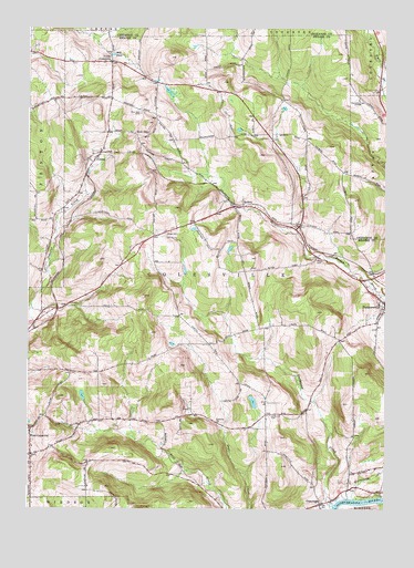
Belden, NY USGS Topographic Map
Click on map above to begin viewing in our Map Viewer.

This topographic map contains these locations and features:
Feature Name Type Latitude Longitude GNIS ID View Map
BeldenPopulated PlaceN42.2037°W75.6749°943568View Map
Belden HillPopulated PlaceN42.2011°W75.6994°2490789View Map
Belden Hill CampgroundLocaleN42.2010°W75.7000°2598411View Map
Belden Hill Golf CourseLocaleN42.1959°W75.7002°974314View Map
Coles Hill CemeteryCemeteryN42.1494°W75.6648°947123View Map
Colesville Town HallBuildingN42.1730°W75.6272°2598439View Map
Colesville Volunteer Ambulance ServiceBuildingN42.1843°W75.6328°2720082View Map
Country ManorPopulated PlaceN42.1958°W75.7078°2490696View Map
Creekside VillagePopulated PlaceN42.1833°W75.6306°2490790View Map
Flannerys Mobile Home ParkPopulated PlaceN42.2011°W75.6903°2490700View Map
Hapursville Fire Department Station 2BuildingN42.1967°W75.7042°2718701View Map
Harpursville Baptist ChurchChurchN42.1833°W75.6263°2597324View Map
Harpursville Post OfficePost OfficeN42.1830°W75.6342°2598377View Map
Mill PondLakeN42.2431°W75.7204°957265View Map
New OhioPopulated PlaceN42.2223°W75.7127°972837View Map
New Ohio CemeteryCemeteryN42.2283°W75.7101°958441View Map
North ColesvillePopulated PlaceN42.2412°W75.7216°958753View Map
OuaquagaPopulated PlaceN42.1262°W75.6471°959583View Map
Ouaquaga CreekStreamN42.1256°W75.6427°959584View Map
Ouaquaga Fire CompanyBuildingN42.1262°W75.6469°2734692View Map
Ouaquaga Post OfficePost OfficeN42.1262°W75.6471°978650View Map
Ouaquaga United Methodist ChurchChurchN42.1267°W75.6467°2597346View Map
Pratt CemeteryCemeteryN42.1902°W75.6486°961100View Map
Town of ColesvilleCivilN42.1742°W75.6627°978851View Map
TunnelPopulated PlaceN42.2162°W75.7266°967942View Map
Tunnel Post OfficePost OfficeN42.2174°W75.7248°2598384View Map
Watersnake CreekStreamN42.1279°W75.6357°968912View Map
West ColesvillePopulated PlaceN42.1434°W75.7488°969182View Map
West Colesville Baptist ChurchChurchN42.1451°W75.7491°2597370View Map
West Colesville Fire CompanyBuildingN42.1416°W75.7413°2718678View Map
Windy Hill FarmsLocaleN42.2383°W75.7325°2517020View Map
Wooded EstatesPopulated PlaceN42.1992°W75.6856°2490698View Map

Note: Coordinates in the location and feature list above are referenced to NAD83 datum.


Copyright (C) 2008-2025 Ryan Niemi / Sunset Dynamics ... All Rights Reserved