TopoQuest Logo
Do you find TopoQuest useful?
Help keep TopoQuest running and adding new maps/features by donating!
Bitcoin:  19c7KJd3qBynnjoSw5npx9KScwjBe4ifkT
Litecoin:  LXs6TkuXGGXo1vDsWCkWVdjQX94eUKd6ui
Home View Maps Find Maps Find Places Resources & Links


West Bainbridge, New York Topographic Map

USGS Map Title: West Bainbridge, NY
USGS Map MRC: 42075C5
DRG (GeoTIFF) Download: o42075c5.tif


Neighboring USGS Topographic Map Quads:


  Tyner, NY  
42075D6
 

  Oxford, NY  
42075D5
 

  Guilford, NY  
42075D4
 

  Brisben, NY  
42075C6
 

  West Bainbridge, NY  
42075C5
 

  Sidney, NY  
42075C4
 

  Belden, NY  
42075B6
 

  Afton, NY  
42075B5
 

  North Sanford, NY  
42075B4


Map MRC Location:

N43°
W76°
N43°
W75°
H8 H7 H6 H5 H4 H3 H2 H1
G8 G7 G6 G5 G4 G3 G2 G1
F8 F7 F6 F5 F4 F3 F2 F1
E8 E7 E6 E5 E4 E3 E2 E1
D8 D7 D6 D5 D4 D3 D2 D1
C8 C7 C6 C5 C4 C3 C2 C1
B8 B7 B6 B5 B4 B3 B2 B1
A8 A7 A6 A5 A4 A3 A2 A1
N42°
W76°
N42°
W75°

West Bainbridge, NY USGS 1:24K Topographic Map Preview:
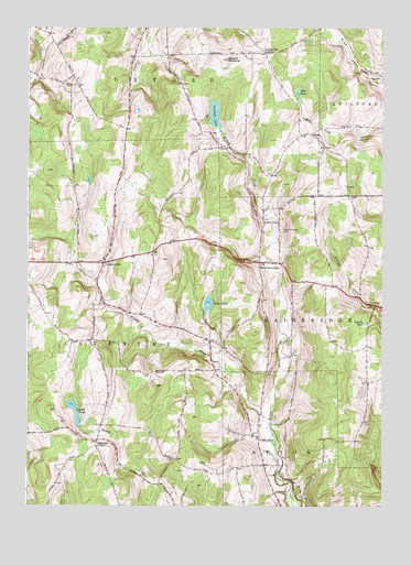
West Bainbridge, NY USGS Topographic Map
Click on map above to begin viewing in our Map Viewer.

This topographic map contains these locations and features:
Feature Name Type Latitude Longitude GNIS ID View Map
Blackesley CornerPopulated PlaceN42.2659°W75.6007°972239View Map
Brackett LakeLakeN42.3525°W75.5592°944565View Map
CoventryvillePopulated PlaceN42.3134°W75.5982°947576View Map
Coventryville CemeteryCemeteryN42.3128°W75.5982°2496814View Map
Echo LakeLakeN42.3028°W75.5613°949341View Map
First Congregational ChurchChurchN42.3144°W75.5981°2496810View Map
Gibson PinnaclePillarN42.3667°W75.5555°951069View Map
Kelsey Brook Trailer CourtPopulated PlaceN42.2725°W75.5422°2496758View Map
Miller FieldAirportN42.3190°W75.5997°977974View Map
Mud PondLakeN42.3583°W75.5299°958059View Map
North AftonPopulated PlaceN42.2679°W75.5432°958663View Map
North Afton CemeteryCemeteryN42.2730°W75.5431°2496761View Map
North Afton Methodist ChurchChurchN42.2692°W75.5433°2496768View Map
North Fork AirportAirportN42.2691°W75.5592°2443531View Map
Puckerville CornersLocaleN42.3684°W75.5421°961937View Map
Roberts PondLakeN42.2979°W75.5061°962654View Map
Smith PondLakeN42.2750°W75.6084°965504View Map
The New Echo Lake ResortLocaleN42.3050°W75.5624°2615244View Map
Union ValleyPopulated PlaceN42.3242°W75.5418°973177View Map
West BainbridgePopulated PlaceN42.3140°W75.5435°973221View Map
West Bainbridge Baptist ChurchChurchN42.3133°W75.5386°2496813View Map
West Bainbridge CemeteryCemeteryN42.3221°W75.5359°969087View Map
Wilkins BrookStreamN42.2723°W75.5391°971277View Map
Yaleville CemeteryCemeteryN42.3612°W75.5007°2559178View Map

Note: Coordinates in the location and feature list above are referenced to NAD83 datum.


Copyright (C) 2008-2024 Ryan Niemi / Sunset Dynamics ... All Rights Reserved