TopoQuest Logo
Do you find TopoQuest useful?
Help keep TopoQuest running and adding new maps/features by donating!
Bitcoin:  19c7KJd3qBynnjoSw5npx9KScwjBe4ifkT
Litecoin:  LXs6TkuXGGXo1vDsWCkWVdjQX94eUKd6ui
Home View Maps Find Maps Find Places Resources & Links


Gulf Summit, New York Topographic Map

USGS Map Title: Gulf Summit, NY
USGS Map MRC: 42075A5
DRG (GeoTIFF) Download: o42075a5.tif


Neighboring USGS Topographic Map Quads:


  Belden, NY  
42075B6
 

  Afton, NY  
42075B5
 

  North Sanford, NY  
42075B4
 

  Windsor, NY  
42075A6
 

  Gulf Summit, NY  
42075A5
 

  Deposit, NY  
42075A4
 

  Great Bend, PA  
41075H6
 

  Susquehanna, PA  
41075H5
 

  Starrucca, PA  
41075H4


Map MRC Location:

N43°
W76°
N43°
W75°
H8 H7 H6 H5 H4 H3 H2 H1
G8 G7 G6 G5 G4 G3 G2 G1
F8 F7 F6 F5 F4 F3 F2 F1
E8 E7 E6 E5 E4 E3 E2 E1
D8 D7 D6 D5 D4 D3 D2 D1
C8 C7 C6 C5 C4 C3 C2 C1
B8 B7 B6 B5 B4 B3 B2 B1
A8 A7 A6 A5 A4 A3 A2 A1
N42°
W76°
N42°
W75°

Gulf Summit, NY USGS 1:24K Topographic Map Preview:
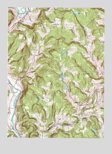
Gulf Summit, NY USGS Topographic Map
Click on map above to begin viewing in our Map Viewer.

This topographic map contains these locations and features:
Feature Name Type Latitude Longitude GNIS ID View Map
Alexander Hill CemeteryCemeteryN42.0845°W75.5428°942305View Map
Cascade ValleyPopulated PlaceN42.0023°W75.5791°972303View Map
Cascade Valley CemeteryCemeteryN42.0148°W75.5780°945955View Map
DamascusPopulated PlaceN42.0559°W75.6102°948006View Map
Deer LakeLakeN42.0594°W75.5534°948200View Map
East WindsorPopulated PlaceN42.1112°W75.6085°949279View Map
East Windsor CemeteryCemeteryN42.1111°W75.6103°2543002View Map
Edwards CemeteryCemeteryN42.0612°W75.6221°949405View Map
Fly PondLakeN42.0482°W75.5489°950341View Map
Forest Lake CampgroundLocaleN42.0947°W75.5985°2598412View Map
Golden Oaks Golf ClubLocaleN42.0391°W75.6191°2598425View Map
Gulf SummitPopulated PlaceN42.0190°W75.5305°951923View Map
Gulf Summit ChurchChurchN42.0217°W75.5313°951924View Map
Happy Times FarmLocaleN42.0506°W75.5719°2517013View Map
Marsh PondLakeN42.1187°W75.5372°956560View Map
Mount CarmelPopulated PlaceN42.1087°W75.5641°972818View Map
Mud PondLakeN42.0382°W75.5822°958058View Map
Sky LakeReservoirN42.0810°W75.5522°965371View Map
South WindsorPopulated PlaceN42.0276°W75.6224°965889View Map
South Windsor CemeteryCemeteryN42.0267°W75.6231°2543001View Map
State LineLocaleN42.0031°W75.6091°966270View Map
Summit LakeLakeN42.0074°W75.5123°966771View Map
Tuscarora CreekStreamN42.0490°W75.6168°967993View Map
Wake CemeteryCemeteryN42.0359°W75.6205°2543003View Map

Note: Coordinates in the location and feature list above are referenced to NAD83 datum.


Copyright (C) 2008-2024 Ryan Niemi / Sunset Dynamics ... All Rights Reserved