TopoQuest Logo
Do you find TopoQuest useful?
Help keep TopoQuest running and adding new maps/features by donating!
Bitcoin:  19c7KJd3qBynnjoSw5npx9KScwjBe4ifkT
Litecoin:  LXs6TkuXGGXo1vDsWCkWVdjQX94eUKd6ui
Home View Maps Find Maps Find Places Resources & Links


Mountain Falls, Virginia Topographic Map

USGS Map Title: Mountain Falls, VA
USGS Map MRC: 39078A4
DRG (GeoTIFF) Download: o39078a4.tif


Neighboring USGS Topographic Map Quads:


  Yellow Spring, WV  
39078B5
 

  Capon Springs, WV  
39078B4
 

  Hayfield, VA  
39078B3
 

  Wardensville, WV  
39078A5
 

  Mountain Falls, VA  
39078A4
 

  Middletown, VA  
39078A3
 

  Woodstock, VA  
38078H5
 

  Toms Brook, VA  
38078H4
 

  Strasburg, VA  
38078H3


Map MRC Location:

N40°
W79°
N40°
W78°
H8 H7 H6 H5 H4 H3 H2 H1
G8 G7 G6 G5 G4 G3 G2 G1
F8 F7 F6 F5 F4 F3 F2 F1
E8 E7 E6 E5 E4 E3 E2 E1
D8 D7 D6 D5 D4 D3 D2 D1
C8 C7 C6 C5 C4 C3 C2 C1
B8 B7 B6 B5 B4 B3 B2 B1
A8 A7 A6 A5 A4 A3 A2 A1
N39°
W79°
N39°
W78°

Mountain Falls, VA USGS 1:24K Topographic Map Preview:
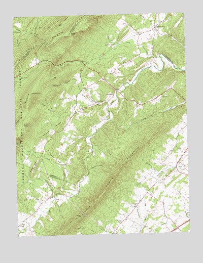
Mountain Falls, VA USGS Topographic Map
Click on map above to begin viewing in our Map Viewer.

This topographic map contains these locations and features:
Feature Name Type Latitude Longitude GNIS ID View Map
Bakers RunStreamN39.0046°W78.4081°1481420View Map
Bear WallowBasinN39.0634°W78.4903°1481532View Map
Cold Spring GapGapN39.0901°W78.4953°1482628View Map
Cold Spring RunStreamN39.0218°W78.4725°1482633View Map
Dog CliffCliffN39.0896°W78.4714°1483054View Map
Dry GapGapN39.1093°W78.4775°1483121View Map
Duck RunStreamN39.1004°W78.3928°1483151View Map
Eagle RockSummitN39.1151°W78.4572°1495488View Map
Fairmont School (historical)SchoolN39.0212°W78.4781°1674003View Map
Gravel SpringsPopulated PlaceN39.0751°W78.4403°1495609View Map
Gravel Springs CemeteryCemeteryN39.0826°W78.4486°1483765View Map
Gravel Springs RunStreamN39.0732°W78.4303°1483766View Map
Hawk CampgroundLocaleN39.1165°W78.4989°1551393View Map
Hockmans RunStreamN39.0337°W78.3947°1484130View Map
Johnnies KnobSummitN39.0809°W78.4886°1484466View Map
Laurel Hill CemeteryCemeteryN39.0773°W78.3924°1673875View Map
Laurel Hill ChurchChurchN39.0776°W78.3922°1484712View Map
Laurel RunStreamN39.1082°W78.4222°1484723View Map
Limestone RidgeRidgeN39.0615°W78.4731°1484848View Map
McIiwee RidgeRidgeN39.0437°W78.4717°1485306View Map
Mineral RidgeRidgeN39.0396°W78.4872°1485489View Map
Mount Carmel CemeteryCemeteryN39.0071°W78.4241°1673882View Map
Mount Carmel ChurchChurchN39.0073°W78.4239°1485582View Map
Mountain FallsPopulated PlaceN39.1173°W78.3956°1485677View Map
Mountain View ChurchChurchN39.1143°W78.4083°1485707View Map
Mulberry Run AirportAirportN39.0364°W78.3924°1498821View Map
Paddy GapGapN39.0523°W78.4983°1486027View Map
Paddy RunStreamN39.0223°W78.4589°1486031View Map
Pembroke SpringsSpringN39.1079°W78.4247°1486125View Map
Pinnacle RockSummitN39.1245°W78.4367°1496093View Map
Polebridge HollowValleyN39.0896°W78.4537°1486316View Map
Pontzer GapGapN39.0107°W78.4536°1486335View Map
Poplar HollowValleyN39.0369°W78.4474°1486355View Map
Richards RunStreamN39.1148°W78.3939°1486594View Map
Rocky HollowValleyN39.0676°W78.4683°1486699View Map
Saint James CemeteryCemeteryN39.0209°W78.4718°1673904View Map
Saint James ChurchChurchN39.0232°W78.4720°1486853View Map
Saint Stephens CemeteryCemeteryN39.0154°W78.4122°1673915View Map
Saint Stephens ChurchChurchN39.0159°W78.4133°1486886View Map
Seven Vistas DamDamN39.1134°W78.3981°1489845View Map
Seven Vistas LakeReservoirN39.1134°W78.3981°1489846View Map
Shell RunStreamN39.0176°W78.4761°1487173View Map
Short MountainSummitN39.1004°W78.4672°1487222View Map
Spring MountainSummitN39.1165°W78.4733°1553005View Map
Star TanneryLocaleN39.0790°W78.4272°1487528View Map
Star Tannery Post OfficePost OfficeN39.0764°W78.4312°1779252View Map
Star Tannery Volunteer Fire and Rescue Station 17BuildingN39.0761°W78.4436°2075418View Map
Star Tannery Volunteer Fire DepartmentBuildingN39.0761°W78.4436°2085914View Map
Tarkiln RidgeRidgeN39.0734°W78.4742°1487777View Map
The Half MoonRidgeN39.0546°W78.4964°1487829View Map
Topnot School (historical)SchoolN39.0140°W78.4156°1674005View Map
Waverly School (historical)SchoolN39.0298°W78.3970°1674006View Map
WESI-FM (Strasburg)TowerN39.0229°W78.4261°1502711View Map
Winchester CampLocaleN39.0396°W78.4639°1488423View Map
ZeppPopulated PlaceN39.0068°W78.4978°1487131View Map

Note: Coordinates in the location and feature list above are referenced to NAD83 datum.


Copyright (C) 2008-2025 Ryan Niemi / Sunset Dynamics ... All Rights Reserved