TopoQuest Logo
Do you find TopoQuest useful?
Help keep TopoQuest running and adding new maps/features by donating!
Bitcoin:  19c7KJd3qBynnjoSw5npx9KScwjBe4ifkT
Litecoin:  LXs6TkuXGGXo1vDsWCkWVdjQX94eUKd6ui
Home View Maps Find Maps Find Places Resources & Links


Mountain Fork, Arkansas Topographic Map

USGS Map Title: Mountain Fork, AR
USGS Map MRC: 34094F4
DRG (GeoTIFF) Download: o34094f4.tif


Neighboring USGS Topographic Map Quads:


  Hontubby, OK  
34094G5
 

  Loving, OK  
34094G4
 

  Horseshoe Mountain, AR  
34094G3
 

  Page, OK  
34094F5
 

  Mountain Fork, AR  
34094F4
 

  Rich Mountain, AR  
34094F3
 

  Lynn Mountain, OK  
34094E5
 

  Zafra, OK  
34094E4
 

  Potter, AR  
34094E3


Map MRC Location:

N35°
W95°
N35°
W94°
H8 H7 H6 H5 H4 H3 H2 H1
G8 G7 G6 G5 G4 G3 G2 G1
F8 F7 F6 F5 F4 F3 F2 F1
E8 E7 E6 E5 E4 E3 E2 E1
D8 D7 D6 D5 D4 D3 D2 D1
C8 C7 C6 C5 C4 C3 C2 C1
B8 B7 B6 B5 B4 B3 B2 B1
A8 A7 A6 A5 A4 A3 A2 A1
N34°
W95°
N34°
W94°

Mountain Fork, AR USGS 1:24K Topographic Map Preview:
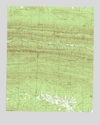
Mountain Fork, AR USGS Topographic Map
Click on map above to begin viewing in our Map Viewer.

This topographic map contains these locations and features:
Feature Name Type Latitude Longitude GNIS ID View Map
Black Fork Mountain WildernessReserveN34.7189°W94.4322°2035057View Map
Brushy CreekStreamN34.6454°W94.4805°1101316View Map
Christs Church of Mountain ForkChurchN34.6398°W94.4191°64106View Map
Collins CreekStreamN34.6304°W94.4138°71202View Map
Dark Hollow BranchStreamN34.6423°W94.4611°1101385View Map
FogelPopulated PlaceN34.7070°W94.4555°1101418View Map
FogelPopulated PlaceN34.7070°W94.4544°71653View Map
Heely CemeteryCemeteryN34.6887°W94.4005°71956View Map
Horsepen CreekStreamN34.6420°W94.4444°72081View Map
HowardPopulated PlaceN34.7059°W94.4372°72095View Map
Kelsey MountainSummitN34.6648°W94.4624°72245View Map
Little MountainSummitN34.7393°W94.3963°72407View Map
Mackey CreekStreamN34.6384°W94.4353°72532View Map
Middle MountainSummitN34.6829°W94.4497°1101543View Map
Middle MountainRidgeN34.6826°W94.4513°72640View Map
Mitchell RidgeRidgeN34.7473°W94.4566°72703View Map
Mountain ForkPopulated PlaceN34.6418°W94.4288°72781View Map
Nichols BranchStreamN34.6373°W94.4336°72866View Map
Pine MountainSummitN34.6440°W94.3763°73097View Map
Pioneer CemeteryCemeteryN34.6887°W94.3999°74611View Map
Quentin MountainSummitN34.6590°W94.4080°73223View Map
Red CreekStreamN34.6257°W94.4044°73251View Map
Reeds LakeReservoirN34.6283°W94.4541°81078View Map
Reeds Lake DamDamN34.6284°W94.4536°81077View Map
Richmond CreekStreamN34.6451°W94.4727°1101628View Map
Rocky Fire Station District 5BuildingN34.6410°W94.4270°2117034View Map
Round Top MountainSummitN34.7426°W94.4877°1101643View Map
Self MountainSummitN34.6734°W94.4541°78312View Map
Township of FreedomCivilN34.6366°W94.3882°68990View Map
Weehunt BranchStreamN34.6426°W94.4497°74040View Map
Weehunt MountainSummitN34.6609°W94.4352°74041View Map
White CreekStreamN34.6415°W94.3888°74106View Map
Wilcox BranchStreamN34.6443°W94.4905°1101737View Map

Note: Coordinates in the location and feature list above are referenced to NAD83 datum.


Copyright (C) 2008-2024 Ryan Niemi / Sunset Dynamics ... All Rights Reserved