TopoQuest Logo
Do you find TopoQuest useful?
Help keep TopoQuest running and adding new maps/features by donating!
Bitcoin:  19c7KJd3qBynnjoSw5npx9KScwjBe4ifkT
Litecoin:  LXs6TkuXGGXo1vDsWCkWVdjQX94eUKd6ui
Home View Maps Find Maps Find Places Resources & Links


Rich Mountain, Arkansas Topographic Map

USGS Map Title: Rich Mountain, AR
USGS Map MRC: 34094F3
DRG (GeoTIFF) Download: o34094f3.tif


Neighboring USGS Topographic Map Quads:


  Loving, OK  
34094G4
 

  Horseshoe Mountain, AR  
34094G3
 

  Peanut Mountain, AR  
34094G2
 

  Mountain Fork, AR  
34094F4
 

  Rich Mountain, AR  
34094F3
 

  Acorn, AR  
34094F2
 

  Zafra, OK  
34094E4
 

  Potter, AR  
34094E3
 

  Mena, AR  
34094E2


Map MRC Location:

N35°
W95°
N35°
W94°
H8 H7 H6 H5 H4 H3 H2 H1
G8 G7 G6 G5 G4 G3 G2 G1
F8 F7 F6 F5 F4 F3 F2 F1
E8 E7 E6 E5 E4 E3 E2 E1
D8 D7 D6 D5 D4 D3 D2 D1
C8 C7 C6 C5 C4 C3 C2 C1
B8 B7 B6 B5 B4 B3 B2 B1
A8 A7 A6 A5 A4 A3 A2 A1
N34°
W95°
N34°
W94°

Rich Mountain, AR USGS 1:24K Topographic Map Preview:
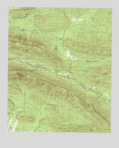
Rich Mountain, AR USGS Topographic Map
Click on map above to begin viewing in our Map Viewer.

This topographic map contains these locations and features:
Feature Name Type Latitude Longitude GNIS ID View Map
Black Fork MountainSummitN34.7120°W94.3680°70695View Map
Bufram CreekStreamN34.6470°W94.3663°70917View Map
Center PointPopulated PlaceN34.6273°W94.3691°63171View Map
Center Point ChurchChurchN34.6284°W94.3699°71098View Map
Eagle GapGapN34.6854°W94.3002°71484View Map
Eagle Gap Ranger StationLocaleN34.7195°W94.3085°71486View Map
EagletonPopulated PlaceN34.6804°W94.3002°71488View Map
Little CemeteryCemeteryN34.7148°W94.3722°51220View Map
Middle MountainSummitN34.6268°W94.2697°72641View Map
Pilot MountainSummitN34.6387°W94.3455°73081View Map
Queen Wilhelmina State ParkParkN34.6857°W94.3699°74156View Map
Rich MountainPopulated PlaceN34.6907°W94.3372°78171View Map
Rich MountainRidgeN34.6698°W94.3102°78172View Map
Rich Mountain ChurchChurchN34.6898°W94.3374°64130View Map
Rich Mountain Lookout TowerTowerN34.6740°W94.3285°82546View Map
Rich Mountain Tower Recreation AreaLocaleN34.6737°W94.3283°74610View Map
Round MountainSummitN34.6270°W94.2972°73417View Map
Saddle GapGapN34.7432°W94.3555°73448View Map
Salt CreekStreamN34.7457°W94.2738°73465View Map
Sexton CemeteryCemeteryN34.6932°W94.3558°73513View Map
Shut-In MountainSummitN34.7073°W94.2663°73573View Map
Township of Rich MountainCivilN34.6985°W94.3711°68998View Map

Note: Coordinates in the location and feature list above are referenced to NAD83 datum.


Copyright (C) 2008-2025 Ryan Niemi / Sunset Dynamics ... All Rights Reserved