TopoQuest Logo
Do you find TopoQuest useful?
Help keep TopoQuest running and adding new maps/features by donating!
Bitcoin:  19c7KJd3qBynnjoSw5npx9KScwjBe4ifkT
Litecoin:  LXs6TkuXGGXo1vDsWCkWVdjQX94eUKd6ui
Home View Maps Find Maps Find Places Resources & Links


Mulberry, Mississippi Topographic Map

USGS Map Title: Mulberry, MS
USGS Map MRC: 31088D7
DRG (GeoTIFF) Download: o31088d7.tif


Neighboring USGS Topographic Map Quads:


  Strengthford, MS  
31088E8
 

  Water Oak, MS  
31088E7
 

  Clara, MS  
31088E6
 

  Rhodes, MS  
31088D8
 

  Mulberry, MS  
31088D7
 

  Piave, MS  
31088D6
 

  Richton, MS  
31088C8
 

  Brewer, MS  
31088C7
 

  Avera, MS  
31088C6


Map MRC Location:

N32°
W89°
N32°
W88°
H8 H7 H6 H5 H4 H3 H2 H1
G8 G7 G6 G5 G4 G3 G2 G1
F8 F7 F6 F5 F4 F3 F2 F1
E8 E7 E6 E5 E4 E3 E2 E1
D8 D7 D6 D5 D4 D3 D2 D1
C8 C7 C6 C5 C4 C3 C2 C1
B8 B7 B6 B5 B4 B3 B2 B1
A8 A7 A6 A5 A4 A3 A2 A1
N31°
W89°
N31°
W88°

Mulberry, MS USGS 1:24K Topographic Map Preview:
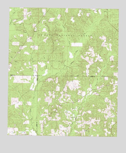
Mulberry, MS USGS Topographic Map
Click on map above to begin viewing in our Map Viewer.

This topographic map contains these locations and features:
Feature Name Type Latitude Longitude GNIS ID View Map
Fellowship Free Will Baptist ChurchChurchN31.4044°W88.8164°2596999View Map
Gator BranchStreamN31.4252°W88.8423°693287View Map
Gunstock BranchStreamN31.4407°W88.8139°693390View Map
Hall BranchStreamN31.4291°W88.8370°693398View Map
HendersonPopulated PlaceN31.4488°W88.7737°704799View Map
Hickory Grove CemeteryCemeteryN31.4510°W88.7717°693468View Map
J R Stinson Lake DamDamN31.4202°W88.8300°695381View Map
Lovewell ChurchChurchN31.3932°W88.7981°693836View Map
Mohlenoff Pond DamDamN31.3985°W88.8650°695377View Map
Mount Zion CemeteryCemeteryN31.3807°W88.7839°707717View Map
Mount Zion ChurchChurchN31.3813°W88.7845°694111View Map
MulberryPopulated PlaceN31.4771°W88.8478°694128View Map
Mulberry CemeteryCemeteryN31.4813°W88.8456°706437View Map
Mulberry ChurchChurchN31.4816°W88.8453°704804View Map
New Lovewell ChurchChurchN31.4024°W88.8017°694180View Map
Okey BranchStreamN31.4963°W88.7678°694252View Map
Pineview ChurchChurchN31.4627°W88.8600°694393View Map
Spring BranchStreamN31.4835°W88.8731°694859View Map
Union CemeteryCemeteryN31.4049°W88.8161°695036View Map
Union Grove ChurchChurchN31.4104°W88.7948°695051View Map
Union School (historical)SchoolN31.4046°W88.8167°705245View Map
Wayne County Volunteer Fire Department Mulberry - Corinth StationBuildingN31.4955°W88.8546°2667982View Map

Note: Coordinates in the location and feature list above are referenced to NAD83 datum.


Copyright (C) 2008-2025 Ryan Niemi / Sunset Dynamics ... All Rights Reserved