TopoQuest Logo
Do you find TopoQuest useful?
Help keep TopoQuest running and adding new maps/features by donating!
Bitcoin:  19c7KJd3qBynnjoSw5npx9KScwjBe4ifkT
Litecoin:  LXs6TkuXGGXo1vDsWCkWVdjQX94eUKd6ui
Home View Maps Find Maps Find Places Resources & Links


Water Oak, Mississippi Topographic Map

USGS Map Title: Water Oak, MS
USGS Map MRC: 31088E7
DRG (GeoTIFF) Download: o31088e7.tif


Neighboring USGS Topographic Map Quads:


  Myrick, MS  
31088F8
 

  Whistler, MS  
31088F7
 

  Waynesboro, MS  
31088F6
 

  Strengthford, MS  
31088E8
 

  Water Oak, MS  
31088E7
 

  Clara, MS  
31088E6
 

  Rhodes, MS  
31088D8
 

  Mulberry, MS  
31088D7
 

  Piave, MS  
31088D6


Map MRC Location:

N32°
W89°
N32°
W88°
H8 H7 H6 H5 H4 H3 H2 H1
G8 G7 G6 G5 G4 G3 G2 G1
F8 F7 F6 F5 F4 F3 F2 F1
E8 E7 E6 E5 E4 E3 E2 E1
D8 D7 D6 D5 D4 D3 D2 D1
C8 C7 C6 C5 C4 C3 C2 C1
B8 B7 B6 B5 B4 B3 B2 B1
A8 A7 A6 A5 A4 A3 A2 A1
N31°
W89°
N31°
W88°

Water Oak, MS USGS 1:24K Topographic Map Preview:
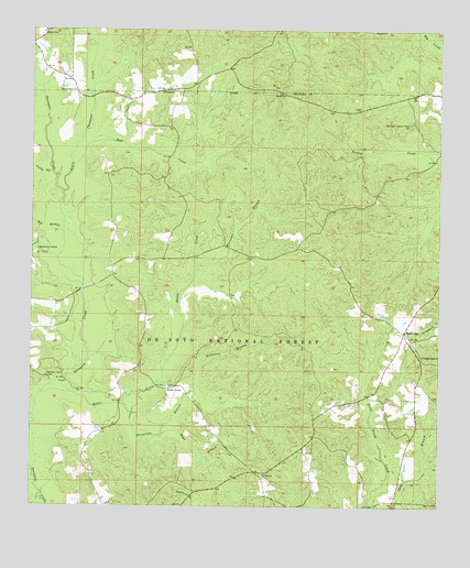
Water Oak, MS USGS Topographic Map
Click on map above to begin viewing in our Map Viewer.

This topographic map contains these locations and features:
Feature Name Type Latitude Longitude GNIS ID View Map
Bear CreekStreamN31.5893°W88.8623°692492View Map
Big BranchStreamN31.5718°W88.8650°692592View Map
Big Creek Lookout TowerTowerN31.6002°W88.7598°711203View Map
Burleys Precinct (historical)LocaleN31.5635°W88.7831°704791View Map
Chickasawhay State Wildlife Management AreaParkN31.5016°W88.8334°704792View Map
Corinth CemeteryCemeteryN31.5082°W88.8034°706422View Map
Corinth ChurchChurchN31.5085°W88.8042°692975View Map
Green Head School (historical)SchoolN31.5646°W88.8417°704797View Map
Harrison School (historical)SchoolN31.6085°W88.8364°704798View Map
Hays BranchStreamN31.5188°W88.8350°693438View Map
Hollis CreekPopulated PlaceN31.5310°W88.8337°693502View Map
Hollis CreekStreamN31.5296°W88.8617°693503View Map
Hollis Creek CemeteryCemeteryN31.5315°W88.8325°706431View Map
Hollis Creek ChurchChurchN31.5313°W88.8334°704800View Map
Little CreekStreamN31.5877°W88.8684°693759View Map
Little Thompson CreekStreamN31.5824°W88.8653°693791View Map
Nicholson BranchStreamN31.5271°W88.8464°694201View Map
Pleasant Ridge ChurchChurchN31.5399°W88.7553°694439View Map
Sanderson Lake DamDamN31.5252°W88.8367°695397View Map
Shirley ChurchChurchN31.6077°W88.7975°694771View Map
Shirley Place CemeteryCemeteryN31.6074°W88.7978°706448View Map
Shows CemeteryCemeteryN31.6246°W88.8703°694780View Map
South Thompson Creek Oil FieldOilfieldN31.5307°W88.8625°706450View Map
Strengthford ChurchChurchN31.6091°W88.8620°694896View Map
Supervisor District 5CivilN31.5481°W88.7938°712133View Map
Thompson Creek ParkParkN31.5338°W88.8695°694974View Map
Water OakLocaleN31.5463°W88.7609°695099View Map
West Clara Oil FieldOilfieldN31.6016°W88.7742°706460View Map
Whetstone BranchStreamN31.5616°W88.8237°695140View Map

Note: Coordinates in the location and feature list above are referenced to NAD83 datum.


Copyright (C) 2008-2025 Ryan Niemi / Sunset Dynamics ... All Rights Reserved