TopoQuest Logo
Do you find TopoQuest useful?
Help keep TopoQuest running and adding new maps/features by donating!
Bitcoin:  19c7KJd3qBynnjoSw5npx9KScwjBe4ifkT
Litecoin:  LXs6TkuXGGXo1vDsWCkWVdjQX94eUKd6ui
Home View Maps Find Maps Find Places Resources & Links


Clara, Mississippi Topographic Map

USGS Map Title: Clara, MS
USGS Map MRC: 31088E6
DRG (GeoTIFF) Download: o31088e6.tif


Neighboring USGS Topographic Map Quads:


  Whistler, MS  
31088F7
 

  Waynesboro, MS  
31088F6
 

  Denham, MS  
31088F5
 

  Water Oak, MS  
31088E7
 

  Clara, MS  
31088E6
 

  Buckatunna, MS  
31088E5
 

  Mulberry, MS  
31088D7
 

  Piave, MS  
31088D6
 

  Knobtown, MS  
31088D5


Map MRC Location:

N32°
W89°
N32°
W88°
H8 H7 H6 H5 H4 H3 H2 H1
G8 G7 G6 G5 G4 G3 G2 G1
F8 F7 F6 F5 F4 F3 F2 F1
E8 E7 E6 E5 E4 E3 E2 E1
D8 D7 D6 D5 D4 D3 D2 D1
C8 C7 C6 C5 C4 C3 C2 C1
B8 B7 B6 B5 B4 B3 B2 B1
A8 A7 A6 A5 A4 A3 A2 A1
N31°
W89°
N31°
W88°

Clara, MS USGS 1:24K Topographic Map Preview:
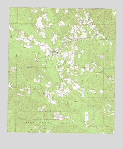
Clara, MS USGS Topographic Map
Click on map above to begin viewing in our Map Viewer.

This topographic map contains these locations and features:
Feature Name Type Latitude Longitude GNIS ID View Map
Bazor Pond DamDamN31.5768°W88.6334°695403View Map
Bethel Church (historical)ChurchN31.6124°W88.6292°704790View Map
Big Creek CemeteryCemeteryN31.5921°W88.6728°706411View Map
Big Creek ChurchChurchN31.5932°W88.6723°692600View Map
ClaraPopulated PlaceN31.5804°W88.6964°692912View Map
Clara Attendance CenterSchoolN31.5802°W88.6959°706419View Map
Clara Census Designated PlaceCensusN31.5831°W88.6916°2586586View Map
Clara ChurchChurchN31.5657°W88.6789°692913View Map
Clara Elementary SchoolSchoolN31.5807°W88.6953°706420View Map
Clara Post OfficePost OfficeN31.5820°W88.6951°2768840View Map
Clara United Methodist ChurchChurchN31.5804°W88.6970°704793View Map
Crawford CreekStreamN31.5335°W88.6634°693007View Map
Dry CreekStreamN31.5282°W88.6545°693116View Map
First Baptist Church of ClaraChurchN31.5813°W88.6961°704796View Map
Hathorn BranchStreamN31.5627°W88.6945°693430View Map
Jones School (historical)SchoolN31.5441°W88.6867°704801View Map
Long BranchStreamN31.5077°W88.6481°693818View Map
Maynor CreekStreamN31.5824°W88.6981°693896View Map
Mile CreekStreamN31.5091°W88.6670°693965View Map
Mill CreekStreamN31.5104°W88.6489°693984View Map
Mills CemeteryCemeteryN31.5574°W88.6323°694008View Map
Patricks School (historical)SchoolN31.5113°W88.6370°704806View Map
Pittman BranchStreamN31.5124°W88.6895°694414View Map
Pittman CemeteryCemeteryN31.5046°W88.7100°694415View Map
Spring Hill Church (historical)ChurchN31.6079°W88.6673°704808View Map
Turkey CreekStreamN31.5710°W88.7000°695020View Map
Wards School (historical)SchoolN31.6127°W88.7087°704809View Map
Wayne County Volunteer Fire Department Clara StationBuildingN31.5793°W88.6994°2667993View Map

Note: Coordinates in the location and feature list above are referenced to NAD83 datum.


Copyright (C) 2008-2025 Ryan Niemi / Sunset Dynamics ... All Rights Reserved