TopoQuest Logo
Do you find TopoQuest useful?
Help keep TopoQuest running and adding new maps/features by donating!
Bitcoin:  19c7KJd3qBynnjoSw5npx9KScwjBe4ifkT
Litecoin:  LXs6TkuXGGXo1vDsWCkWVdjQX94eUKd6ui
Home View Maps Find Maps Find Places Resources & Links


Belfast, Tennessee Topographic Map

USGS Map Title: Belfast, TN
USGS Map MRC: 35086D6
DRG (GeoTIFF) Download: o35086d6.tif


Neighboring USGS Topographic Map Quads:


  Verona, TN  
35086E7
 

  Farmington, TN  
35086E6
 

  Unionville, TN  
35086E5
 

  Lewisburg, TN  
35086D7
 

  Belfast, TN  
35086D6
 

  Bedford, TN  
35086D5
 

  Cornersville, TN  
35086C7
 

  Petersburg, TN  
35086C6
 

  Belleville, TN  
35086C5


Map MRC Location:

N36°
W87°
N36°
W86°
H8 H7 H6 H5 H4 H3 H2 H1
G8 G7 G6 G5 G4 G3 G2 G1
F8 F7 F6 F5 F4 F3 F2 F1
E8 E7 E6 E5 E4 E3 E2 E1
D8 D7 D6 D5 D4 D3 D2 D1
C8 C7 C6 C5 C4 C3 C2 C1
B8 B7 B6 B5 B4 B3 B2 B1
A8 A7 A6 A5 A4 A3 A2 A1
N35°
W87°
N35°
W86°

Belfast, TN USGS 1:24K Topographic Map Preview:
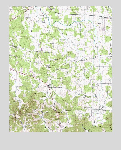
Belfast, TN USGS Topographic Map
Click on map above to begin viewing in our Map Viewer.

This topographic map contains these locations and features:
Feature Name Type Latitude Longitude GNIS ID View Map
Adams CemeteryCemeteryN35.3970°W86.6322°1275458View Map
Bagley GapGapN35.3942°W86.6914°1276084View Map
Bagley HollowValleyN35.4060°W86.6960°1276086View Map
Beech Hill ChurchChurchN35.4137°W86.6647°1276843View Map
BelfastPopulated PlaceN35.4209°W86.7025°1276896View Map
Belfast CreekStreamN35.4987°W86.7156°1276897View Map
Belfast Post OfficePost OfficeN35.4216°W86.7043°1650500View Map
Belfast Rural Fire DepartmentBuildingN35.4206°W86.7019°2653877View Map
Belfast School (historical)SchoolN35.4215°W86.7022°1320165View Map
Bethel CemeteryCemeteryN35.4412°W86.6944°1277106View Map
Bills CemeteryCemeteryN35.4848°W86.7117°1277467View Map
Blackwell CrossingLocaleN35.3965°W86.6811°1314690View Map
Cedar Grove CemeteryCemeteryN35.4384°W86.6828°1316526View Map
Cedar Grove ChurchChurchN35.4381°W86.6900°1280039View Map
Cedar Grove SchoolSchoolN35.4301°W86.7125°1280058View Map
Commissioner District 3CivilN35.3849°W86.6963°2464176View Map
Confederate Memorial ParkCemeteryN35.4981°W86.6983°1281083View Map
Erwin CemeteryCemeteryN35.4592°W86.6978°1283850View Map
Farmington School (historical)SchoolN35.4981°W86.6992°1320168View Map
Glenn HillSummitN35.4470°W86.6897°1285518View Map
Grandview RidgeRidgeN35.4123°W86.7206°1285832View Map
Hardison HollowValleyN35.3904°W86.7121°1286850View Map
Head Springs CemeteryCemeteryN35.4098°W86.7047°1644550View Map
Head Springs ChurchChurchN35.4095°W86.7047°1287277View Map
Holly GrovePopulated PlaceN35.4601°W86.7453°1288103View Map
Holly Grove School (historical)SchoolN35.4604°W86.7461°1316543View Map
Hudgin AirAirportN35.4731°W86.6803°2675507View Map
Ledford BranchStreamN35.4140°W86.6408°1290932View Map
Leonard ChurchChurchN35.3829°W86.7297°1291033View Map
Leonard School (historical)SchoolN35.3826°W86.7300°1316547View Map
Liberty ValleyValleyN35.4890°W86.7119°1291166View Map
Liberty Valley ChurchChurchN35.4109°W86.6592°1291167View Map
Mud CreekStreamN35.4812°W86.6978°1294992View Map
Negro HollowValleyN35.3760°W86.6564°1295337View Map
Neil GapGapN35.4048°W86.7247°1295360View Map
Nowlin CemeteryCemeteryN35.4831°W86.6417°1296004View Map
O'Neal CemeteryCemeteryN35.4659°W86.6664°1296041View Map
Oak HillPopulated PlaceN35.4554°W86.7125°1315624View Map
OrrsPopulated PlaceN35.4240°W86.7231°1315657View Map
PalmettoPopulated PlaceN35.4920°W86.6644°1296702View Map
Palmetto CemeteryCemeteryN35.4940°W86.6719°1296703View Map
Patton CemeteryCemeteryN35.3909°W86.7119°1296975View Map
Petty HollowValleyN35.3770°W86.7029°1644560View Map
Polecat HollowValleyN35.3993°W86.7369°1298044View Map
Poplar RidgeRidgeN35.3784°W86.6689°1298217View Map
Poplar Ridge School (historical)SchoolN35.3773°W86.6519°1316564View Map
Rocky Point ChurchChurchN35.4312°W86.7242°1299924View Map
Round Hill CemeteryCemeteryN35.4284°W86.6867°1300156View Map
Spout SpringSpringN35.4470°W86.6950°1271028View Map
Temple CemeteryCemeteryN35.4990°W86.7311°1272279View Map
Twitty KnobSummitN35.4054°W86.7450°1273130View Map
Twitty SpringSpringN35.4067°W86.7403°1273131View Map
Union SchoolSchoolN35.4298°W86.6464°1304257View Map
Welch HillSummitN35.3937°W86.7439°1274075View Map
WheelPopulated PlaceN35.4887°W86.6297°1274280View Map
Wheel CemeteryCemeteryN35.4890°W86.6317°1319559View Map
WhitakerPopulated PlaceN35.4520°W86.6264°1304514View Map
Whitakers School (historical)SchoolN35.4579°W86.6272°1319562View Map
Woodard CemeteryCemeteryN35.3956°W86.6639°1275026View Map
Woods-Mayes CemeteryCemeteryN35.4290°W86.6283°1319571View Map

Note: Coordinates in the location and feature list above are referenced to NAD83 datum.


Copyright (C) 2008-2025 Ryan Niemi / Sunset Dynamics ... All Rights Reserved