TopoQuest Logo
Do you find TopoQuest useful?
Help keep TopoQuest running and adding new maps/features by donating!
Bitcoin:  19c7KJd3qBynnjoSw5npx9KScwjBe4ifkT
Litecoin:  LXs6TkuXGGXo1vDsWCkWVdjQX94eUKd6ui
Home View Maps Find Maps Find Places Resources & Links


Airlie North, Oregon Topographic Map

USGS Map Title: Airlie North, OR
USGS Map MRC: 44123G3
DRG (GeoTIFF) Download: o44123g3.tif


Neighboring USGS Topographic Map Quads:


  Socialist Valley, OR  
44123H4
 

  Dallas, OR  
44123H3
 

  Rickreall, OR  
44123H2
 

  Falls City, OR  
44123G4
 

  Airlie North, OR  
44123G3
 

  Monmouth, OR  
44123G2
 

  Kings Valley, OR  
44123F4
 

  Airlie South, OR  
44123F3
 

  Lewisburg, OR  
44123F2


Map MRC Location:

N45°
W124°
N45°
W123°
H8 H7 H6 H5 H4 H3 H2 H1
G8 G7 G6 G5 G4 G3 G2 G1
F8 F7 F6 F5 F4 F3 F2 F1
E8 E7 E6 E5 E4 E3 E2 E1
D8 D7 D6 D5 D4 D3 D2 D1
C8 C7 C6 C5 C4 C3 C2 C1
B8 B7 B6 B5 B4 B3 B2 B1
A8 A7 A6 A5 A4 A3 A2 A1
N44°
W124°
N44°
W123°

Airlie North, OR USGS 1:24K Topographic Map Preview:
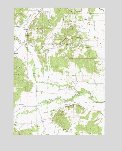
Airlie North, OR USGS Topographic Map
Click on map above to begin viewing in our Map Viewer.

This topographic map contains these locations and features:
Feature Name Type Latitude Longitude GNIS ID View Map
AirliePopulated PlaceN44.7504°W123.3315°1162809View Map
Airlie CreekStreamN44.7515°W123.3345°1162810View Map
Airlie Post Office (historical)Post OfficeN44.7504°W123.3315°1164812View Map
Alsip ReservoirReservoirN44.8657°W123.3004°1130197View Map
Bass ReservoirReservoirN44.8525°W123.3588°1161041View Map
Bauman ReservoirReservoirN44.8567°W123.2998°1117326View Map
Bowen ReservoirReservoirN44.8557°W123.3264°1130161View Map
Bridgeport Post Office (historical)Post OfficeN44.8393°W123.3643°1164236View Map
Buchanan ReservoirReservoirN44.7621°W123.3206°1162858View Map
Butler Davidson CemeteryCemeteryN44.8354°W123.2707°1162868View Map
Cooper CreekStreamN44.7998°W123.3023°1119249View Map
Cooper HollowValleyN44.8112°W123.3270°1162916View Map
Crisp (historical)LocaleN44.7665°W123.3248°1163477View Map
Dry CreekStreamN44.7726°W123.3518°1120125View Map
Fern CornerLocaleN44.8535°W123.3579°1162980View Map
Fern CreekStreamN44.8373°W123.3604°1162981View Map
Ferns (historical)Populated PlaceN44.8554°W123.3679°1163473View Map
Fishback HillSummitN44.8387°W123.3032°1120771View Map
Fisher ReservoirReservoirN44.8634°W123.3293°1130199View Map
Garber ReservoirReservoirN44.8709°W123.3264°1130198View Map
Gilliam SwaleValleyN44.8665°W123.3498°1163472View Map
Gilliams (historical)LocaleN44.8610°W123.3595°1130200View Map
Guthrie Community ParkParkN44.8712°W123.3395°1121495View Map
Hamilton ReservoirReservoirN44.7548°W123.3084°1163029View Map
Hart Riggs CemeteryCemeteryN44.8471°W123.3604°1163032View Map
Jont CreekStreamN44.7840°W123.3087°1163074View Map
JPM AirportAirportN44.8398°W123.2593°2645981View Map
Lackemute Post Office (historical)Post OfficeN44.7832°W123.2523°1164451View Map
Lamer PondLakeN44.8207°W123.2583°1130201View Map
Lenhard ReservoirReservoirN44.8463°W123.3019°1130196View Map
Lewis PondLakeN44.7916°W123.3526°1123060View Map
LewisvillePopulated PlaceN44.7882°W123.3454°1163101View Map
Lewisville Post Office (historical)Post OfficeN44.7882°W123.3454°1165534View Map
Little Luckiamute RiverStreamN44.7912°W123.2882°1163106View Map
Luckiamute (historical)LocaleN44.8012°W123.2693°1163474View Map
Maple Grove (historical)LocaleN44.7782°W123.3454°1163121View Map
Maple Grove Post Office (historical)Post OfficeN44.7782°W123.3454°1165581View Map
Marr FieldAirportN44.8558°W123.2631°1163617View Map
McCrae ReservoirReservoirN44.8637°W123.2800°1163133View Map
McGuire ReservoirReservoirN44.7989°W123.3461°1161048View Map
Mitchell (historical)LocaleN44.7812°W123.2859°1163154View Map
Oberg ReservoirReservoirN44.8629°W123.3554°1161043View Map
Polk County Fire District 1 Station 80BuildingN44.7548°W123.3353°2576751View Map
Polk Post Office (historical)Post OfficeN44.8418°W123.3665°1164606View Map
Pond AReservoirN44.8522°W123.3715°1161042View Map
Putnam (historical)Populated PlaceN44.7846°W123.2845°1163476View Map
Ratzlaff ReservoirReservoirN44.7933°W123.3420°1161047View Map
Simpson (historical)LocaleN44.7798°W123.3026°1163272View Map
Tarter (historical)LocaleN44.7629°W123.3368°1127895View Map
V and S Crossing (historical)LocaleN44.7815°W123.2957°1166233View Map
Wallinch (historical)LocaleN44.7593°W123.3734°1163334View Map
Winegar ReservoirReservoirN44.7934°W123.2544°1163475View Map

Note: Coordinates in the location and feature list above are referenced to NAD83 datum.


Copyright (C) 2008-2025 Ryan Niemi / Sunset Dynamics ... All Rights Reserved