TopoQuest Logo
Do you find TopoQuest useful?
Help keep TopoQuest running and adding new maps/features by donating!
Bitcoin:  19c7KJd3qBynnjoSw5npx9KScwjBe4ifkT
Litecoin:  LXs6TkuXGGXo1vDsWCkWVdjQX94eUKd6ui
Home View Maps Find Maps Find Places Resources & Links


Hubbardsville, New York Topographic Map

USGS Map Title: Hubbardsville, NY
USGS Map MRC: 42075G4
DRG (GeoTIFF) Download: o42075g4.tif


Neighboring USGS Topographic Map Quads:


  Munnsville, NY  
42075H5
 

  Oriskany Falls, NY  
42075H4
 

  Cassville, NY  
42075H3
 

  Hamilton, NY  
42075G5
 

  Hubbardsville, NY  
42075G4
 

  Brookfield, NY  
42075G3
 

  Earlville, NY  
42075F5
 

  Sherburne, NY  
42075F4
 

  New Berlin North, NY  
42075F3


Map MRC Location:

N43°
W76°
N43°
W75°
H8 H7 H6 H5 H4 H3 H2 H1
G8 G7 G6 G5 G4 G3 G2 G1
F8 F7 F6 F5 F4 F3 F2 F1
E8 E7 E6 E5 E4 E3 E2 E1
D8 D7 D6 D5 D4 D3 D2 D1
C8 C7 C6 C5 C4 C3 C2 C1
B8 B7 B6 B5 B4 B3 B2 B1
A8 A7 A6 A5 A4 A3 A2 A1
N42°
W76°
N42°
W75°

Hubbardsville, NY USGS 1:24K Topographic Map Preview:
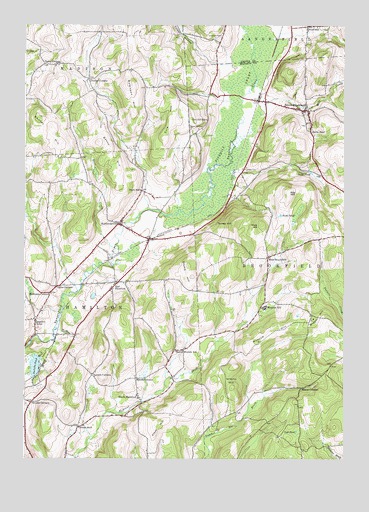
Hubbardsville, NY USGS Topographic Map
Click on map above to begin viewing in our Map Viewer.

This topographic map contains these locations and features:
Feature Name Type Latitude Longitude GNIS ID View Map
Bacon HillSummitN42.8415°W75.4716°942765View Map
Barns PondLakeN42.8444°W75.3878°943064View Map
Beaver Meadow SchoolSchoolN42.7815°W75.4405°943415View Map
Beekman CornersLocaleN42.7978°W75.4896°943550View Map
Bonney HillSummitN42.8440°W75.4885°944429View Map
Brooks CornerPopulated PlaceN42.7662°W75.4968°972267View Map
Clark HillSummitN42.7598°W75.4482°946759View Map
Cole HillSummitN42.8476°W75.4432°947105View Map
Cole Hill CemeteryCemeteryN42.8457°W75.4355°947107View Map
Cole Hill SchoolSchoolN42.8478°W75.4291°947108View Map
Crumb HillSummitN42.8023°W75.4346°947872View Map
Darts CornersLocaleN42.7998°W75.4871°948044View Map
Durfee CornersLocaleN42.8595°W75.4752°948829View Map
East HamiltonPopulated PlaceN42.7992°W75.4655°949092View Map
Excell CornersLocaleN42.7731°W75.4560°949785View Map
Faulkner CemeteryCemeteryN42.8336°W75.4145°949929View Map
Graham CemeteryCemeteryN42.8157°W75.4495°2542888View Map
Grassy HillSummitN42.7703°W75.4188°951563View Map
Hamilton CenterPopulated PlaceN42.7898°W75.4957°952093View Map
Hamilton Center CemeteryCemeteryN42.7904°W75.4936°2542887View Map
HubbardsvillePopulated PlaceN42.8178°W75.4632°953359View Map
Hubbardsville Volunteer Fire DepartmentBuildingN42.8160°W75.4589°2735038View Map
Hunt CreekStreamN42.8103°W75.4635°953456View Map
Loomis CornersLocaleN42.7742°W75.4732°955962View Map
Lost PondLakeN42.7578°W75.3935°956017View Map
Marsh CornersLocaleN42.7703°W75.3913°956549View Map
Mill CreekStreamN42.8487°W75.4105°957232View Map
Moscow HillPopulated PlaceN42.7937°W75.4060°957723View Map
Moscow HillSummitN42.7840°W75.4080°957724View Map
Ninemile SwampSwampN42.8640°W75.4134°958603View Map
North BrookfieldPopulated PlaceN42.8503°W75.3907°958735View Map
North Brookfield CemeteryCemeteryN42.8551°W75.4050°2542889View Map
North Brookfield Volunteer Fire DepartmentBuildingN42.8507°W75.3893°2735041View Map
Poolville PondLakeN42.7768°W75.4958°960919View Map
Quaker HillSummitN42.7903°W75.3868°962046View Map
Quaker Hill CemeteryCemeteryN42.7914°W75.3878°2542890View Map
Ritz HillSummitN42.8267°W75.3968°962554View Map
Robinson HillSummitN42.8581°W75.4591°962668View Map
Rocky Top AcresLocaleN42.7953°W75.3950°2547239View Map
School Number 8 (historical)SchoolN42.7590°W75.4785°975591View Map
School Number 9 (historical)SchoolN42.7983°W75.4675°2106762View Map
Sigby CornersPopulated PlaceN42.8640°W75.4924°973070View Map
Snow PondLakeN42.8326°W75.3881°965582View Map
South HamiltonPopulated PlaceN42.7678°W75.4549°965762View Map
StockwellPopulated PlaceN42.8748°W75.3891°966479View Map
Tarrytown CemeteryCemeteryN42.8720°W75.4232°967067View Map
Tinker HollowValleyN42.8634°W75.4238°967545View Map
Town of HamiltonCivilN42.7898°W75.4940°979038View Map
Turkey HillSummitN42.8181°W75.4182°967964View Map
Union School (historical)SchoolN42.8511°W75.3981°2106763View Map
West BrookfieldPopulated PlaceN42.8078°W75.4046°969154View Map
York HillSummitN42.8176°W75.4071°971832View Map
York PondLakeN42.8202°W75.3998°971835View Map

Note: Coordinates in the location and feature list above are referenced to NAD83 datum.


Copyright (C) 2008-2024 Ryan Niemi / Sunset Dynamics ... All Rights Reserved