TopoQuest Logo
Do you find TopoQuest useful?
Help keep TopoQuest running and adding new maps/features by donating!
Bitcoin:  19c7KJd3qBynnjoSw5npx9KScwjBe4ifkT
Litecoin:  LXs6TkuXGGXo1vDsWCkWVdjQX94eUKd6ui
Home View Maps Find Maps Find Places Resources & Links


Murchisontown, North Carolina Topographic Map

USGS Map Title: Murchisontown, NC
USGS Map MRC: 35079C2
DRG (GeoTIFF) Download: o35079c2.tif


Neighboring USGS Topographic Map Quads:


  White Hill, NC  
35079D3
 

  Sanford, NC  
35079D2
 

  Broadway, NC  
35079D1
 

  Vass, NC  
35079C3
 

  Murchisontown, NC  
35079C2
 

  Olivia, NC  
35079C1
 

  Niagara, NC  
35079B3
 

  Lobelia, NC  
35079B2
 

  Overhills, NC  
35079B1


Map MRC Location:

N36°
W80°
N36°
W79°
H8 H7 H6 H5 H4 H3 H2 H1
G8 G7 G6 G5 G4 G3 G2 G1
F8 F7 F6 F5 F4 F3 F2 F1
E8 E7 E6 E5 E4 E3 E2 E1
D8 D7 D6 D5 D4 D3 D2 D1
C8 C7 C6 C5 C4 C3 C2 C1
B8 B7 B6 B5 B4 B3 B2 B1
A8 A7 A6 A5 A4 A3 A2 A1
N35°
W80°
N35°
W79°

Murchisontown, NC USGS 1:24K Topographic Map Preview:
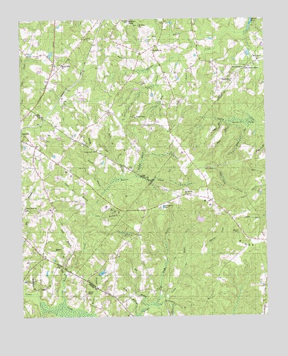
Murchisontown, NC USGS Topographic Map
Click on map above to begin viewing in our Map Viewer.

This topographic map contains these locations and features:
Feature Name Type Latitude Longitude GNIS ID View Map
Beaver CreekStreamN35.2543°W79.2284°980787View Map
Big BranchStreamN35.2549°W79.1859°981332View Map
Big BranchStreamN35.3082°W79.1975°981333View Map
Black ChapelChurchN35.3338°W79.1914°981519View Map
Blue Brothers PondReservoirN35.2686°W79.2091°998703View Map
Blue Brothers Pond DamDamN35.2685°W79.2097°998704View Map
Butler BranchStreamN35.3035°W79.2072°982332View Map
Deep BranchStreamN35.2504°W79.1920°984049View Map
Duck PondLakeN35.3119°W79.1512°984386View Map
Duck Pond BranchStreamN35.3010°W79.1345°984387View Map
Garners ChapelChurchN35.2599°W79.2170°985577View Map
Green Grove ChurchChurchN35.3199°W79.2111°986055View Map
Head BranchStreamN35.3221°W79.2159°986565View Map
Horse BranchStreamN35.2521°W79.2145°987081View Map
Huckleberry PondLakeN35.2960°W79.1775°987205View Map
Johnson CemeteryCemeteryN35.3482°W79.1886°987661View Map
Long BranchStreamN35.2935°W79.2139°988898View Map
Long BranchStreamN35.3152°W79.1997°988902View Map
Long BranchStreamN35.3599°W79.1686°988903View Map
Lower RunStreamN35.3321°W79.1334°989100View Map
MacDonald SwampSwampN35.3316°W79.1376°989167View Map
Macedonia ChurchChurchN35.3577°W79.1284°989179View Map
Mare BranchStreamN35.3638°W79.1597°989328View Map
McDougald BranchStreamN35.2552°W79.1828°989561View Map
McIver SchoolSchoolN35.3743°W79.1945°989589View Map
McQueen ChapelChurchN35.3746°W79.1936°989651View Map
Middle Prong Cypress CreekStreamN35.2724°W79.1661°989788View Map
Middle RunStreamN35.3315°W79.1420°989795View Map
Moore BranchStreamN35.2699°W79.2264°990172View Map
Mount Moriah ChurchChurchN35.3013°W79.1650°990437View Map
Mount Nebo ChurchChurchN35.3621°W79.1825°990448View Map
Mount Nebo ChurchChurchN35.3724°W79.1892°990449View Map
Murchison ChapelChurchN35.3540°W79.1347°990798View Map
MurchisontownPopulated PlaceN35.3546°W79.1339°990799View Map
Old Field BranchStreamN35.2682°W79.2278°991549View Map
Pierce CemeteryCemeteryN35.3307°W79.1831°992170View Map
Pilgrim Rest ChurchChurchN35.3496°W79.1417°992202View Map
Piney Wood ChurchChurchN35.2960°W79.2481°992397View Map
Polly BranchStreamN35.2699°W79.2264°992649View Map
Reedy BranchStreamN35.2571°W79.1811°993172View Map
Reedy BranchStreamN35.3552°W79.1806°993174View Map
Rocky Fork ChurchChurchN35.3563°W79.2284°993593View Map
Rooster FieldAirportN35.2721°W79.2485°2679126View Map
Round TopSummitN35.2849°W79.1395°1022425View Map
Roundabout BranchStreamN35.2610°W79.2425°993758View Map
Run BranchStreamN35.3477°W79.1803°993803View Map
Slash BranchStreamN35.2602°W79.2425°994903View Map
Stony BranchStreamN35.2968°W79.2142°995550View Map
Succor BranchStreamN35.3199°W79.2036°995636View Map
Township 1-GreenwoodCivilN35.3714°W79.1953°1026867View Map
Upper RunStreamN35.3318°W79.1472°996559View Map
Wildcat BranchStreamN35.3093°W79.1906°997308View Map

Note: Coordinates in the location and feature list above are referenced to NAD83 datum.


Copyright (C) 2008-2025 Ryan Niemi / Sunset Dynamics ... All Rights Reserved