TopoQuest Logo
Do you find TopoQuest useful?
Help keep TopoQuest running and adding new maps/features by donating!
Bitcoin:  19c7KJd3qBynnjoSw5npx9KScwjBe4ifkT
Litecoin:  LXs6TkuXGGXo1vDsWCkWVdjQX94eUKd6ui
Home View Maps Find Maps Find Places Resources & Links


Myrtle, West Virginia Topographic Map

USGS Map Title: Myrtle, WV
USGS Map MRC: 37082G2
DRG (GeoTIFF) Download: o37082g2.tif


Neighboring USGS Topographic Map Quads:


  Wilsondale, WV  
37082H3
 

  Trace, WV  
37082H2
 

  Chapmanville, WV  
37082H1
 

  Naugatuck, WV  
37082G3
 

  Myrtle, WV  
37082G2
 

  Holden, WV  
37082G1
 

  Williamson, WV  
37082F3
 

  Delbarton, WV  
37082F2
 

  Barnabus, WV  
37082F1


Map MRC Location:

N38°
W83°
N38°
W82°
H8 H7 H6 H5 H4 H3 H2 H1
G8 G7 G6 G5 G4 G3 G2 G1
F8 F7 F6 F5 F4 F3 F2 F1
E8 E7 E6 E5 E4 E3 E2 E1
D8 D7 D6 D5 D4 D3 D2 D1
C8 C7 C6 C5 C4 C3 C2 C1
B8 B7 B6 B5 B4 B3 B2 B1
A8 A7 A6 A5 A4 A3 A2 A1
N37°
W83°
N37°
W82°

Myrtle, WV USGS 1:24K Topographic Map Preview:
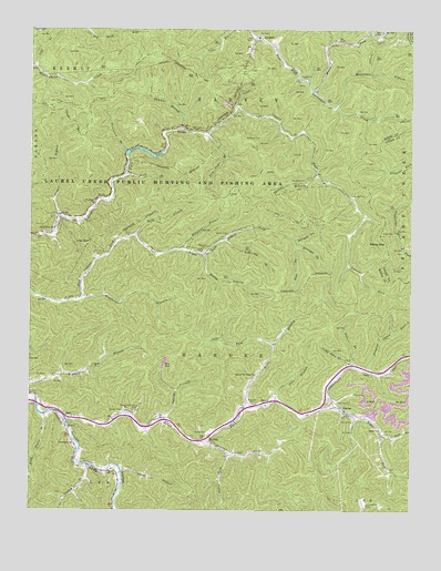
Myrtle, WV USGS Topographic Map
Click on map above to begin viewing in our Map Viewer.

This topographic map contains these locations and features:
Feature Name Type Latitude Longitude GNIS ID View Map
Alexanders CemeteryCemeteryN37.8623°W82.1596°1534871View Map
Ashcamp BranchStreamN37.8207°W82.1862°1535054View Map
BeloPopulated PlaceN37.7743°W82.2376°1553854View Map
Bethany ChurchChurchN37.8295°W82.2296°1535677View Map
Bubby BranchStreamN37.8168°W82.1929°1536541View Map
Buck BranchStreamN37.8212°W82.2154°1536544View Map
Caney BranchStreamN37.7601°W82.2196°1536995View Map
Caney ChurchChurchN37.7604°W82.2237°1536998View Map
Canterbury ChurchChurchN37.8232°W82.2424°1537019View Map
Conley BranchStreamN37.7620°W82.2310°1537572View Map
Dempsey CemeteryCemeteryN37.7784°W82.1487°1538123View Map
DingessPopulated PlaceN37.8723°W82.1749°1554306View Map
Dingess Camp BranchStreamN37.7865°W82.1399°1549511View Map
Dingess Elementary SchoolSchoolN37.8549°W82.1503°2088179View Map
Dingess Post OfficePost OfficeN37.8733°W82.1762°1728760View Map
Duncan ForkStreamN37.7679°W82.1932°1538431View Map
Estep CemeteryCemeteryN37.7651°W82.1832°1538742View Map
Estep CemeteryCemeteryN37.7709°W82.1343°1538743View Map
Evans CemeteryCemeteryN37.8170°W82.1935°1538752View Map
Evans CemeteryCemeteryN37.8215°W82.2193°1538753View Map
Gap Hollow CemeteryCemeteryN37.8165°W82.2285°1539328View Map
Gilman CemeteryCemeteryN37.8218°W82.1854°1539405View Map
Hardee District (historical)CivilN37.7845°W82.2421°1928286View Map
Jims BranchStreamN37.7784°W82.1690°1540907View Map
Lackey CemeteryCemeteryN37.8559°W82.2404°1541302View Map
Lake Front Church of GodChurchN37.7503°W82.1807°2095993View Map
Laurel BranchStreamN37.8490°W82.2007°1541372View Map
Laurel LakeReservoirN37.8434°W82.2122°1541478View Map
Laurel Lake DamDamN37.8384°W82.2165°1559113View Map
Laurel Lake State Wildlife Management AreaParkN37.8351°W82.1968°1541425View Map
Laurel Lake Wildlife Management AreaParkN37.8370°W82.2312°2043534View Map
Left Fork Riffe BranchStreamN37.7934°W82.1704°1541709View Map
Left Fork Right Fork Trace ForkStreamN37.7698°W82.1343°1541711View Map
Lick BranchStreamN37.8376°W82.2190°1541843View Map
Lick BranchStreamN37.8654°W82.2490°1541844View Map
Lily of the Valley ChurchChurchN37.7854°W82.1757°1541966View Map
Little Twin BranchStreamN37.7873°W82.1457°1542244View Map
Low GapGapN37.8195°W82.2307°1542492View Map
Marcum CemeteryCemeteryN37.8726°W82.1368°1542749View Map
Maynard CemeteryCemeteryN37.7779°W82.1768°1542900View Map
Messenger BranchStreamN37.8543°W82.1504°1543137View Map
Millstone BranchStreamN37.8182°W82.1990°1543421View Map
Moses ForkStreamN37.8593°W82.1576°1543592View Map
Mounts CemeteriesCemeteryN37.7754°W82.2207°1543883View Map
MyrtlePopulated PlaceN37.7679°W82.1912°1555186View Map
Myrtle Elementary School (historical)SchoolN37.7676°W82.1901°1728819View Map
Myrtle Post OfficePost OfficeN37.7695°W82.1915°1728820View Map
Newsome CemeteryCemeteryN37.8179°W82.1932°1544156View Map
Newsome CemeteryCemeteryN37.8468°W82.1746°1544158View Map
Ooten CemeteryCemeteryN37.7704°W82.1915°1544408View Map
Ooten ForkStreamN37.7648°W82.1843°1544410View Map
Panther BranchStreamN37.8373°W82.1562°1544542View Map
ParsleyPopulated PlaceN37.8498°W82.2001°1544597View Map
Paw Paw BranchStreamN37.8482°W82.1924°1544642View Map
Rebecca ChurchChurchN37.7784°W82.1726°1545444View Map
Riffe BranchStreamN37.7762°W82.1793°1545585View Map
Right Fork Trace ForkStreamN37.7773°W82.1512°1545716View Map
Rockhouse BranchStreamN37.8057°W82.2321°1545968View Map
Rockhouse BranchStreamN37.8434°W82.2190°1545969View Map
Rodd ForkStreamN37.8187°W82.1626°1546039View Map
Ruth Trace BranchStreamN37.7748°W82.2451°1546194View Map
Sandy GapGapN37.8198°W82.1335°1546406View Map
Sardis ChurchChurchN37.7709°W82.1351°1546434View Map
ScarletPopulated PlaceN37.7759°W82.1471°1555580View Map
Spring BranchStreamN37.7737°W82.2057°1547164View Map
Straight ForkStreamN37.8187°W82.1626°1547553View Map
Sturgell CemeteryCemeteryN37.8320°W82.1446°1547604View Map
Sturgell ForkStreamN37.8204°W82.1635°1547605View Map
Toms BranchStreamN37.8265°W82.2401°1548130View Map
Trace ForkStreamN37.7734°W82.2371°1548220View Map
Trace Fork ChurchChurchN37.7759°W82.2179°1548234View Map
Twin BranchStreamN37.7879°W82.1437°1548397View Map
Vance CemeteryCemeteryN37.8218°W82.1307°1548613View Map
Zion ChurchChurchN37.8215°W82.2474°1549487View Map
Zornes CemeteryCemeteryN37.7762°W82.2160°1549507View Map

Note: Coordinates in the location and feature list above are referenced to NAD83 datum.


Copyright (C) 2008-2024 Ryan Niemi / Sunset Dynamics ... All Rights Reserved