TopoQuest Logo
Do you find TopoQuest useful?
Help keep TopoQuest running and adding new maps/features by donating!
Bitcoin:  19c7KJd3qBynnjoSw5npx9KScwjBe4ifkT
Litecoin:  LXs6TkuXGGXo1vDsWCkWVdjQX94eUKd6ui
Home View Maps Find Maps Find Places Resources & Links


Trace, West Virginia Topographic Map

USGS Map Title: Trace, WV
USGS Map MRC: 37082H2
DRG (GeoTIFF) Download: o37082h2.tif


Neighboring USGS Topographic Map Quads:


  Kiahsville, WV  
38082A3
 

  Ranger, WV  
38082A2
 

  Big Creek, WV  
38082A1
 

  Wilsondale, WV  
37082H3
 

  Trace, WV  
37082H2
 

  Chapmanville, WV  
37082H1
 

  Naugatuck, WV  
37082G3
 

  Myrtle, WV  
37082G2
 

  Holden, WV  
37082G1


Map MRC Location:

N38°
W83°
N38°
W82°
H8 H7 H6 H5 H4 H3 H2 H1
G8 G7 G6 G5 G4 G3 G2 G1
F8 F7 F6 F5 F4 F3 F2 F1
E8 E7 E6 E5 E4 E3 E2 E1
D8 D7 D6 D5 D4 D3 D2 D1
C8 C7 C6 C5 C4 C3 C2 C1
B8 B7 B6 B5 B4 B3 B2 B1
A8 A7 A6 A5 A4 A3 A2 A1
N37°
W83°
N37°
W82°

Trace, WV USGS 1:24K Topographic Map Preview:
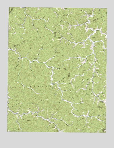
Trace, WV USGS Topographic Map
Click on map above to begin viewing in our Map Viewer.

This topographic map contains these locations and features:
Feature Name Type Latitude Longitude GNIS ID View Map
Adams BranchStreamN37.9648°W82.1665°1534802View Map
Adams CemeteryCemeteryN37.9668°W82.1415°1534806View Map
Alex BranchStreamN37.9495°W82.2271°1534865View Map
Andy BranchStreamN37.9565°W82.2410°1534952View Map
Bailey BranchStreamN37.8907°W82.2321°1535113View Map
Barker BranchStreamN37.9082°W82.1804°1535220View Map
Big BranchStreamN37.9232°W82.1929°1535790View Map
Big Sang KillStreamN37.8932°W82.2404°1535965View Map
Bills BranchStreamN37.9190°W82.1840°1536000View Map
Blair ForkStreamN37.8912°W82.1368°1536075View Map
Boardtree BranchStreamN37.9654°W82.1693°1536170View Map
Brier BranchStreamN37.9118°W82.1385°1536342View Map
Bryan RidgeRidgeN37.9890°W82.1804°1536528View Map
Buck ForkStreamN37.9651°W82.1424°1536556View Map
Bulwark BranchStreamN37.9273°W82.1426°1536716View Map
Bulwark School (historical)SchoolN37.9309°W82.1418°1536717View Map
Bus Kirk SchoolSchoolN37.9476°W82.2137°1536777View Map
Camp BranchStreamN37.8759°W82.1832°1536901View Map
Caney ForkStreamN37.9484°W82.2329°1536999View Map
Carter BranchStreamN37.9595°W82.1271°1537069View Map
Coon HollowValleyN37.8995°W82.1660°1537630View Map
Copley BranchStreamN37.9920°W82.2268°1537668View Map
Copley Trace School (historical)SchoolN37.9920°W82.2274°1537670View Map
Dalton School Number 3 (historical)SchoolN37.9062°W82.1293°1557821View Map
Damron CemeteryCemeteryN37.8795°W82.1890°1537971View Map
Dingess CemeteryCemeteryN37.9793°W82.1432°1538202View Map
Dingess Trace BranchStreamN37.8873°W82.1974°1538208View Map
East Fork Volunteer Fire DepartmentBuildingN37.9087°W82.1809°2577926View Map
Elizabeth ChurchChurchN37.9570°W82.2413°1538607View Map
Farley CemeteryCemeteryN37.9473°W82.1376°1538893View Map
Frances Creek School (historical)SchoolN37.9998°W82.1965°1539224View Map
Hannah ChurchChurchN37.9118°W82.1360°1539915View Map
Harvey District (historical)CivilN37.8954°W82.2135°1928290View Map
Henderson BranchStreamN37.9443°W82.1410°1540142View Map
High Top School (historical)SchoolN37.9918°W82.1779°1540254View Map
Hogger BranchStreamN37.9232°W82.1857°1540364View Map
Hogger RunStreamN37.8945°W82.2118°1540365View Map
Hoover ForkStreamN37.9551°W82.1412°1540437View Map
Hoover KnobSummitN37.9379°W82.1757°1540438View Map
Hugh Dingess Elementary SchoolSchoolN37.9783°W82.1387°1540563View Map
Hurricane BranchStreamN37.9243°W82.1874°1540616View Map
Ivy BranchStreamN37.9695°W82.1810°1540754View Map
Jims BranchStreamN37.9879°W82.2193°1540909View Map
Kinser CemeteryCemeteryN37.9690°W82.1840°1541232View Map
KirkPopulated PlaceN37.8943°W82.2432°1554888View Map
Lambert BranchStreamN37.9373°W82.1399°1541325View Map
Left Hand Fork Hoover ForkStreamN37.9495°W82.1512°1541754View Map
Lick BranchStreamN37.9040°W82.1687°1541847View Map
Little Sang KillStreamN37.8929°W82.2368°1542212View Map
Log BranchStreamN37.9234°W82.1935°1542305View Map
Main Harts Creek Volunteer Fire DepartmentBuildingN37.9455°W82.1399°2577684View Map
Marcum BranchStreamN37.9162°W82.1807°1542745View Map
Mare BranchStreamN37.9470°W82.2135°1542756View Map
Martin CemeteryCemeteryN37.9823°W82.1890°1542804View Map
McCloudPopulated PlaceN37.9234°W82.1943°1728808View Map
McCloud BranchStreamN37.9443°W82.2029°1542935View Map
McCloud CemeteryCemeteryN37.9232°W82.1954°1542936View Map
McCloud ChurchChurchN37.9232°W82.1921°1542937View Map
Meeks CemeteryCemeteryN37.9801°W82.2399°1543110View Map
Mount Mariah ChurchChurchN37.9576°W82.2465°1543672View Map
Mountaineer ChurchChurchN37.9712°W82.1479°1543882View Map
Mudlick BranchStreamN37.8984°W82.2485°1543936View Map
Mullins CemeteryCemeteryN37.9626°W82.1410°1543996View Map
Mullins CemeteryCemeteryN37.9645°W82.1568°1543997View Map
Mullins-Adams CemeteryCemeteryN37.9618°W82.1649°2586277View Map
Old House BranchStreamN37.9390°W82.1926°1544359View Map
Old House BranchStreamN37.9487°W82.2357°1544360View Map
Openmouth BranchStreamN37.9104°W82.2488°1544419View Map
Pigeonroost ForkStreamN37.9045°W82.1668°1544826View Map
Pilgrim Rest ChurchChurchN37.9179°W82.1426°1544856View Map
Pretty BranchStreamN37.9445°W82.2215°1545241View Map
Rockhouse ForkStreamN37.9843°W82.1521°1545981View Map
Roosevelt School (historical)SchoolN37.9504°W82.1510°1546059View Map
Samaria ChurchChurchN37.8943°W82.2229°1546322View Map
Shaft BranchStreamN37.8854°W82.1946°1546607View Map
Shepherd CemeteryCemeteryN37.9790°W82.2415°1546667View Map
Smokehouse ForkStreamN37.9779°W82.1404°1547012View Map
Sol Adams CemeteryCemeteryN37.9370°W82.1382°1547054View Map
Spicewood BranchStreamN37.9934°W82.1504°1547143View Map
Thompson BranchStreamN37.9923°W82.1471°1548039View Map
Thompson Branch School (historical)SchoolN37.9932°W82.1471°1548040View Map
Tomblin BranchStreamN37.9112°W82.1357°1548122View Map
Tomblin CemeteryCemeteryN37.9118°W82.1351°1548124View Map
TracePopulated PlaceN37.8873°W82.1968°1549957View Map
Trace BranchStreamN37.8965°W82.2468°1548195View Map
Trace ChurchChurchN37.8912°W82.2118°1548198View Map
Trace ForkStreamN37.9695°W82.1471°1548212View Map
Upper Trace School (historical)SchoolN37.9690°W82.1835°1548561View Map
Vance CemeteryCemeteryN37.9695°W82.2315°1548617View Map
Wellman CemeteryCemeteryN37.8757°W82.1846°1548895View Map
WhirlwindPopulated PlaceN37.9273°W82.1429°1742641View Map
Williams CemeteryCemeteryN37.9829°W82.1876°1549168View Map
Workman BranchStreamN37.9284°W82.1429°1549401View Map

Note: Coordinates in the location and feature list above are referenced to NAD83 datum.


Copyright (C) 2008-2024 Ryan Niemi / Sunset Dynamics ... All Rights Reserved