TopoQuest Logo
Do you find TopoQuest useful?
Help keep TopoQuest running and adding new maps/features by donating!
Bitcoin:  19c7KJd3qBynnjoSw5npx9KScwjBe4ifkT
Litecoin:  LXs6TkuXGGXo1vDsWCkWVdjQX94eUKd6ui
Home View Maps Find Maps Find Places Resources & Links


Wilsondale, West Virginia Topographic Map

USGS Map Title: Wilsondale, WV
USGS Map MRC: 37082H3
DRG (GeoTIFF) Download: o37082h3.tif


Neighboring USGS Topographic Map Quads:


  Radnor, WV  
38082A4
 

  Kiahsville, WV  
38082A3
 

  Ranger, WV  
38082A2
 

  Webb, WV  
37082H4
 

  Wilsondale, WV  
37082H3
 

  Trace, WV  
37082H2
 

  Kermit, WV  
37082G4
 

  Naugatuck, WV  
37082G3
 

  Myrtle, WV  
37082G2


Map MRC Location:

N38°
W83°
N38°
W82°
H8 H7 H6 H5 H4 H3 H2 H1
G8 G7 G6 G5 G4 G3 G2 G1
F8 F7 F6 F5 F4 F3 F2 F1
E8 E7 E6 E5 E4 E3 E2 E1
D8 D7 D6 D5 D4 D3 D2 D1
C8 C7 C6 C5 C4 C3 C2 C1
B8 B7 B6 B5 B4 B3 B2 B1
A8 A7 A6 A5 A4 A3 A2 A1
N37°
W83°
N37°
W82°

Wilsondale, WV USGS 1:24K Topographic Map Preview:
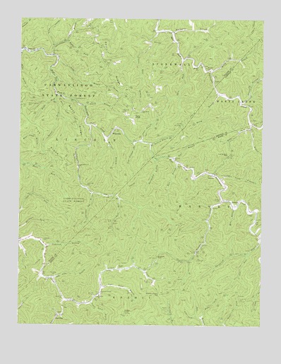
Wilsondale, WV USGS Topographic Map
Click on map above to begin viewing in our Map Viewer.

This topographic map contains these locations and features:
Feature Name Type Latitude Longitude GNIS ID View Map
Anderson BranchStreamN37.9065°W82.3613°1534933View Map
Anderson CemeteryCemeteryN37.9090°W82.3621°1534935View Map
Antley KnobSummitN37.8793°W82.3204°1534980View Map
Baisden CemeteryCemeteryN37.8868°W82.3363°1535136View Map
Beech RidgeRidgeN37.9579°W82.3454°1535545View Map
Beech Ridge TrailTrailN37.9626°W82.3510°1535546View Map
Big Jims BranchStreamN37.8934°W82.3565°1535874View Map
Bluewater BranchStreamN37.9945°W82.2968°1536150View Map
Board Camp Branch BridgeBridgeN37.9429°W82.3041°2647463View Map
Boardcamp BranchStreamN37.9423°W82.3051°1536167View Map
BreedenPopulated PlaceN37.9254°W82.2660°1549610View Map
Breeden CreekStreamN37.9262°W82.2701°1536316View Map
Breeden GapGapN37.9032°W82.3035°1536317View Map
Breeden Post OfficePost OfficeN37.9260°W82.2582°1728736View Map
Breeden TunnelTunnelN37.8840°W82.2543°2647515View Map
Breeden Tunnel BridgeBridgeN37.9129°W82.2529°2647513View Map
Brewer CemeteryCemeteryN37.8790°W82.3540°1536323View Map
Bull BranchStreamN37.9418°W82.2938°1536685View Map
Cabwaylingo State ForestForestN37.9743°W82.3518°1536844View Map
Chestnut Log BranchStreamN37.9290°W82.3376°1537285View Map
Clark CemeteryCemeteryN37.9804°W82.3013°1537353View Map
Cranes BranchStreamN37.9951°W82.3049°1537799View Map
Cub BranchStreamN37.9570°W82.2551°1537892View Map
Cub Branch GapGapN37.9443°W82.2674°1537895View Map
DoanePopulated PlaceN37.9876°W82.3732°1538220View Map
Fays Cash And Carry BridgeBridgeN37.9219°W82.2549°2647466View Map
Ferguson CemeteryCemeteryN37.9701°W82.3660°1538918View Map
Gourd BranchStreamN37.9645°W82.3426°1539549View Map
Harrison BranchStreamN37.9512°W82.3301°1540015View Map
Hickory BranchStreamN37.9376°W82.2796°1728786View Map
Hodges CemeteryCemeteryN37.8984°W82.3235°1540334View Map
Honey BranchStreamN37.9693°W82.2724°1540417View Map
Jacks ForkStreamN37.9270°W82.3243°1540771View Map
Jakes BranchStreamN37.9495°W82.3121°1540797View Map
Jennie Creek ChurchChurchN37.8865°W82.3521°1540864View Map
Jennie Creek School (historical)SchoolN37.8870°W82.3332°1540865View Map
Jonas CemeteryCemeteryN37.9684°W82.3090°1541000View Map
Kelly KnobSummitN37.9595°W82.3188°1541140View Map
Kelly Knob School (historical)SchoolN37.9618°W82.3124°1541141View Map
Kermit Harvey DistrictCivilN37.8828°W82.2552°2071873View Map
Kirk CemeteryCemeteryN37.9293°W82.2657°1541235View Map
Kirk CemeteryCemeteryN37.9379°W82.2779°1541236View Map
Laurel BranchStreamN37.9662°W82.2618°1541393View Map
Left Fork Dan BranchStreamN37.8787°W82.2835°1541648View Map
Left Fork Openmouth BranchStreamN37.9037°W82.2571°1541700View Map
Long BranchStreamN37.9829°W82.3557°1542341View Map
Lora Fleming Memorial BridgeBridgeN37.9438°W82.3019°2647496View Map
Lower Honey BranchStreamN37.8843°W82.3374°1542545View Map
Lower Turkey Creek School (historical)SchoolN37.9398°W82.3449°1542581View Map
LowneyPopulated PlaceN37.9370°W82.2751°1549801View Map
Lowney Singing BridgeBridgeN37.9375°W82.2795°2647465View Map
Marcum CemeteryCemeteryN37.9207°W82.2546°1542751View Map
Marcum CemeteryCemeteryN37.9445°W82.3618°1542753View Map
Matty Ferguson CemeteryCemeteryN37.9645°W82.3710°1542876View Map
Maynard CemeteryCemeteryN37.9620°W82.3221°1542901View Map
Meade and Messer CemeteryCemeteryN37.8876°W82.3321°1543039View Map
Meades CemeteryCemeteryN37.9743°W82.2749°1543043View Map
Meades CemeteryCemeteryN37.9918°W82.2779°1543044View Map
Messer CemeteryCemeteryN37.8812°W82.2990°1543141View Map
Messer CemeteryCemeteryN37.8929°W82.3076°1543142View Map
Mill BranchStreamN37.9226°W82.2640°1543291View Map
Mount Sinai ChurchChurchN37.9804°W82.2790°1543762View Map
Mount Sinai School (historical)SchoolN37.9809°W82.2838°1543764View Map
Mullins CemeteryCemeteryN37.9893°W82.2749°1543998View Map
New Ground BranchStreamN37.9495°W82.3168°1544117View Map
Open ForkStreamN37.9832°W82.2918°1544414View Map
Perry CemeteryCemeteryN37.8995°W82.3046°1544722View Map
Perry RidgeRidgeN37.9795°W82.3296°1544732View Map
Perry Ridge CemeteryCemeteryN37.9829°W82.3321°1544733View Map
Phelps CemeteryCemeteryN37.9370°W82.2838°1544774View Map
Poor BranchStreamN37.9420°W82.2957°1545138View Map
Pumpkin Field BranchStreamN37.9345°W82.2715°1545312View Map
Right Fork Cub BranchStreamN37.9557°W82.2565°1545632View Map
Right Fork Dan BranchStreamN37.8779°W82.2799°1545633View Map
Right Fork Spruce ForkStreamN37.9668°W82.3568°1545707View Map
Right Fork Sweetwater BranchStreamN37.9906°W82.3513°1545712View Map
Saltlick BranchStreamN37.9493°W82.3085°1546312View Map
Sleepy HollowValleyN37.9893°W82.3571°1546938View Map
South Bull BridgeBridgeN37.9393°W82.2872°2647464View Map
SpauldingPopulated PlaceN37.8784°W82.3549°1555679View Map
Spaulding CemeteryCemeteryN37.8949°W82.3569°1547109View Map
Spaulding CemeteryCemeteryN37.9168°W82.3276°1547110View Map
Spaulding CemeteryCemeteryN37.9318°W82.3401°1547111View Map
Spruce ForkStreamN37.9690°W82.3557°1547231View Map
Stafford CemeteryCemeteryN37.9265°W82.2715°1547315View Map
Stroud CemeteryCemeteryN37.9479°W82.2979°1547590View Map
Stroud CemeteryCemeteryN37.9698°W82.3354°1547591View Map
Sweetwater BranchStreamN37.9848°W82.3590°1547801View Map
Swelled Hickory GapGapN37.8873°W82.3018°1547804View Map
Turkey CreekStreamN37.9568°W82.3393°1548330View Map
Upper Honey BranchStreamN37.8907°W82.3321°1548525View Map
Vance CemeteryCemeteryN37.9409°W82.2932°1548614View Map
Vance CemeteryCemeteryN37.9445°W82.2668°1548615View Map
Wiley BranchStreamN37.9787°W82.2768°1549145View Map
Wiley BranchStreamN37.9854°W82.3749°1549146View Map
Williamson CemeteryCemeteryN37.9570°W82.2915°1549189View Map
Williamson CemeteryCemeteryN37.9898°W82.3035°1549190View Map
WilsondalePopulated PlaceN37.9537°W82.3276°1549993View Map
Wilsondale Post OfficePost OfficeN37.9519°W82.3296°1729025View Map
Workman CemeteryCemeteryN37.9432°W82.2954°1549406View Map

Note: Coordinates in the location and feature list above are referenced to NAD83 datum.


Copyright (C) 2008-2024 Ryan Niemi / Sunset Dynamics ... All Rights Reserved