TopoQuest Logo
Do you find TopoQuest useful?
Help keep TopoQuest running and adding new maps/features by donating!
Bitcoin:  19c7KJd3qBynnjoSw5npx9KScwjBe4ifkT
Litecoin:  LXs6TkuXGGXo1vDsWCkWVdjQX94eUKd6ui
Home View Maps Find Maps Find Places Resources & Links


Naugatuck, West Virginia Topographic Map

USGS Map Title: Naugatuck, WV
USGS Map MRC: 37082G3
DRG (GeoTIFF) Download: o37082g3.tif


Neighboring USGS Topographic Map Quads:


  Webb, WV  
37082H4
 

  Wilsondale, WV  
37082H3
 

  Trace, WV  
37082H2
 

  Kermit, WV  
37082G4
 

  Naugatuck, WV  
37082G3
 

  Myrtle, WV  
37082G2
 

  Varney, KY  
37082F4
 

  Williamson, WV  
37082F3
 

  Delbarton, WV  
37082F2


Map MRC Location:

N38°
W83°
N38°
W82°
H8 H7 H6 H5 H4 H3 H2 H1
G8 G7 G6 G5 G4 G3 G2 G1
F8 F7 F6 F5 F4 F3 F2 F1
E8 E7 E6 E5 E4 E3 E2 E1
D8 D7 D6 D5 D4 D3 D2 D1
C8 C7 C6 C5 C4 C3 C2 C1
B8 B7 B6 B5 B4 B3 B2 B1
A8 A7 A6 A5 A4 A3 A2 A1
N37°
W83°
N37°
W82°

Naugatuck, WV USGS 1:24K Topographic Map Preview:
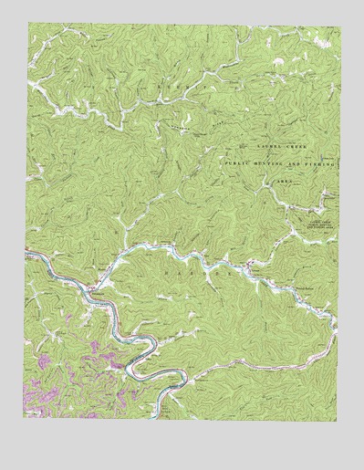
Naugatuck, WV USGS Topographic Map
Click on map above to begin viewing in our Map Viewer.

This topographic map contains these locations and features:
Feature Name Type Latitude Longitude GNIS ID View Map
AjaxPopulated PlaceN37.8026°W82.3046°1553703View Map
Ajax BranchStreamN37.8015°W82.3054°1534847View Map
Aldrich BranchStreamN37.8223°W82.3151°1534858View Map
Antley BranchStreamN37.8690°W82.2910°1534979View Map
Bailey CemeteryCemeteryN37.7759°W82.3638°486220View Map
Baisden BranchStreamN37.8045°W82.3165°1535133View Map
Baisden CemeteryCemeteryN37.8504°W82.3210°1535135View Map
Baisden ChurchChurchN37.8501°W82.3238°1535138View Map
Baisdentown ChurchChurchN37.8054°W82.3171°1535141View Map
Barkcamp BranchStreamN37.8470°W82.3368°1535217View Map
Big BranchStreamN37.8032°W82.3338°1535788View Map
Big HollowValleyN37.7883°W82.3707°487192View Map
Block HollowValleyN37.8732°W82.3590°1536103View Map
BloctonPopulated PlaceN37.7968°W82.3421°1553926View Map
Brewer CemeteryCemeteryN37.8484°W82.3565°1536320View Map
Buck RunStreamN37.8543°W82.3713°1536563View Map
Cane BranchStreamN37.8479°W82.3579°1536984View Map
CanterburyPopulated PlaceN37.8215°W82.2568°1537016View Map
Carter BranchStreamN37.7998°W82.3665°1537068View Map
Chapman CemeteryCemeteryN37.7554°W82.3221°489354View Map
Clark CemeteryCemeteryN37.7945°W82.2788°1537351View Map
Clark CemeteryCemeteryN37.8098°W82.2665°1537352View Map
Collins CemeteryCemeteryN37.7937°W82.2757°1537528View Map
Cotigo LakeReservoirN37.8336°W82.2573°1537695View Map
Cub BranchStreamN37.8598°W82.3043°1537894View Map
Dan BranchStreamN37.8745°W82.2793°1537977View Map
Davis BranchStreamN37.7948°W82.2829°1538021View Map
Davis CemeteryCemeteryN37.7751°W82.3207°1538027View Map
Davis CemeteryCemeteryN37.7890°W82.3101°1538028View Map
Den BranchStreamN37.7923°W82.3443°1538126View Map
Evans CemeteryCemeteryN37.8445°W82.3224°1538754View Map
Ferrell CemeteryCemeteryN37.8009°W82.2952°2586312View Map
Gun Rack HollowValleyN37.7669°W82.3607°493497View Map
Hanna CemeteriesCemeteryN37.8576°W82.2654°1539914View Map
Harden CemeteryCemeteryN37.8070°W82.2726°1539938View Map
Head of Long Branch SchoolSchoolN37.7757°W82.3613°493964View Map
Hensley Big BranchStreamN37.7820°W82.2529°1540164View Map
Hensley CemeteryCemeteryN37.7657°W82.3296°1540166View Map
Hensley CemeteryCemeteryN37.7704°W82.3238°1540167View Map
Jacks BranchStreamN37.7620°W82.3285°495086View Map
Kermit District (historical)CivilN37.8511°W82.3228°1928297View Map
Laurel BranchStreamN37.8601°W82.3004°1541373View Map
Laurel Branch School (historical)SchoolN37.8593°W82.2763°1541396View Map
Laurel Creek BridgeBridgeN37.8175°W82.2573°2647498View Map
Laurel ForkStreamN37.8265°W82.3685°1541430View Map
Laurel ForkStreamN37.7962°W82.2871°1541452View Map
Left Fork Big BranchStreamN37.8095°W82.3346°1541631View Map
Left Fork Mount Sterling BranchStreamN37.7648°W82.3332°496245View Map
Left Fork Neely BranchStreamN37.8582°W82.3201°1541698View Map
Left Fork Spruce ForkStreamN37.8237°W82.2776°1541729View Map
Left Fork Upper Burning CreekStreamN37.8276°W82.3679°1541741View Map
LenorePopulated PlaceN37.7990°W82.2868°1541780View Map
Lenore ChurchChurchN37.8009°W82.2963°1541781View Map
Lenore Elementary School (historical)SchoolN37.8001°W82.2843°1728798View Map
Lenore Middle School (historical)SchoolN37.7995°W82.2860°1728799View Map
Lenore PK - 8 SchoolSchoolN37.7978°W82.2897°2489145View Map
Lenore Post OfficePost OfficeN37.7977°W82.2849°1728800View Map
Lenore Volunteer Fire DepartmentBuildingN37.8005°W82.2848°2577638View Map
Little Dove ChurchChurchN37.7854°W82.2590°1542089View Map
Little Laurel BranchStreamN37.8518°W82.3132°1542138View Map
Little Road BranchStreamN37.7795°W82.2515°1542195View Map
Lone Star ChurchChurchN37.7959°W82.2851°1542328View Map
MaherPopulated PlaceN37.7693°W82.3274°1555025View Map
Marcum CemeteryCemeteryN37.7990°W82.3410°1542747View Map
Marcum CemeteryCemeteryN37.8479°W82.2868°1542748View Map
Marcum CemeteryCemeteryN37.7606°W82.3554°497531View Map
Marie BranchStreamN37.8307°W82.3557°1542761View Map
Meade CemeteryCemeteryN37.7770°W82.3121°1543041View Map
Meade CemeteryCemeteryN37.8604°W82.3021°1543042View Map
Middle Fork Spruce ForkStreamN37.8245°W82.2799°1543196View Map
Mill BranchStreamN37.7998°W82.2954°1543289View Map
Miller CreekStreamN37.7593°W82.3182°1543382View Map
Mingo Christian SchoolSchoolN37.7854°W82.2597°2088274View Map
Mountain View Memory GardensCemeteryN37.7654°W82.3321°1543878View Map
Mouth of Long Branch SchoolSchoolN37.8015°W82.3735°498967View Map
Mudlick BranchStreamN37.8207°W82.3218°1543935View Map
NaugatuckPopulated PlaceN37.7898°W82.3490°1544057View Map
Naugatuck Post OfficePost OfficeN37.7910°W82.3474°1728821View Map
Neely BranchStreamN37.8512°W82.3224°1544077View Map
Newsome CemeteryCemeteryN37.8445°W82.3213°1544157View Map
Newsome RidgeRidgeN37.8415°W82.3015°1544160View Map
Old Zion ChurchChurchN37.7751°W82.3346°1544377View Map
Oldfield BranchStreamN37.7734°W82.3226°1544379View Map
Oldfield SchoolSchoolN37.7754°W82.3171°1544381View Map
Oldhouse BranchStreamN37.7920°W82.2685°1544386View Map
Painter LickStreamN37.7768°W82.3640°500124View Map
Parsley BottomPopulated PlaceN37.7912°W82.2668°1555311View Map
Parsley Bottom Freewill Baptist ChurchChurchN37.7887°W82.2660°1728831View Map
Parsley CemeteryCemeteryN37.7631°W82.3129°500219View Map
Pat FlatFlatN37.8607°W82.3299°1544613View Map
Pickletub BranchStreamN37.8473°W82.3499°1544802View Map
Pigeon BranchStreamN37.7893°W82.3701°500582View Map
Pigeon CreekStreamN37.7901°W82.3510°1549518View Map
RappPopulated PlaceN37.8098°W82.2693°1728841View Map
Right Fork Laurel ForkStreamN37.8093°W82.2679°1545660View Map
Right Fork Mount Sterling BranchStreamN37.7640°W82.3340°501912View Map
Road BranchStreamN37.7629°W82.3107°1545791View Map
Road Branch School (historical)SchoolN37.7629°W82.3065°1545797View Map
Robinette CemeteryCemeteryN37.7657°W82.2743°1545858View Map
Rose CemeteryCemeteryN37.8479°W82.3563°1546069View Map
Sheep House KnobSummitN37.8393°W82.3082°1555604View Map
Shop BranchStreamN37.7937°W82.3438°1546710View Map
Spruce ForkStreamN37.8176°W82.2701°1547240View Map
Stepp BranchStreamN37.7868°W82.3479°504346View Map
Stepp CemeteryCemeteryN37.7826°W82.3393°504348View Map
Sturgell CemeteryCemeteryN37.8093°W82.2688°1547603View Map
Sugarcamp BranchStreamN37.7979°W82.3018°1547662View Map
Sweetwater BranchStreamN37.7923°W82.3718°504854View Map
Taylor SchoolSchoolN37.7520°W82.3218°505037View Map
Trace ForkStreamN37.8740°W82.2676°1548221View Map
Tug Hardee DistrictCivilN37.7651°W82.2703°2071874View Map
Tug Valley High SchoolSchoolN37.7927°W82.3403°1728871View Map
Turkey HollowValleyN37.8504°W82.3301°1548347View Map
Turkey RockPillarN37.8365°W82.2890°1548351View Map
Upper Canterbury BridgeBridgeN37.8219°W82.2566°2647499View Map
Vernatter BranchStreamN37.7759°W82.3307°1548646View Map
Vernatter CemeteryCemeteryN37.7768°W82.3318°1548647View Map
Waldron CemeteryCemeteryN37.7934°W82.3410°1548711View Map
Webb CemeteryCemeteryN37.7670°W82.2935°1548863View Map
White BranchStreamN37.7848°W82.2554°1728882View Map
William Shady Chapman BridgeBridgeN37.7585°W82.3171°2647488View Map
Wills CemeteryCemeteryN37.8709°W82.3624°1549204View Map
Winco Block SchoolSchoolN37.7862°W82.3435°506927View Map

Note: Coordinates in the location and feature list above are referenced to NAD83 datum.


Copyright (C) 2008-2024 Ryan Niemi / Sunset Dynamics ... All Rights Reserved