TopoQuest Logo
Do you find TopoQuest useful?
Help keep TopoQuest running and adding new maps/features by donating!
Bitcoin:  19c7KJd3qBynnjoSw5npx9KScwjBe4ifkT
Litecoin:  LXs6TkuXGGXo1vDsWCkWVdjQX94eUKd6ui
Home View Maps Find Maps Find Places Resources & Links


Namur, Wisconsin Topographic Map

USGS Map Title: Namur, WI
USGS Map MRC: 44087F6
DRG (GeoTIFF) Download: o44087f6.tif


Neighboring USGS Topographic Map Quads:


  Oconto SE, WI  
44087G7
 

  Little Sturgeon SW, WI  
44087G6
 

  Little Sturgeon, WI  
44087G5
 

  Dyckesville, WI  
44087F7
 

  Namur, WI  
44087F6
 

  Brussels, WI  
44087F5
 

  New Franken, WI  
44087E7
 

  Luxemburg, WI  
44087E6
 

  Casco, WI  
44087E5


Map MRC Location:

N45°
W88°
N45°
W87°
H8 H7 H6 H5 H4 H3 H2 H1
G8 G7 G6 G5 G4 G3 G2 G1
F8 F7 F6 F5 F4 F3 F2 F1
E8 E7 E6 E5 E4 E3 E2 E1
D8 D7 D6 D5 D4 D3 D2 D1
C8 C7 C6 C5 C4 C3 C2 C1
B8 B7 B6 B5 B4 B3 B2 B1
A8 A7 A6 A5 A4 A3 A2 A1
N44°
W88°
N44°
W87°

Namur, WI USGS 1:24K Topographic Map Preview:
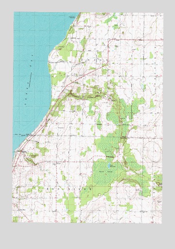
Namur, WI USGS Topographic Map
Click on map above to begin viewing in our Map Viewer.

This topographic map contains these locations and features:
Feature Name Type Latitude Longitude GNIS ID View Map
Baudhuin FarmsLocaleN44.7175°W87.7167°2710632View Map
Bay ViewPopulated PlaceN44.6328°W87.7443°1561322View Map
Bramblewood FarmLocaleN44.6844°W87.6522°2710601View Map
Chaudoirs Dock County ParkParkN44.7467°W87.6965°1562969View Map
Degrave FarmsLocaleN44.6744°W87.6450°2710490View Map
DuvallPopulated PlaceN44.6611°W87.7134°1564221View Map
Duvall CemeteryCemeteryN44.6814°W87.7118°1564222View Map
Duvall SwampSwampN44.6558°W87.6718°1564223View Map
Gospel Truth HallChurchN44.6319°W87.6415°1565682View Map
Gospel Truth Hall CemeteryCemeteryN44.6317°W87.6415°1840636View Map
High View School (historical)SchoolN44.6611°W87.7434°1840641View Map
Little Mud LakeLakeN44.6592°W87.6694°1568327View Map
Macco CreekStreamN44.6750°W87.7393°1568861View Map
Mick Schier Field Airport (historical)AirportN44.6839°W87.6267°2444125View Map
Murray Sand and Gravel PitMineN44.6975°W87.6683°2709839View Map
NamurPopulated PlaceN44.7347°W87.6701°1570098View Map
Norkin FarmsLocaleN44.6308°W87.6478°2710488View Map
Pleasant Ridge School (historical)SchoolN44.7128°W87.6807°1838064View Map
Red RiverStreamN44.6669°W87.7484°1572150View Map
Red River County ParkParkN44.6678°W87.7445°1572154View Map
Red River Valley FarmsLocaleN44.6261°W87.6642°2710491View Map
Renard CreekStreamN44.7142°W87.7201°1572198View Map
Rocky Glen School (historical)SchoolN44.6836°W87.6915°1838067View Map
Saint Francis Catholic ChurchChurchN44.6769°W87.7015°1838069View Map
Saint Marys CemeteryCemeteryN44.6601°W87.7137°1573299View Map
Saint Marys CemeteryCemeteryN44.7302°W87.6614°1573301View Map
San Sauveur School (historical)SchoolN44.6253°W87.6573°1840702View Map
Shoemaker PointPopulated PlaceN44.7205°W87.7207°1574066View Map
Sylvan OrchardLocaleN44.6936°W87.6978°2631612View Map
Tassout FarmLocaleN44.7033°W87.6461°2710635View Map
Town of Red RiverCivilN44.6325°W87.7022°1584003View Map
Town of UnionCivilN44.7201°W87.7017°1584310View Map
WHET-FM (Sturgeon Bay)TowerN44.6356°W87.6270°1582632View Map

Note: Coordinates in the location and feature list above are referenced to NAD83 datum.


Copyright (C) 2008-2025 Ryan Niemi / Sunset Dynamics ... All Rights Reserved