TopoQuest Logo
Do you find TopoQuest useful?
Help keep TopoQuest running and adding new maps/features by donating!
Bitcoin:  19c7KJd3qBynnjoSw5npx9KScwjBe4ifkT
Litecoin:  LXs6TkuXGGXo1vDsWCkWVdjQX94eUKd6ui
Home View Maps Find Maps Find Places Resources & Links


Belle, West Virginia Topographic Map

USGS Map Title: Belle, WV
USGS Map MRC: 38081B5
DRG (GeoTIFF) Download: o38081b5.tif


Neighboring USGS Topographic Map Quads:


  Charleston West, WV  
38081C6
 

  Charleston East, WV  
38081C5
 

  Quick, WV  
38081C4
 

  Racine, WV  
38081B6
 

  Belle, WV  
38081B5
 

  Cedar Grove, WV  
38081B4
 

  Williams Mountain, WV  
38081A6
 

  Sylvester, WV  
38081A5
 

  Eskdale, WV  
38081A4


Map MRC Location:

N39°
W82°
N39°
W81°
H8 H7 H6 H5 H4 H3 H2 H1
G8 G7 G6 G5 G4 G3 G2 G1
F8 F7 F6 F5 F4 F3 F2 F1
E8 E7 E6 E5 E4 E3 E2 E1
D8 D7 D6 D5 D4 D3 D2 D1
C8 C7 C6 C5 C4 C3 C2 C1
B8 B7 B6 B5 B4 B3 B2 B1
A8 A7 A6 A5 A4 A3 A2 A1
N38°
W82°
N38°
W81°

Belle, WV USGS 1:24K Topographic Map Preview:
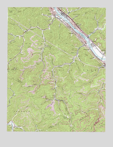
Belle, WV USGS Topographic Map
Click on map above to begin viewing in our Map Viewer.

This topographic map contains these locations and features:
Feature Name Type Latitude Longitude GNIS ID View Map
Bee MountainSummitN38.1884°W81.6148°1535490View Map
Bee Mountain Lookout TowerLocaleN38.1879°W81.6157°1742322View Map
BellePopulated PlaceN38.2320°W81.5376°1553846View Map
Belle Church of the NazareneChurchN38.2307°W81.5368°1742323View Map
Belle Elementary SchoolSchoolN38.2328°W81.5397°1742324View Map
Belle Police DepartmentBuildingN38.2301°W81.5358°2727986View Map
Belle Post OfficePost OfficeN38.2314°W81.5373°1742325View Map
Belle Presbyterian ChurchChurchN38.2323°W81.5390°1742326View Map
Belle Volunteer Fire Department Main StationBuildingN38.2323°W81.5382°2577566View Map
Belle Volunteer Fire Department Witcher StationBuildingN38.2205°W81.5224°2577777View Map
Bradford HollowValleyN38.2351°W81.5571°1536283View Map
Bradley ForkStreamN38.1657°W81.5084°1536285View Map
Brawleys HollowValleyN38.2004°W81.5132°1536312View Map
Carroll BranchStreamN38.1995°W81.5046°1537065View Map
Carrow ForkStreamN38.1265°W81.5746°1537066View Map
ChesapeakePopulated PlaceN38.2234°W81.5362°1554120View Map
Chesapeake City HallBuildingN38.2232°W81.5371°1742341View Map
Chesapeake Elementary SchoolSchoolN38.2155°W81.5264°1742342View Map
Chesapeake Police DepartmentBuildingN38.2241°W81.5366°2727985View Map
Chesapeake Post OfficePost OfficeN38.2193°W81.5307°1742343View Map
Chesapeake Volunteer Fire DepartmentBuildingN38.2238°W81.5362°2577698View Map
Chesapeake Volunteer Fire Department SubstationBuildingN38.1935°W81.5450°2577821View Map
Church of ChristChurchN38.2343°W81.5435°1742347View Map
Church of the NazareneChurchN38.2437°W81.5651°1742350View Map
City of MarmetCivilN38.2458°W81.5712°2390614View Map
ComfortPopulated PlaceN38.1304°W81.6157°1537547View Map
Comfort Census Designated PlaceCensusN38.1317°W81.6102°2586784View Map
Comfort Elementary School (historical)SchoolN38.1304°W81.6146°1741721View Map
Comfort Post OfficePost OfficeN38.1337°W81.6173°1741722View Map
Cooper CemeteryCemeteryN38.2009°W81.5354°1537648View Map
Coopers HollowValleyN38.1923°W81.5454°1537658View Map
DiamondPopulated PlaceN38.2148°W81.5165°1538170View Map
DickinsonPopulated PlaceN38.2037°W81.5026°1550920View Map
Dotson ForkStreamN38.1482°W81.5098°1538283View Map
Drummond Post OfficePost OfficeN38.2143°W81.5173°1742360View Map
Dry BranchStreamN38.2282°W81.5101°1538343View Map
Esta ChurchChurchN38.2354°W81.5110°1538737View Map
Ferrell CemeteryCemeteryN38.1298°W81.6065°1538932View Map
Fields CreekStreamN38.2145°W81.5235°1538953View Map
Fourmile ForkStreamN38.2207°W81.6057°1539182View Map
Frey HollowValleyN38.1720°W81.5854°1539264View Map
Frye CemeteryCemeteryN38.1865°W81.5796°1539292View Map
Green CemeteryCemeteryN38.1429°W81.5501°1539666View Map
Hawks CemeteryCemeteryN38.2270°W81.5993°1540076View Map
HernshawPopulated PlaceN38.2251°W81.6023°1540175View Map
Hernshaw Post OfficePost OfficeN38.2254°W81.6023°2774646View Map
Hoffman CemeteriesCemeteryN38.2073°W81.6079°1540337View Map
Interchange 85CrossingN38.1932°W81.5007°1742393View Map
Interchange 89CrossingN38.2404°W81.5651°1742394View Map
Island AirportAirportN38.2203°W81.5281°1558784View Map
James Kay SpringSpringN38.1973°W81.5104°1678144View Map
Joes BranchStreamN38.1351°W81.6204°1540927View Map
Joes CreekStreamN38.1307°W81.6179°1540931View Map
Judson Baptist ChurchChurchN38.2309°W81.5385°1742398View Map
Kanawha County Emergency Ambulance Authority Station 158BuildingN38.2453°W81.5675°2581025View Map
Kanawha County Emergency Ambulance Authority Station 59BuildingN38.2206°W81.5226°2581180View Map
Kanawha County Sheriff's Office - Quincy DetachmentBuildingN38.2052°W81.5055°2775764View Map
Left Fork Lens CreekStreamN38.2265°W81.5804°1541678View Map
Lens CreekStreamN38.2407°W81.5585°1541784View Map
Lens Creek ChurchChurchN38.2240°W81.6029°1541785View Map
Little CreekStreamN38.1920°W81.5007°1542062View Map
Little Creek ChurchChurchN38.1915°W81.5043°1542072View Map
Living Faith Christian Academy (historical)SchoolN38.2458°W81.5694°2088249View Map
Loudon District Junior High School (historical)SchoolN38.2493°W81.5523°1742410View Map
Maple ForkStreamN38.1287°W81.5187°1542729View Map
MarmetPopulated PlaceN38.2454°W81.5671°1542771View Map
Marmet Baptist ChurchChurchN38.2498°W81.5535°1742411View Map
Marmet City HallBuildingN38.2454°W81.5673°1742412View Map
Marmet Elementary SchoolSchoolN38.2458°W81.5667°1742413View Map
Marmet Fire DepartmentBuildingN38.2453°W81.5678°2577878View Map
Marmet Hospital (historical)HospitalN38.2434°W81.5679°1742414View Map
Marmet Memorial Gardens CemeteryCemeteryN38.2403°W81.5676°2586355View Map
Marmet Police DepartmentBuildingN38.2455°W81.5677°2727987View Map
Marmet Post OfficePost OfficeN38.2460°W81.5679°1742415View Map
Marmet Public LibraryBuildingN38.2459°W81.5683°2727237View Map
Massey CemeteryCemeteryN38.1593°W81.5451°1542854View Map
MaxinePopulated PlaceN38.1326°W81.6221°1555068View Map
Meadows CemeteryCemeteryN38.1287°W81.6154°1543087View Map
Midland Trail Elementary SchoolSchoolN38.2104°W81.5153°1742418View Map
Mill BranchStreamN38.1595°W81.5643°1543294View Map
Mill BranchStreamN38.2087°W81.5346°1543296View Map
Mitchell CemeteryCemeteryN38.1979°W81.5823°1543466View Map
Naomi ChurchChurchN38.2043°W81.5018°1544042View Map
New West HollowValleyN38.1562°W81.5662°1544141View Map
North HollowValleyN38.1562°W81.5587°1544225View Map
Old West HollowValleyN38.1568°W81.5671°1544375View Map
Opera House HollowValleyN38.1682°W81.5643°1544422View Map
Quincy Post OfficePost OfficeN38.2037°W81.5026°1721386View Map
Reynolds BranchStreamN38.2357°W81.5460°1545517View Map
Reynolds Memorial United Methodist ChurchChurchN38.2451°W81.5668°1742431View Map
Ring HollowValleyN38.2257°W81.6032°1545754View Map
Riverside High SchoolSchoolN38.2077°W81.5130°2088332View Map
Riverside LibraryBuildingN38.2065°W81.5119°2727236View Map
Sawmill CemeteryCemeteryN38.1962°W81.5396°1546456View Map
Sawmill HollowValleyN38.1951°W81.5398°1546459View Map
Schoolhouse HollowValleyN38.1907°W81.5657°1546498View Map
Scott BranchStreamN38.2043°W81.5360°1546514View Map
Scotts IslandIslandN38.2207°W81.5287°1546525View Map
Sherman Elementary SchoolSchoolN38.1305°W81.6148°2088350View Map
Simmons CreekStreamN38.2401°W81.5529°1546796View Map
Simmons Creek ChurchChurchN38.2493°W81.5323°1546797View Map
Sixmile BranchStreamN38.1940°W81.6232°1546848View Map
Slaughter Creek CemeteryCemeteryN38.1929°W81.5029°1546924View Map
Snodgrass CemeteryCemeteryN38.1970°W81.6210°1547037View Map
South HollowValleyN38.1557°W81.5598°1547084View Map
Spicelick ForkStreamN38.1265°W81.5746°1547142View Map
Spruce ForkStreamN38.2207°W81.6140°1547243View Map
Sweethome HollowValleyN38.1440°W81.5234°1547800View Map
Town HollowValleyN38.1704°W81.5623°1548182View Map
Town of BelleCivilN38.2337°W81.5387°2390719View Map
Town of ChesapeakeCivilN38.2231°W81.5362°2390782View Map
Trace ForkStreamN38.1268°W81.5868°1548213View Map
Upper Kanawha Valley Christian SchoolSchoolN38.2217°W81.5343°2088387View Map
Walker I HeliportAirportN38.2279°W81.5329°1558775View Map
West Virginia State Police Troop 4 - Quincy DetachmentBuildingN38.2056°W81.5060°2727984View Map
WinifredePopulated PlaceN38.1915°W81.5568°1549250View Map
Winifrede JunctionPopulated PlaceN38.2084°W81.5204°1556010View Map
Winifrede Post OfficePost OfficeN38.2108°W81.5295°1742464View Map
WitcherPopulated PlaceN38.2254°W81.5160°1556013View Map
Witcher Baptist ChurchChurchN38.2207°W81.5229°1742465View Map
Witcher CemeteryCemeteryN38.2284°W81.5093°1549258View Map
Witcher CreekStreamN38.2198°W81.5262°1549259View Map
Wolfpen HollowValleyN38.2007°W81.5362°1549329View Map
Wrightsville CemeteryCemeteryN38.1848°W81.5660°1549432View Map

Note: Coordinates in the location and feature list above are referenced to NAD83 datum.


Copyright (C) 2008-2025 Ryan Niemi / Sunset Dynamics ... All Rights Reserved