TopoQuest Logo
Do you find TopoQuest useful?
Help keep TopoQuest running and adding new maps/features by donating!
Bitcoin:  19c7KJd3qBynnjoSw5npx9KScwjBe4ifkT
Litecoin:  LXs6TkuXGGXo1vDsWCkWVdjQX94eUKd6ui
Home View Maps Find Maps Find Places Resources & Links


Neponset, Illinois Topographic Map

USGS Map Title: Neponset, IL
USGS Map MRC: 41089C7
DRG (GeoTIFF) Download: o41089c7.tif


Neighboring USGS Topographic Map Quads:


  Annawan, IL  
41089D8
 

  Mineral, IL  
41089D7
 

  Manlius, IL  
41089D6
 

  Kewanee North, IL  
41089C8
 

  Neponset, IL  
41089C7
 

  Buda, IL  
41089C6
 

  Kewanee South, IL  
41089B8
 

  Elmira, IL  
41089B7
 

  Bradford, IL  
41089B6


Map MRC Location:

N42°
W90°
N42°
W89°
H8 H7 H6 H5 H4 H3 H2 H1
G8 G7 G6 G5 G4 G3 G2 G1
F8 F7 F6 F5 F4 F3 F2 F1
E8 E7 E6 E5 E4 E3 E2 E1
D8 D7 D6 D5 D4 D3 D2 D1
C8 C7 C6 C5 C4 C3 C2 C1
B8 B7 B6 B5 B4 B3 B2 B1
A8 A7 A6 A5 A4 A3 A2 A1
N41°
W90°
N41°
W89°

Neponset, IL USGS 1:24K Topographic Map Preview:
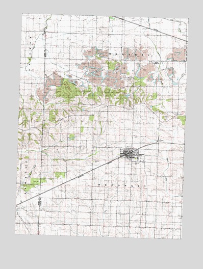
Neponset, IL USGS Topographic Map
Click on map above to begin viewing in our Map Viewer.

This topographic map contains these locations and features:
Feature Name Type Latitude Longitude GNIS ID View Map
Bowen School (historical)SchoolN41.2800°W89.8384°404728View Map
Douglas School (historical)SchoolN41.2564°W89.7676°407356View Map
Edwin G Bennett AirportAirportN41.3504°W89.7706°427802View Map
Floral Hill CemeteryCemeteryN41.2923°W89.7882°1720975View Map
Francis ParkParkN41.2803°W89.8609°408649View Map
Indian HillSummitN41.3489°W89.8140°410861View Map
Kentville School (historical)SchoolN41.2561°W89.7973°411415View Map
Kuster School (historical)SchoolN41.3070°W89.8379°411627View Map
Miller School (historical)SchoolN41.2559°W89.8376°413599View Map
Mineral CemeteryCemeteryN41.3498°W89.8051°1721004View Map
NeponsetPopulated PlaceN41.2959°W89.7904°414366View Map
Neponset CemeteryCemeteryN41.2927°W89.8178°1721008View Map
Neponset Elementary SchoolsSchoolN41.2950°W89.7915°1822689View Map
Neponset Fire Protection DistrictBuildingN41.2963°W89.7916°2640718View Map
Neponset High School (historical)SchoolN41.2964°W89.7854°1721009View Map
Neponset Post OfficePost OfficeN41.2967°W89.7904°1822690View Map
Neponset Public LibraryBuildingN41.2964°W89.7912°1820568View Map
Neponset Village Police DepartmentBuildingN41.2967°W89.7911°2756804View Map
Scott ParkParkN41.2956°W89.7920°1721022View Map
Scott School (historical)SchoolN41.2928°W89.7704°418147View Map
Tomahawk CreekStreamN41.2973°W89.8615°419770View Map
Township of MineralCivilN41.3650°W89.7993°429373View Map
Township of NeponsetCivilN41.2777°W89.7992°429426View Map
Village of NeponsetCivilN41.2968°W89.7895°2399446View Map

Note: Coordinates in the location and feature list above are referenced to NAD83 datum.


Copyright (C) 2008-2024 Ryan Niemi / Sunset Dynamics ... All Rights Reserved