TopoQuest Logo
Do you find TopoQuest useful?
Help keep TopoQuest running and adding new maps/features by donating!
Bitcoin:  19c7KJd3qBynnjoSw5npx9KScwjBe4ifkT
Litecoin:  LXs6TkuXGGXo1vDsWCkWVdjQX94eUKd6ui
Home View Maps Find Maps Find Places Resources & Links


New Bedford, Ohio Topographic Map

USGS Map Title: New Bedford, OH
USGS Map MRC: 40081D7
DRG (GeoTIFF) Download: o40081d7.tif


Neighboring USGS Topographic Map Quads:


  Millersburg, OH  
40081E8
 

  Berlin, OH  
40081E7
 

  Sugarcreek, OH  
40081E6
 

  Killbuck, OH  
40081D8
 

  New Bedford, OH  
40081D7
 

  Baltic, OH  
40081D6
 

  Randle, OH  
40081C8
 

  Coshocton, OH  
40081C7
 

  Fresno, OH  
40081C6


Map MRC Location:

N41°
W82°
N41°
W81°
H8 H7 H6 H5 H4 H3 H2 H1
G8 G7 G6 G5 G4 G3 G2 G1
F8 F7 F6 F5 F4 F3 F2 F1
E8 E7 E6 E5 E4 E3 E2 E1
D8 D7 D6 D5 D4 D3 D2 D1
C8 C7 C6 C5 C4 C3 C2 C1
B8 B7 B6 B5 B4 B3 B2 B1
A8 A7 A6 A5 A4 A3 A2 A1
N40°
W82°
N40°
W81°

New Bedford, OH USGS 1:24K Topographic Map Preview:
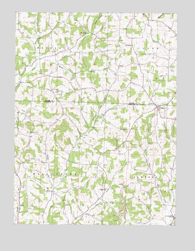
New Bedford, OH USGS Topographic Map
Click on map above to begin viewing in our Map Viewer.

This topographic map contains these locations and features:
Feature Name Type Latitude Longitude GNIS ID View Map
Beards RunStreamN40.3945°W81.8451°1037732View Map
Beck Mills Post Office (historical)Post OfficeN40.4876°W81.8193°2013563View Map
Becks MillsPopulated PlaceN40.4878°W81.8193°1062647View Map
Beech Grove School (historical)SchoolN40.4917°W81.8224°1056035View Map
Burkhardt CemeteryCemeteryN40.3956°W81.8060°1964101View Map
Burkhart ChurchChurchN40.3956°W81.8043°1038536View Map
Center School (historical)SchoolN40.4134°W81.7604°1050298View Map
Chili Crossroads ChurchChurchN40.3803°W81.7518°1064498View Map
Crossroads Church CemeteryCemeteryN40.3806°W81.7518°1964107View Map
Fairview School (historical)SchoolN40.4645°W81.8674°1056048View Map
Flat Ridge Middle SchoolSchoolN40.4806°W81.7851°1081313View Map
Grade School (historical)SchoolN40.3931°W81.8740°1050292View Map
Green Hill School (historical)SchoolN40.3895°W81.7882°1050297View Map
Knob CemeteryCemeteryN40.3864°W81.8357°1042324View Map
Knob School (historical)SchoolN40.4592°W81.7851°1056057View Map
Military RunStreamN40.4734°W81.8590°1043313View Map
MoundLocaleN40.3942°W81.8457°1043519View Map
Mound School (historical)SchoolN40.3923°W81.8354°1050293View Map
Mud Valley School (historical)SchoolN40.4787°W81.7557°1056069View Map
Mullet RunStreamN40.4701°W81.8451°1043729View Map
New BedfordPopulated PlaceN40.4448°W81.7651°1043821View Map
New Bedford Post Office (historical)Post OfficeN40.4445°W81.7651°1967443View Map
Oak Hill CemeteryCemeteryN40.4617°W81.8429°1961608View Map
Oak Hill CurchChurchN40.4620°W81.8429°1044044View Map
Oak Valley School (historical)SchoolN40.4617°W81.8282°1056073View Map
Rock Valley School (historical)SchoolN40.4281°W81.8215°1050295View Map
Saint Johns Evangelical Lutheran CemeteryCemeteryN40.4456°W81.7662°1964135View Map
Sheetz School (historical)SchoolN40.4273°W81.7879°1050296View Map
Shepler ChurchChurchN40.4290°W81.8624°1046188View Map
Shepler School (historical)SchoolN40.4320°W81.8726°1050294View Map
Sheplers Evangelical CemeteryCemeteryN40.4287°W81.8627°1964139View Map
Township of CrawfordCivilN40.4091°W81.7583°1085914View Map
Township of MechanicCivilN40.4848°W81.8671°1086332View Map
Township of Mill CreekCivilN40.4110°W81.8505°1085921View Map
Troyer HollowValleyN40.4884°W81.8157°1066244View Map
WKLM-FM (Millersburg)TowerN40.4853°W81.8443°1085386View Map
Yoder School (historical)SchoolN40.4759°W81.7815°1056088View Map
Zion CemeteryCemeteryN40.4464°W81.7710°1961628View Map
Zion ChurchChurchN40.3792°W81.7504°1080488View Map
Zion United Church of ChristChurchN40.4467°W81.7704°1048271View Map

Note: Coordinates in the location and feature list above are referenced to NAD83 datum.


Copyright (C) 2008-2025 Ryan Niemi / Sunset Dynamics ... All Rights Reserved