TopoQuest Logo
Do you find TopoQuest useful?
Help keep TopoQuest running and adding new maps/features by donating!
Bitcoin:  19c7KJd3qBynnjoSw5npx9KScwjBe4ifkT
Litecoin:  LXs6TkuXGGXo1vDsWCkWVdjQX94eUKd6ui
Home View Maps Find Maps Find Places Resources & Links


Killbuck, Ohio Topographic Map

USGS Map Title: Killbuck, OH
USGS Map MRC: 40081D8
DRG (GeoTIFF) Download: o40081d8.tif


Neighboring USGS Topographic Map Quads:


  Glenmont, OH  
40082E1
 

  Millersburg, OH  
40081E8
 

  Berlin, OH  
40081E7
 

  Spring Mountain, OH  
40082D1
 

  Killbuck, OH  
40081D8
 

  New Bedford, OH  
40081D7
 

  Warsaw, OH  
40082C1
 

  Randle, OH  
40081C8
 

  Coshocton, OH  
40081C7


Map MRC Location:

N41°
W82°
N41°
W81°
H8 H7 H6 H5 H4 H3 H2 H1
G8 G7 G6 G5 G4 G3 G2 G1
F8 F7 F6 F5 F4 F3 F2 F1
E8 E7 E6 E5 E4 E3 E2 E1
D8 D7 D6 D5 D4 D3 D2 D1
C8 C7 C6 C5 C4 C3 C2 C1
B8 B7 B6 B5 B4 B3 B2 B1
A8 A7 A6 A5 A4 A3 A2 A1
N40°
W82°
N40°
W81°

Killbuck, OH USGS 1:24K Topographic Map Preview:
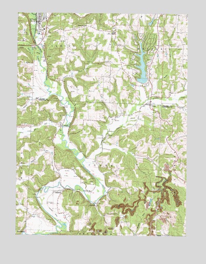
Killbuck, OH USGS Topographic Map
Click on map above to begin viewing in our Map Viewer.

This topographic map contains these locations and features:
Feature Name Type Latitude Longitude GNIS ID View Map
Big RunStreamN40.4342°W81.9665°1038028View Map
Black CreekStreamN40.4992°W81.9868°1038068View Map
BlissfieldPopulated PlaceN40.3998°W81.9654°1038117View Map
Blissfield CemeteryCemeteryN40.3932°W81.9726°1038118View Map
Blissfield Post OfficePost OfficeN40.4003°W81.9674°1964089View Map
Bucklew CemeteryCemeteryN40.3851°W81.9857°1038484View Map
Bucks RunStreamN40.4515°W81.9040°1038486View Map
ClarkPopulated PlaceN40.4490°W81.9024°1079574View Map
Clark CemeteryCemeteryN40.4445°W81.8968°1039138View Map
Clark Post OfficePost OfficeN40.4487°W81.9026°1967476View Map
Doughty CreekStreamN40.4170°W81.9501°1066682View Map
Elliott CemeteryCemeteryN40.4803°W81.8782°1040142View Map
Fox CemeteryCemeteryN40.4037°W81.9424°1040629View Map
Green Valley School (historical)SchoolN40.4090°W81.9679°1050288View Map
Greenhorn School (historical)SchoolN40.4315°W81.9371°1050290View Map
HelmickPopulated PlaceN40.3917°W81.9410°1064821View Map
Helmick BridgeBridgeN40.3931°W81.9429°1050300View Map
Helmick Post Office (historical)Post OfficeN40.3917°W81.9415°1967429View Map
Helmick StationLocaleN40.3995°W81.9454°1041475View Map
Hickory LakeReservoirN40.4917°W81.9049°1077716View Map
Hickory Lake DamDamN40.4917°W81.9049°1077715View Map
Hoagland RunStreamN40.4048°W81.9688°1079580View Map
Holmes Fire District 1 Buckhorn StationBuildingN40.4713°W81.9015°2549319View Map
KillbuckPopulated PlaceN40.4951°W81.9846°1064935View Map
Killbuck Elementary SchoolSchoolN40.4967°W81.9810°1056055View Map
Killbuck Post OfficePost OfficeN40.4945°W81.9846°2013541View Map
Killbuck Township Fire DepartmentBuildingN40.4973°W81.9839°2549954View Map
Lake BuckhornReservoirN40.4601°W81.9099°1077714View Map
Lake Buckhorn Census Designated PlaceCensusN40.4744°W81.9082°2628915View Map
Lake Buckhorn DamDamN40.4601°W81.9099°1077713View Map
Laurel CreekStreamN40.4540°W81.9704°1066065View Map
Laurel Run School (historical)SchoolN40.4615°W81.9554°1056060View Map
LaylandPopulated PlaceN40.4362°W81.9668°1048911View Map
Layland Post Office (historical)Post OfficeN40.4362°W81.9665°1967433View Map
Layland School (historical)SchoolN40.4412°W81.9757°1050289View Map
Lepley RunStreamN40.4534°W81.9757°1066067View Map
Mill Creek LandfillLocaleN40.3844°W81.8911°2677752View Map
Mount Dispute School (historical)SchoolN40.4040°W81.9049°1050291View Map
Mount Union (historical)Populated PlaceN40.4565°W81.9013°1056067View Map
Oakhill CemeteryCemeteryN40.4953°W81.9810°1961609View Map
Pleasant Grove CemeteryCemeteryN40.4934°W81.9496°1961613View Map
Pleasant Grove School (historical)SchoolN40.4931°W81.9501°1056076View Map
Salem CemeteryCemeteryN40.4501°W81.9479°1045877View Map
Stony Point School (historical)SchoolN40.4787°W81.9121°1056080View Map
Township of ClarkCivilN40.4134°W81.9429°1085912View Map
Township of KillbuckCivilN40.4882°W81.9870°1086330View Map
Village of KillbuckCivilN40.4961°W81.9825°2398346View Map
Weatherwax CemeteryCemeteryN40.3839°W81.9918°1964146View Map
Wolf CreekStreamN40.4773°W81.9829°1048037View Map

Note: Coordinates in the location and feature list above are referenced to NAD83 datum.


Copyright (C) 2008-2024 Ryan Niemi / Sunset Dynamics ... All Rights Reserved