TopoQuest Logo
Do you find TopoQuest useful?
Help keep TopoQuest running and adding new maps/features by donating!
Bitcoin:  19c7KJd3qBynnjoSw5npx9KScwjBe4ifkT
Litecoin:  LXs6TkuXGGXo1vDsWCkWVdjQX94eUKd6ui
Home View Maps Find Maps Find Places Resources & Links


New Buffalo West, Michigan Topographic Map

USGS Map Title: New Buffalo West, MI
USGS Map MRC: 41086G7
DRG (GeoTIFF) Download: o41086g7.tif


Neighboring USGS Topographic Map Quads:


  New Buffalo West, MI  
41086G7
 

  New Buffalo East, MI  
41086G6
 

  Michigan City West, IN  
41086F8
 

  Michigan City East, IN  
41086F7
 

  Springville, IN  
41086F6


Map MRC Location:

N42°
W87°
N42°
W86°
H8 H7 H6 H5 H4 H3 H2 H1
G8 G7 G6 G5 G4 G3 G2 G1
F8 F7 F6 F5 F4 F3 F2 F1
E8 E7 E6 E5 E4 E3 E2 E1
D8 D7 D6 D5 D4 D3 D2 D1
C8 C7 C6 C5 C4 C3 C2 C1
B8 B7 B6 B5 B4 B3 B2 B1
A8 A7 A6 A5 A4 A3 A2 A1
N41°
W87°
N41°
W86°

New Buffalo West, MI USGS 1:24K Topographic Map Preview:
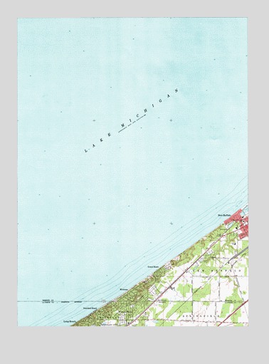
New Buffalo West, MI USGS Topographic Map
Click on map above to begin viewing in our Map Viewer.

This topographic map contains these locations and features:
Feature Name Type Latitude Longitude GNIS ID View Map
Duneland BeachPopulated PlaceN41.7562°W86.8334°446769View Map
Grand BeachPopulated PlaceN41.7734°W86.7975°627080View Map
Grand Beach Golf CourseLocaleN41.7719°W86.7922°2377496View Map
Grand Beach Police DepartmentBuildingN41.7731°W86.7914°2377530View Map
Grand Beach Post Office (historical)Post OfficeN41.7734°W86.7947°1926639View Map
Grand Beach StationLocaleN41.7667°W86.7922°2376466View Map
Judy's Mobile Home CourtPopulated PlaceN41.7769°W86.7758°2377495View Map
Lake Michigan Yacht ClubLocaleN41.7984°W86.7514°1618680View Map
Lighthouse Village Church of GodChurchN41.7842°W86.7683°2377521View Map
MichianaPopulated PlaceN41.7642°W86.8134°632191View Map
Michiana ShoresPopulated PlaceN41.7559°W86.8167°446768View Map
Michiana Shores Volunteer Fire DepartmentBuildingN41.7512°W86.8158°2625898View Map
Michiana Village Police DepartmentBuildingN41.7610°W86.8101°2377529View Map
New Buffalo Elementary SchoolSchoolN41.7837°W86.7572°1616169View Map
New Buffalo Fire DepartmentBuildingN41.7922°W86.7504°2377528View Map
New Buffalo Township Fire Department Station 2BuildingN41.7610°W86.7989°2636096View Map
Oselkas Snug Harbor MarinaLocaleN41.7948°W86.7539°1618681View Map
Pine Grove CemeteryCemeteryN41.7882°W86.7558°634923View Map
Saint Mary of the Lake ChurchChurchN41.7908°W86.7517°2377522View Map
Saint Mary of the Lake SchoolSchoolN41.7925°W86.7531°636860View Map
Town of Michiana ShoresCivilN41.7563°W86.8181°2396756View Map
Village of Grand BeachCivilN41.7746°W86.7884°2398185View Map
Village of MichianaCivilN41.7637°W86.8111°2399330View Map
White DitchStreamN41.7717°W86.8025°1617040View Map
Whittaker Woods Golf CourseLocaleN41.7667°W86.7583°2377497View Map

Note: Coordinates in the location and feature list above are referenced to NAD83 datum.


Copyright (C) 2008-2024 Ryan Niemi / Sunset Dynamics ... All Rights Reserved