TopoQuest Logo
Do you find TopoQuest useful?
Help keep TopoQuest running and adding new maps/features by donating!
Bitcoin:  19c7KJd3qBynnjoSw5npx9KScwjBe4ifkT
Litecoin:  LXs6TkuXGGXo1vDsWCkWVdjQX94eUKd6ui
Home View Maps Find Maps Find Places Resources & Links


New Ellenton SW, South Carolina Topographic Map

USGS Map Title: New Ellenton SW, SC
USGS Map MRC: 33081C6
DRG (GeoTIFF) Download: o33081c6.tif


Neighboring USGS Topographic Map Quads:


  Hollow Creek, SC  
33081D7
 

  New Ellenton, SC  
33081D6
 

  Windsor, SC  
33081D5
 

  Jackson, SC  
33081C7
 

  New Ellenton SW, SC  
33081C6
 

  New Ellenton SE, SC  
33081C5
 

  Shell Bluff Landing, GA  
33081B7
 

  Girard NW, SC  
33081B6
 

  Girard NE, SC  
33081B5


Map MRC Location:

N34°
W82°
N34°
W81°
H8 H7 H6 H5 H4 H3 H2 H1
G8 G7 G6 G5 G4 G3 G2 G1
F8 F7 F6 F5 F4 F3 F2 F1
E8 E7 E6 E5 E4 E3 E2 E1
D8 D7 D6 D5 D4 D3 D2 D1
C8 C7 C6 C5 C4 C3 C2 C1
B8 B7 B6 B5 B4 B3 B2 B1
A8 A7 A6 A5 A4 A3 A2 A1
N33°
W82°
N33°
W81°

New Ellenton SW, SC USGS 1:24K Topographic Map Preview:
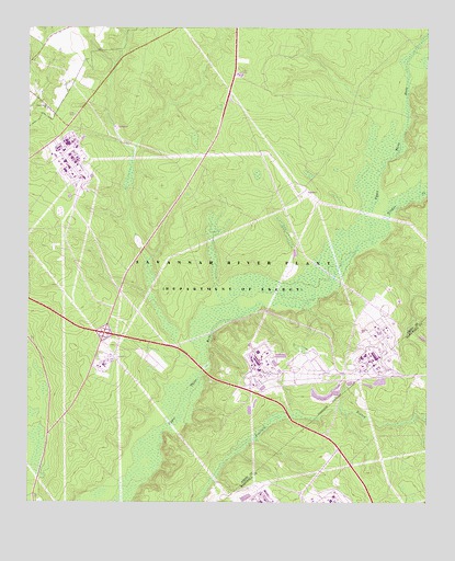
New Ellenton SW, SC USGS Topographic Map
Click on map above to begin viewing in our Map Viewer.

This topographic map contains these locations and features:
Feature Name Type Latitude Longitude GNIS ID View Map
Bear Pond Church (historical)ChurchN33.2743°W81.7426°1236231View Map
Bloomsdale School (historical)SchoolN33.3579°W81.7484°1236245View Map
Brinkley Academy School (historical)SchoolN33.2699°W81.7412°1236255View Map
Ford CemeteryCemeteryN33.3524°W81.7359°1236328View Map
Green Pond Baptist ChurchChurchN33.3538°W81.7440°1245831View Map
Greendale School (historical)SchoolN33.3557°W81.6487°1236350View Map
Hawthorne (historical)Populated PlaceN33.3335°W81.6998°1236360View Map
Hawthorne School (historical)SchoolN33.3740°W81.7073°1236361View Map
Jackson DivisionCivilN33.3178°W81.7241°1938308View Map
Saint Johns Church (historical)ChurchN33.3329°W81.7179°1236513View Map
Savannah River Ecology LaboratoryBuildingN33.3438°W81.7348°1731895View Map
Savannah River Forest StationLocaleN33.3629°W81.6837°1731896View Map
Savannah River LaboratoryBuildingN33.3446°W81.7379°1731897View Map
Savannah River Plant HeliportAirportN33.2849°W81.7276°1251841View Map
Savannah River Plant Pond Number 25-288-F D-3156 DamDamN33.2885°W81.6715°1239693View Map
Substation Number 2LocaleN33.3315°W81.6632°1731899View Map
Tims BranchStreamN33.2857°W81.6948°1236565View Map
Tinker CreekStreamN33.3199°W81.6432°1251177View Map
Treadway Church (historical)ChurchN33.3701°W81.6351°1236566View Map
Turner BranchStreamN33.2982°W81.6890°1236568View Map
Union Branch Church (historical)ChurchN33.2676°W81.6384°1235565View Map
Union Branch School (historical)SchoolN33.2674°W81.6384°1235566View Map
Zion Fair Church (historical)ChurchN33.2904°W81.6990°1236599View Map

Note: Coordinates in the location and feature list above are referenced to NAD83 datum.


Copyright (C) 2008-2025 Ryan Niemi / Sunset Dynamics ... All Rights Reserved